Staffordshire
| Hrabstwo ceremonialne i niemetropolitalne | |||||
 Miasto Lichfield w południowo-wschodniej części hrabstwa | |||||
| |||||
| Dewiza: The Knot Unites (Węzeł jednoczy) | |||||
| Państwo | |||||
|---|---|---|---|---|---|
| Kraj | |||||
| Region | |||||
| Siedziba | |||||
| Powierzchnia |
2713 km² (cerem.) | ||||
| Populacja (2011) • liczba ludności |
| ||||
| • gęstość |
404,5 os./km² (cerem.) | ||||
| Szczegółowy podział administracyjny | |||||

| |||||
| Liczba dystryktów |
8 | ||||
| Liczba unitary authorities |
1 | ||||
Położenie na mapie
| |||||
| Strona internetowa | |||||


Staffordshire – hrabstwo administracyjne (niemetropolitalne), ceremonialne i historyczne w środkowo-zachodniej Anglii, w regionie West Midlands[1].
Hrabstwo administracyjne zajmuje powierzchnię 2620 km², a zamieszkane jest przez 848 500 mieszkańców (2011). Hrabstwo ceremonialne, obejmujące dodatkowo jednostkę administracyjną unitary authority Stoke-on-Trent, liczy 2713 km² powierzchni oraz 1 097 500 mieszkańców (2011)[2]. Największymi miastami na terenie hrabstwa są Stoke-on-Trent, Newcastle-under-Lyme, Tamworth, Burton upon Trent, Stafford (stolica hrabstwa) oraz Cannock[3]. Dwa miasta posiadają status city – Stoke-on-Trent oraz Lichfield[1].
W północnej części Staffordshire znajduje się kraina The Potteries, obejmująca miasto Stoke-on-Trent, słynąca z produkcji ceramiki. Północno-wschodni kraniec hrabstwa znajduje się na terenie parku narodowego Peak District[1].
Na zachodzie Staffordshire graniczy z hrabstwem Shropshire, na północy z Cheshire, na wschodzie z Derbyshire, na południowym wschodzie z Leicestershire i Warwickshire, na południu z West Midlands, a na południowym zachodzie z Worcestershire[1].
Podział administracyjny
[edytuj | edytuj kod]W skład hrabstwa wchodzi osiem dystryktów. Jako hrabstwo ceremonialne Staffordshire obejmuje dodatkowo jedną jednolitą jednostkę administracyjną (unitary authority)[1].
- Tamworth
- Lichfield
- Cannock Chase
- South Staffordshire
- Stafford
- Newcastle-under-Lyme
- Staffordshire Moorlands
- East Staffordshire
- Stoke-on-Trent (unitary authority)
Mapa
[edytuj | edytuj kod]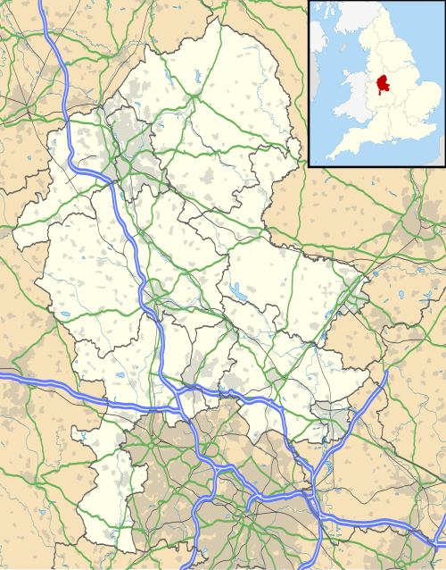
Przypisy
[edytuj | edytuj kod]- ↑ a b c d e Staffordshire, [w:] Encyclopædia Britannica [dostęp 2011-10-13] (ang.).
- ↑ Table P04 2011 Census: Usual resident population by five-year age group, local authorities in England and Wales. Office for National Statistics. [dostęp 2012-07-18]. (ang.).
- ↑ a b Office for National Statistics: KS101EW - Usual resident population. [w:] 2011 Census [on-line]. Nomis – Official labour market statistics, 2013-02-12. [dostęp 2022-06-05]. (ang.).
- ↑ Office for National Statistics: Built-up Area to Local Authority District (December 2011) Lookup in England and Wales. [w:] Open Geography Portal [on-line]. [dostęp 2022-06-05]. (ang.).
- ↑ Office for National Statistics: Built-up Area Sub Divisions (December 2011) Boundaries. [w:] Open Geography Potal [on-line]. [dostęp 2022-06-05]. (ang.).
![]()
|
![]()
Text is available under the CC BY-SA 4.0 license; additional terms may apply.
Images, videos and audio are available under their respective licenses.
