Kingston upon Hull
 Maritime Museum w Kingston upon Hull | |||
| |||
| Państwo | |||
|---|---|---|---|
| Kraj | |||
| Region | |||
| Hrabstwo | |||
| Powierzchnia |
71 km² | ||
| Populacja (2021) • liczba ludności • gęstość |
| ||
| Nr kierunkowy |
01482 | ||
| Kod pocztowy |
HU | ||
Położenie na mapie East Riding of Yorkshire 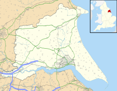 | |||
Położenie na mapie Wielkiej Brytanii  | |||
Położenie na mapie Anglii  | |||
| Strona internetowa | |||

Kingston upon Hull (potocznie Hull) – miasto w Wielkiej Brytanii (Anglia), w hrabstwie ceremonialnym East Riding of Yorkshire, nad estuarium Humber i jego dopływem Hull, typowo przemysłowe (stocznie, rafinerie, fabryka czekolady).
Było największym miastem zlikwidowanego hrabstwa Humberside. Obecnie jest samodzielną jednolitą jednostką administracyjną (unitary authority), wchodzącą w skład regionu Yorkshire and the Humber.
W mieście jest most obrotowy, który stał się lokalną atrakcją i przyczynił się do rewitalizacji zaniedbanej, poprzemysłowej dzielnicy na lewym brzegu rzeki Hull[2].
Transport
[edytuj | edytuj kod]W mieście w latach 1876–1945 kursowały tramwaje, a w latach 1937–1964 działała sieć trolejbusowa, która składała się z 7 linii[3][4]. Współcześnie po mieście kursują już tylko autobusy.
W kulturze
[edytuj | edytuj kod]Hull jako jedyne miasto w Anglii ma budki telefoniczne w kolorze kremowym (a nie czerwonym, jak pozostałe)[5].

Miasta partnerskie
[edytuj | edytuj kod] Freetown, Sierra Leone
 Niigata, Japonia
 Raleigh, Stany Zjednoczone
 Reykjavík, Islandia
 Rotterdam, Holandia
 Szczecin, Polska
Przypisy
[edytuj | edytuj kod]- ↑ Figure 1: Explore population characteristics of individual BUAs [online], www.ons.gov.uk [dostęp 2023-08-18] (ang.).
- ↑ Kingston upon Hull: grający most. Bryla.pl, 2017-01-20. [dostęp 2017-01-20].
- ↑ J. Joyce, J.S. King, A.G. Newman, British trolleybus systems, London: I. Allan, 1986, s. 78–80, ISBN 0-7110-1647-X [dostęp 2020-06-08] (ang.).
- ↑ Peter Short: Former UK systems. British Trolleybus Society. [dostęp 2011-04-09]. (ang.).
- ↑ Why Hull has cream phone boxes (and why it’s relevant to tech today). NS Tech, 2016-08-25. [dostęp 2017-01-15]. (ang.).
![]()
|
![]()
Text is available under the CC BY-SA 4.0 license; additional terms may apply.
Images, videos and audio are available under their respective licenses.
