ශ්රී ලංකාවේ පළාත්
| පළාත Province மாகாணம் | |
|---|---|
 | |
| වර්ගය | පළමු පරිපාලන කොට්ඨාසය |
| පිහිටීම | ශ්රී ලංකාව |
| නිර්මිතය | 1 ඔක්තෝබර් 1833 |
| ගණන | 9 (1 ජනවාරි 2007 වන විට) |
| ජනගහනය | 1,061,315–5,851,130 |
| විශාලත්වය | 3,684–10,472 ව.කි.මී. |
| පරිපාලනය | පළාත් සභාව |
| අනු පරිපාලන කොට්ඨාස | දිස්ත්රික්ක |
| ශ්රී ලංකාවේ පරිපාලන ඒකක |
|---|
| පළමු ඒකකය |
| පළාත් |
| දෙවන ඒකකය |
| දිස්ත්රික්ක |
| තෙවන ඒකකය |
| ප්රාදේශීය ලේකම් කොට්ඨාස |
| සිව්වන ඒකකය |
| පළාත් පාලන ඡන්ද කොට්ඨාශය |
| පස්වන ඒකකය |
|
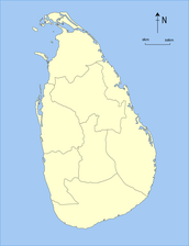
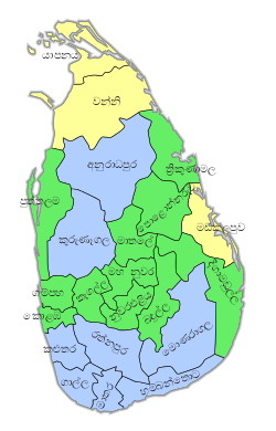
ශ්රී ලංකාවේ පළාත් නවයක් ඇත. 19 වන සියවසෙහි සිට මෙම පළාත් පැවතුණද 1987 දී ශ්රී ලංකාවේ 1978 ආණ්ඩුක්රම ව්යවස්ථාව සඳහා 1987 දී 13 වන ව්යවස්ථා සංශෝධනය වෙතින් පළාත් සභා පිහිටුවන තුරු වන තෙක් නීති ක්රියාත්මක කිරීමෙහි දේශපාලනමය හා පරිපාලනමය බලතල ඒවා සතුව නොපැවතිනි
ඉතිහාසය
[සංස්කරණය]අනුරාධපුර රාජධානිය
[සංස්කරණය]
බ්රිතාන්ය ලංකාව
[සංස්කරණය]ශ්රී ලංකාව
[සංස්කරණය]
| 1833 සිට පළාත් විකාශනය වීම | ||||||||||
|---|---|---|---|---|---|---|---|---|---|---|
|
පළාත්
[සංස්කරණය]පවතින
[සංස්කරණය]සියලුම ජනගහන දත්ත ආසන්නයේම පැවති 2012 ශ්රී ලංකා ජන සංගණනය අනුවය.
| පළාත | Area map | පළාත්බද අග නගරය |
නිර්මිත දිනය/වසර |
භුමි ප්රමාණය ව.කි.මී. වලින් (ව.සැත)[1] |
ජලජ භූමි ප්රමාණය ව.කි.මී. වලින් (ව.සැත)[1] |
මුළු භූමි ප්රමාණය ව.කි.මී. වලින් (ව.සැත)[1] |
ජනගහනය (2012)[2] |
ජන ඝනත්වය ව.කි.මී. වලින් (ව.සැත)[a] |
|---|---|---|---|---|---|---|---|---|

|
ත්රිකුණාමලය | 1 ඔක්තෝබර් 1833 | 9,361 (3,614) | 635 (245) | 9,996 (3,859) | 1,555,510 | 166 (430) | |

|
අනුරාධපුරය | 1873 | 9,741 (3,761) | 731 (282) | 10,472 (4,043) | 1,266,663 | 130 (340) | |
|
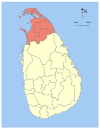
යාපනය | 1 ඔක්තෝබර් 1833 | 8,290 (3,200) | 594 (229) | 8,884 (3,430) | 1,061,315 | 128 (330) | |
|
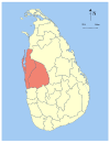
කුරුණෑගල | 1845 | 7,506 (2,898) | 382 (147) | 7,888 (3,046) | 2,380,861 | 317 (820) | |

|
රත්නපුරය | 1889 | 4,921 (1,900) | 47 (18) | 4,968 (1,918) | 1,928,655 | 392 (1,020) | |

|
ගාල්ල | 1 ඔක්තෝබර් 1833 | 5,383 (2,078) | 161 (62) | 5,544 (2,141) | 2,477,285 | 460 (1,200) | |

|
බදුල්ල | 1886 | 8,335 (3,218) | 165 (64) | 8,500 (3,300) | 1,266,463 | 152 (390) | |

|
කොලඹ | 1 ඔක්තෝබර් 1833 | 3,593 (1,387) | 91 (35) | 3,684 (1,422) | 5,851,130 | 1,628 (4,220) | |
| Total | 62,705 (24,211) | 2,905 (1,122) | 65,610 (25,330) | 20,359,439 | 325 (840) |
| මෙම ලිපිය |
| පිළිබඳ ලිපි මාලාවක කොටසකි |
|---|
 |
Notes
[සංස්කරණය]- ^ Population density has been calculated using the land area rather than the total area.
මූලාශ්ර
[සංස්කරණය]- ^ a b c "Table 1.1: Area of Sri Lanka by province and district" (PDF). Statistical Abstract 2014. Department of Census and Statistics, Sri Lanka.
- ^ "Census of Population and Housing of Sri Lanka, 2012 – Table A1: Population by district, sex and sector" (PDF). Department of Census & Statistics, Sri Lanka.
ශ්රී ලංකාව මාතෘකා | |||||||||||
|---|---|---|---|---|---|---|---|---|---|---|---|
| දළ විශ්ලේෂණය |
| ||||||||||
| ඉතිහාසය |
| ||||||||||
| රජය |
| ||||||||||
| දේශපාලන |
| ||||||||||
| භූගෝල විද්යාව |
| ||||||||||
| ආර්ථිකය |
| ||||||||||
| සමාජය |
| ||||||||||
Text is available under the CC BY-SA 4.0 license; additional terms may apply.
Images, videos and audio are available under their respective licenses.


