For faster navigation, this Iframe is preloading the Wikiwand page for 比利时地理.

比利时地理

此條目没有列出任何参考或来源。 (2013年4月30日)維基百科所有的內容都應該可供查證。请协助補充可靠来源改善这篇条目。无法查证的內容可能會因為異議提出而被移除。

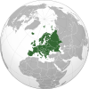
比利时位于欧洲大陆西北部,与英国隔海相望。北邻为荷兰,南接为法国,东南临卢森堡,东与德国接壤。国土面积3.05万平方公里。

比利时分为三大地理区域:西部的海边平原、中部的高原、以及东部的阿登山脉。西部平原地势平坦,有诸多围海造出的洼地。中部为渐渐升高的平原地区,土地富饶,河流众多,灌溉充分,同时也有一些洞穴峡谷。东部为阿登山脉,地势升高,最高点海拔694米(博特朗日山:Signal de Botrange),多森林,多处基岩裸露,不宜耕种。这也是比利时大多数野生动物的栖息处。

比利时主要河流有:斯凯尔特河ScheldeEscaut),流经图尔奈根特安特卫普,和默兹河MeuseMaas),流经那慕尔列日

比利时属于温带海洋性气候——温和、凉爽、多雨,夏天平均气温25℃,冬天平均气温7.2℃。全年最低与最高气温一般在-12.2℃和32.2℃左右。

主要城市有:布鲁塞尔(人口:959,318)、安特卫普(人口:445,570)、根特(人口:224,685)、查内尔(人口:200,233)、列日(人口:184,550)、布鲁日(人口:117,352)。

{{bottomLinkPreText}} {{bottomLinkText}}
比利时地理
Listen to this article

This browser is not supported by Wikiwand :(
Wikiwand requires a browser with modern capabilities in order to provide you with the best reading experience.
Please download and use one of the following browsers:

This article was just edited, click to reload
This article has been deleted on Wikipedia (Why?)

Back to homepage

Please click Add in the dialog above
Please click Allow in the top-left corner,
then click Install Now in the dialog
Please click Open in the download dialog,
then click Install
Please click the "Downloads" icon in the Safari toolbar, open the first download in the list,
then click Install
{{::$root.activation.text}}

Install Wikiwand

Install on Chrome Install on Firefox
Don't forget to rate us

Tell your friends about Wikiwand!

Gmail Facebook Twitter Link

Enjoying Wikiwand?

Tell your friends and spread the love:
Share on Gmail Share on Facebook Share on Twitter Share on Buffer

Our magic isn't perfect

You can help our automatic cover photo selection by reporting an unsuitable photo.

This photo is visually disturbing This photo is not a good choice

Thank you for helping!


Your input will affect cover photo selection, along with input from other users.

X

Get ready for Wikiwand 2.0 🎉! the new version arrives on September 1st! Don't want to wait?