For faster navigation, this Iframe is preloading the Wikiwand page for 阿见飞行场.

阿见飞行场

阿见飞行场
Ami Airfield

阿見飛行場
概览
机场类型其他
营运者东京航空
地理位置 日本茨城县稻敷郡阿见町岛津3440
启用日期1980年
关闭日期2015年2月5日
海拔高度66英尺(20.05米)
坐标36°01′26″N 140°16′00″E / 36.02389°N 140.26667°E / 36.02389; 140.26667
网址阿见飞行场网站
跑道
方向 长度 表面
英尺
09/27 1,969 600 柏油
阿见飞行场一带的空拍图,(摄于1990年)。

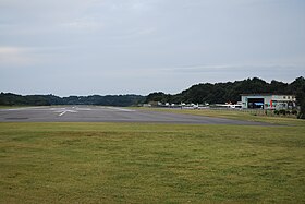
阿见飞行场(日语:阿見飛行場あみひこうじょう Ami hikōjō */?)是一座位于日本茨城县稻敷郡阿见町飞行场,主要提供轻型飞机使用。此机场被日本政府归类为“其他机场”,由东京航空管理。

沿革

  • 1980年(昭和55年)- 东京航空位在东京都江东区东云的东云飞行场关闭,转往阿见町开设阿见飞行场。
  • 2015年(平成27年)2月5日 - 阿见飞行场关闭,东京航空迁移至调布飞行场。同年秋于原址建成太阳能发电厂区。

利用团体

  • 东京航空

周边

交通

利用状况

  • 东京航空进行飞行游览、拍摄航空照、宣传飞行、操纵训练等活动。
  • 拍摄电影音乐影片的取景地。

相关条目

参考资料

外部链接

{{bottomLinkPreText}} {{bottomLinkText}}
阿见飞行场
Listen to this article

This browser is not supported by Wikiwand :(
Wikiwand requires a browser with modern capabilities in order to provide you with the best reading experience.
Please download and use one of the following browsers:

This article was just edited, click to reload
This article has been deleted on Wikipedia (Why?)

Back to homepage

Please click Add in the dialog above
Please click Allow in the top-left corner,
then click Install Now in the dialog
Please click Open in the download dialog,
then click Install
Please click the "Downloads" icon in the Safari toolbar, open the first download in the list,
then click Install
{{::$root.activation.text}}

Install Wikiwand

Install on Chrome Install on Firefox
Don't forget to rate us

Tell your friends about Wikiwand!

Gmail Facebook Twitter Link

Enjoying Wikiwand?

Tell your friends and spread the love:
Share on Gmail Share on Facebook Share on Twitter Share on Buffer

Our magic isn't perfect

You can help our automatic cover photo selection by reporting an unsuitable photo.

This photo is visually disturbing This photo is not a good choice

Thank you for helping!


Your input will affect cover photo selection, along with input from other users.

X

Get ready for Wikiwand 2.0 🎉! the new version arrives on September 1st! Don't want to wait?