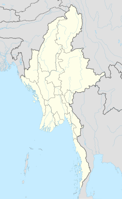
ท่าขี้เหล็ก
ท่าขี้เหล็ก | |
|---|---|
เมือง | |
| การถอดเสียงภาษาไทใหญ่ | |
| • อักษรไทใหญ่ | ဝဵင်းတႃႈၶီႈလဵၵ်း |
| • ทับศัพท์ | เวงต้าขี้เล็ก |
| การถอดเสียงภาษาพม่า | |
| • อักษรพม่า | တာချီလိတ်မြို့ |
| • ทับศัพท์ | ตาชีเละมโหย่ |
 หมู่บ้านบนเทือกเขาแดนลาวในท่าขี้เหล็ก มองจากวัดพระธาตุดอยเวา | |
| พิกัด: 20°27′N 99°53′E / 20.450°N 99.883°E | |
| ประเทศ | |
| รัฐ | |
| จังหวัด | ท่าขี้เหล็ก |
| อำเภอ | ท่าขี้เหล็ก |
| ประชากร (พ.ศ. 2557) | 51,553 คน |
| • กลุ่มชาติพันธุ์ | ไทใหญ่ |
| • ศาสนา | พุทธ |
| เขตเวลา | UTC+ 6:30 (เวลามาตรฐานพม่า) |
ท่าขี้เหล็ก (ไทใหญ่: တႃႈၶီႈလဵၵ်း; พม่า: တာချီလိတ်, ออกเสียง: [tà.t͡ɕʰì.leɪ̯ʔ]) เป็นเมืองชายแดนตั้งอยู่ในรัฐฉาน ทางตะวันออกของประเทศพม่า เป็นที่ตั้งศูนย์ราชการของจังหวัดและอำเภอท่าขี้เหล็ก เป็นเมืองที่มีประชากรมากที่สุดในภาคตะวันออกของรัฐ กล่าวคือ 51,553 คน จากสำมะโนประชากรเมื่อปี พ.ศ. 2557 นำหน้าเมืองเชียงตุง แต่มีประชากรมากเป็นอันดับที่ 4 ของรัฐ[1]
การขนส่ง
มีท่าอากาศยานท่าขี้เหล็กซึ่งเชื่อมไปยังเมืองย่างกุ้ง มัณฑะเลย์ และเชียงตุง[2] ส่วนการขนส่งทางถนน ด้านทิศเหนือมีทางหลวงเอเชียสาย 2 เชื่อมไปยังเมืองเชียงตุง ระยะทาง 106 กิโลเมตร และต่อไปทางตะวันตกถึงตองจี เมืองหลักของรัฐฉาน รวมทั้งถนนทางด้านตะวันออกทางหลวงเอเชียสาย 3 ไปยังเมืองลา และต่อไปยังมณฑลยูนนาน ประเทศจีน[3][4]
ภูมิอากาศ
| ข้อมูลภูมิอากาศของท่าขี้เหล็ก | |||||||||||||
|---|---|---|---|---|---|---|---|---|---|---|---|---|---|
| เดือน | ม.ค. | ก.พ. | มี.ค. | เม.ย. | พ.ค. | มิ.ย. | ก.ค. | ส.ค. | ก.ย. | ต.ค. | พ.ย. | ธ.ค. | ทั้งปี |
| อุณหภูมิสูงสุดเฉลี่ย °C (°F) | 28 (82) |
31 (88) |
33 (91) |
35 (95) |
33 (91) |
32 (90) |
31 (88) |
31 (88) |
31 (88) |
30 (86) |
28 (82) |
26 (79) |
30.8 (87.4) |
| อุณหภูมิต่ำสุดเฉลี่ย °C (°F) | 12 (54) |
13 (55) |
16 (61) |
20 (68) |
22 (72) |
23 (73) |
23 (73) |
23 (73) |
22 (72) |
20 (68) |
17 (63) |
13 (55) |
18.7 (65.6) |
| ปริมาณฝน มม (นิ้ว) | 15 (0.59) |
8 (0.31) |
20 (0.79) |
73 (2.87) |
186 (7.32) |
204 (8.03) |
276 (10.87) |
342 (13.46) |
224 (8.82) |
128 (5.04) |
59 (2.32) |
22 (0.87) |
1,557 (61.3) |
| วันที่มีฝนตกโดยเฉลี่ย | 5 | 3 | 3 | 10 | 18 | 21 | 23 | 25 | 19 | 14 | 8 | 6 | 155 |
| จำนวนชั่วโมงที่มีแดด | 248 | 252 | 248 | 240 | 217 | 150 | 124 | 155 | 180 | 186 | 210 | 217 | 2,427 |
| แหล่งที่มา: World Climate Guide | |||||||||||||
อ้างอิง
- ↑ http://citypopulation.de/Myanmar-Cities.html
- ↑ "Time Taken and Distances (Car / Flight / Boat)". myanmartravels.net. คลังข้อมูลเก่าเก็บจากแหล่งเดิมเมื่อ 2009-01-30. สืบค้นเมื่อ 2009-03-15.
- ↑ "Asian Highway in Myanmar" (PDF). unescap.org. คลังข้อมูลเก่าเก็บจากแหล่งเดิม (PDF)เมื่อ 2011-04-29. สืบค้นเมื่อ 2009-03-15.
- ↑ Lawi Weng (March 11, 2009). "'Yaa-Baa' Bust in Tachilek". The Irrawaddy. คลังข้อมูลเก่าเก็บจากแหล่งเดิมเมื่อ 2009-03-15. สืบค้นเมื่อ 2009-03-15.
แหล่งข้อมูลอื่น
 วิกิมีเดียคอมมอนส์มีสื่อเกี่ยวกับ ท่าขี้เหล็ก
 คู่มือการท่องเที่ยว ท่าขี้เหล็ก จากวิกิท่องเที่ยว (ในภาษาอังกฤษ)
- Satellite map Maplandia
- Picture เก็บถาวร 2016-03-04 ที่ เวย์แบ็กแมชชีน
Text is available under the CC BY-SA 4.0 license; additional terms may apply.
Images, videos and audio are available under their respective licenses.


