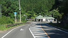
国道115号
| 一般国道 | |
|---|---|
| 国道115号 | |
| 地図 | |

| |
| 総延長 | 159.2 km |
| 実延長 | 155.5 km |
| 現道 | 149.5 km |
| 制定年 | 1963年(昭和38年) |
| 起点 | 福島県相馬市 塚ノ町交差点(北緯37度47分27.0秒 東経140度56分39.9秒 / 北緯37.790833度 東経140.944417度) |
| 主な 経由都市 |
福島県福島市、伊達市 |
| 終点 | 福島県耶麻郡猪苗代町 堅田中丸交差点(北緯37度45分23.8秒 東経140度28分24.6秒 / 北緯37.756611度 東経140.473500度) |
| 接続する 主な道路 (記法) |
|
| ■テンプレート(■ノート ■使い方) ■PJ道路 | |

福島県耶麻郡猪苗代町
堅田中丸交差点
国道115号(こくどう115ごう)は、福島県相馬市から耶麻郡猪苗代町に至る一般国道である。
概要
[編集]
(2018年6月)
相馬市から福島市の間は通称中村街道または相馬街道、福島市から猪苗代町の間は土湯街道と呼ばれている。また、福島市から耶麻郡猪苗代町の間は中通り北部と会津地方を結ぶルートとなっている。
路線データ
[編集]一般国道の路線を指定する政令[1][注釈 1]に基づく起終点および重要な経過地は次のとおり。
- 起点:相馬市(塚ノ町交差点 = 福島県道394号相馬新地線交点、福島県道・宮城県道38号相馬亘理線起点)
- 終点:福島県耶麻郡猪苗代町(堅田中丸交差点 = 国道49号交点)
- 重要な経過地:福島県伊達郡霊山町(現:福島県伊達市霊山町[注釈 2])、福島市(八島町)。なお、バイパスとなる阿武隈東道路(東北中央自動車道の一部を構成する区間)は、宮城県伊具郡丸森町も経由する。
- 総延長 : 159.2 km(宮城県 2.1 km、福島県 157.0 km)重用延長を含む。[2][注釈 3]
- 重用延長 : 3.7 km(宮城県 - km、福島県 3.7 km)[2][注釈 3]
- 未供用延長 : なし[2][注釈 3]
- 実延長 : 155.5 km(宮城県 2.1 km、福島県 153.4 km)[2][注釈 3]
- 指定区間:国道4号と重複する区間(福島市・岩谷下交差点 - 鳥谷野南交差点)、相馬市山上字小田原300番11 - 伊達市霊山町下小国字荒屋敷5番7(相馬市山上字小田原300番11 - 同市山上字落合1番1、同市東玉野字ウト沼45番10、伊達市霊山町掛田字西陣場7番2を経て同市霊山町下小国字荒屋敷5番7までを除く。(E13 東北中央道(相馬福島道路)区間))[3]
- 最急勾配 : 9.4 %
歴史
[編集]現行の道路法(昭和27年法律第180号)に基づく二級国道として初回指定された1953年(昭和28年)では、新潟平線として指定されていた[4]。
1963年(昭和38年)に一級国道49号として指定施行(昇格)[5]に伴って欠番となり、同日新たに指定された相馬猪苗代線に採番された[6]。
年表
[編集]- 1954年(昭和29年)1月20日 - 建設省告示第16号が公布され、県道福島猪苗代線の一部、猪苗代停車場線の一部、猪苗代停車場蜂屋敷線の一部が主要地方道福島若松線に、県道福島中村線の一部、福島梁川線の一部、保原川俣線の一部が主要地方道福島中村線にそれぞれ指定される。
- 1963年(昭和38年)4月1日 - 主要地方道福島中村線、福島若松線の一部が二級国道115号相馬猪苗代線(相馬市 - 福島県耶麻郡猪苗代町)として指定施行[6]。
- 1965年(昭和40年)4月1日 - 道路法改正により一級・二級区分が廃止されて一般国道115号として指定施行[1]。
- 1983年(昭和58年)
- 福島西バイパス一部開通によりバイパス側に国道指定がなされ、福島市南町 - 佐倉下間の旧道が福島市道南町佐倉下線に指定される。なお、当区間の国道指定解除の告示は福島県によりなされなかったが、以後発行された国土地理院地形図はじめ各社が発行する地図において国道である表記はされていなかった。
- 11月 - 国道4号福島南バイパスが開通し、国道4号の経路が変更されたことにより、大町(福島警察署前交差点・国道13号交点) - 郷野目宝来町交差点間の従来の重用区間が国道115号単独区間に指定される。旧国道4号のルートとは異なり、現在の福島県道148号水原福島線と同様に福島県庁前を通る道筋へ変更され、中町 - 本町の区間はこの時に福島市道へ移管された。
- 1988年(昭和63年) - 福島西バイパスが全線開通。これを期にバイパスに本線指定がなされ、大町から郷野目宝来町までの区間が福島県道148号水原福島線に移管された。
- 1989年(平成元年)9月27日 - 土湯トンネルを含む土湯バイパス(当時は土湯道路) 一部開通
- 2005年(平成17年)12月3日 - 土湯バイパス 全線開通
- 2015年(平成27年)9月10日 - 平成27年9月関東・東北豪雨により、伊達市霊山町で当道路の隣を流れる石田川の増水のために長さ約100 mにわたり路面が崩落。9月18日に片側交互通行で復旧。
- 2019年(平成31年)3月22日 - 1983年(昭和58年)に市道に認定されて以降国道指示の解除が行われていなかった福島市道南町佐倉下線の区間が福島県告示により正式に国道指定を解除された。
路線状況
[編集]
(2018年6月)
相馬市山上地内は、幅員狭小に加え急カーブ・急勾配が連続し、冬期間は路面凍結により交通事故が多発している区間である。そのため、これを解消させるために、自動車専用道路としてバイパス(相馬福島道路)を建設し、2017年(平成29年)に開通した。相馬福島道路は常磐道と東北道とを結ぶ交通軸として、その後も延伸され、2021年(令和3年)に全線開通。
バイパス
[編集]
福島県耶麻郡猪苗代町
- 相馬南バイパス(相馬市)
- 相馬福島道路(相馬市 - 伊達郡桑折町)
- 山戸田バイパス(伊達市) - 全長:1.0 km、2008年(平成20年)9月12日開通。
- 北町バイパス・福島南バイパス(福島市、国道4号重複区間)
- 福島西バイパス(福島市)
- 荒井バイパス(福島市)
- 土湯バイパス(福島市 - 耶麻郡猪苗代町)
- 猪苗代バイパス(耶麻郡猪苗代町)
道路の通称名
[編集]重複区間
[編集]
福島市 鳥谷野交差点
道路施設
[編集]休憩施設
[編集]
福島県伊達市霊山
- 霊山パーキング(伊達市霊山町石田行合道)
橋梁
[編集]- 天神前橋(宇多川 相馬南バイパス)
- 相馬南跨線橋(JR常磐線 相馬南バイパス)
- 相馬跨線橋(JR常磐線、相馬市)
- 胴切橋(宇多川支流、相馬市)
- 左右壺橋(宇多川、相馬市)
- けやき橋(玉野川、相馬市)
- 落合橋(玉野川、相馬市)
- 霊山橋(伊達市)
- 全長:14.56 m
- 幅員:6.5(11.0) m
- 形式:PC単純プレテンT桁橋
- 竣工:1998年度
- 霊山川橋(伊達市)
- 全長:16.46 m
- 幅員:6.5(11.0) m
- 形式:PC単純プレテン床版桁橋
- 竣工:1998年度
- いずれも伊達市霊山町石田字大貝から字戸草にかけて、一級水系阿武隈川水系広瀬川支流石田川右岸の旧道の改良のために左岸側に整備された現道の橋である。霊山橋が字大貝、霊山川橋が字戸草に位置し石田川を渡る。従来の橋梁の老朽化対策と25 t対応のために架け替えられた。橋上は上下対向2車線で供用され、上り線側に幅員2.5 mの歩道が設置されている。総工費は霊山橋が1億1050万円、霊山川橋が1億2880万円[7]。
- 文知摺橋(阿武隈川、福島市)
- 大仏橋(福島市)
- 弁天橋(福島市)
- 濁川橋(濁川、福島市)
- 方木田跨線橋(JR東北本線、福島市)
- 産ヶ沢橋(産ヶ沢、福島市)
- 猪ノ倉橋(産ヶ沢、福島市)
- 片栗橋(旧国道115号、福島市)
- 角沢大橋(福島市)
- 額取橋(福島市)
- こぶし橋(福島市)
- 石楠花大橋(福島市)
- 東鴉川橋(東鴉川、福島市)
- 西鴉川橋
- 横向大橋(高森川・滝ノ沢、猪苗代町)
- 新岩弓橋(猪苗代町)
- 支時橋(猪苗代町)
- 猪苗代跨線橋(猪苗代町)
- 全長:187.0 m
- 主径間:39.6 m
- 幅員:13.0(23.0) m
- 形式:2径間鋼連続非合成鈑桁橋×2・鋼単純非合成鈑桁橋(計5径間)
- 竣工:1993年度
- 施工:東京鉄骨・駒井鉄工・矢田工業
- 全長:187.0 m
道の駅
[編集]地理
[編集]通過する自治体
[編集]交差する道路
[編集]- 相馬市
- 国道6号相馬バイパス・福島県道74号原町海老相馬線(相馬市大曲 相馬南バイパス)
- 福島県道394号相馬新地線・福島県道・宮城県道38号相馬亘理線(相馬市・塚ノ町交差点)
- 福島県道121号日下石新沼線
- 福島県道34号相馬浪江線・福島県道・宮城県道228号相馬大内線(相馬市西山)
- 相馬IC - E6常磐自動車道
- 福島県道270号山上赤木線(相馬市山上)
- 伊達市
- 福島県道31号浪江国見線(伊達市霊山町石田)
- 福島県道316号広畑月舘線(伊達市霊山町石田字名目沢)
- 福島県道316号広畑月舘線(伊達市霊山町石田字大平)
- 福島県道149号月舘霊山線(伊達市霊山町山戸田)
- 国道349号(伊達市霊山町掛田字西陣場)
- 福島県道51号霊山松川線(伊達市霊山町下小国)
- 福島市
- 福島県道318号上小国下川原線(福島市大波・約200 m重複)
- 福島県道318号上小国下川原線(福島市大波)
- 福島県道308号山口渡利線(福島市山口)
- 福島県道317号山口保原線(福島市山口)
- 福島県道4号福島保原線(福島市岡部)
- 福島県道309号岡部渡利線(福島市岡部)
- 国道4号(福島市・岩谷下交差点)
- 国道4号(福島市・鳥谷野南交差点[11])
- 福島県道148号水原福島線(福島市郷野目・郷野目宝来町交差点)
- 福島県道148号水原福島線(福島市大森・中屋敷交差点)
- 国道13号福島西道路(福島市成川・八幡西交差点)
- 福島西IC - E4東北自動車道
- 福島県道5号上名倉飯坂伊達線(福島市さくら2丁目)
- 福島県道362号南福島停車場線(福島市荒井)
- 福島県道52号土湯温泉線(福島市土湯温泉町・約300 m重複)
- 福島県道52号土湯温泉線(福島市土湯温泉町)
- 国道459号(福島市松川町水原・道の駅つちゆ)
- 福島県道30号本宮土湯温泉線(福島市松川町水原)
- 猪苗代町
- 福島県道70号福島吾妻裏磐梯線(猪苗代町大字若宮)
- 福島県道70号福島吾妻磐梯線(猪苗代町大字若宮)
- 福島県道24号中の沢熱海線(猪苗代町大字若宮)
- 国道459号(猪苗代町大字若宮)
- 福島県道323号野老沢川桁停車場線(猪苗代町大字蚕養)
- 福島県道227号下舘停車場線(猪苗代町大字三郷)
- 山形県道・福島県道2号米沢猪苗代線(猪苗代町字五百苅)
- 福島県道7号猪苗代塩川線(猪苗代町字二丁田)
- 福島県道204号猪苗代停車場線・福島県道322号壷楊本町線(猪苗代町字梨木西・警察署東交差点)
- 猪苗代磐梯高原IC - E49磐越自動車道(猪苗代町大字堅田)
- 国道49号(猪苗代町・堅田中丸交差点)
脚注
[編集]注釈
[編集]出典
[編集]- ^ a b “一般国道の路線を指定する政令(昭和40年3月29日政令第58号)”. e-Gov法令検索. 総務省行政管理局. 2013年1月6日閲覧。
- ^ a b c d e f g “表26 一般国道の路線別、都道府県別道路現況” (XLS). 道路統計年報2023. 国土交通省道路局. 2024年4月7日閲覧。
- ^ “一般国道の指定区間を指定する政令(昭和33年6月2日政令第164号)”. e-Gov法令検索. 総務省行政管理局. 2013年1月6日閲覧。
- ^
 ウィキソースには、二級国道の路線を指定する政令(昭和28年5月18日政令第96号)の原文があります。
- ^
 ウィキソースには、一級国道の路線を指定する政令の一部を改正する政令(昭和37年5月1日政令第184号)の原文があります。
- ^ a b
 ウィキソースには、二級国道の路線を指定する政令の一部を改正する政令(昭和37年5月1日政令第184号)の原文があります。
- ^ 福島県の橋梁 平成12年度版 - 福島県土木部
- ^ 福島県の橋梁 平成23年度版 (PDF) - 福島県土木部
- ^ 福島県の橋梁 昭和60年度版 - 福島県土木部
- ^ 福島県の橋梁 平成10年度版 - 福島県土木部
- ^ 「駐車監視員活動ガイドライン」の変更について - ウェイバックマシン(2011年11月17日アーカイブ分) - 福島県警察
関連項目
[編集]外部リンク
[編集]| バイパス | |
|---|---|
| 道路名・愛称 | |
| 構造物 | |
| 道の駅 | |
| * 国道4号重用区間 | |
Text is available under the CC BY-SA 4.0 license; additional terms may apply.
Images, videos and audio are available under their respective licenses.

