安哥拉地理
| ||
| 大陸 | 非洲 | |
| 分區 | 南部非洲 | |
| 地理座標 | 12°30′S 18°30′E / 12.500°S 18.500°E | |
| 面積 - Total - Water |
面積排名 1,246,700 km² | |
| 海岸線 | 1600 km | |
| 國界線 | 5,198 km | |
| 鄰國 | 剛果民主共和國 2,511 km 剛果共和國 201 km 納米比亞 1,376 km 贊比亞 1,110 km | |
| 最高處 | Mount Moco, 2,620 m | |
| 最低處 | 大西洋, 0 m | |
| 最長河流 | Congo River, 4,344 m | |
| 最大水體 | ||
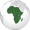
安哥拉位於南部非洲的西部,地處納米比亞和剛果共和國之間的大西洋沿岸,此外在東部還和剛果民主共和國及贊比亞接壤。安哥拉的人口主要集中在沿海地區。而內地則多是高原。安哥拉的國土面積是1246700平方公里,略大於五個英國的大小。首都位於羅安達,也是安哥拉重要的港口。安哥拉大多數地區地處熱帶。安哥拉在地形上可分為四個地理大區,在地質上可分為三個區域。
參考資料
[编辑]- 本條目含有部份來自美國國會圖書館的國家研究資料。這些資料由美國聯邦政府於公共領域出版。
 本条目引用的公有领域材料来自CIA World Factbook的网站或文档。
 本条目引用的公有领域材料来自美国国务院的网站或文档 (Background Note)。
- 本条目包含来自公有领域出版物的文本:
Chisholm, Hugh (编). Encyclopædia Britannica (第11版). London: Cambridge University Press. 1911.
| |||||||||||||||||||
Text is available under the CC BY-SA 4.0 license; additional terms may apply.
Images, videos and audio are available under their respective licenses.


