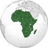
南非地理
| 南非地理 | |
|---|---|
 | |
| 洲 | 非洲 |
| 地区 | 南部非洲 |
| 坐标 | 29°00′S 24°00′E / 29.000°S 24.000°E |
| 面积 | 第25th名 |
| • 总计 | 1,221,037平方公里(471,445平方英里) |
| 海岸线 | 2,798公里(1,739英里) |
| 毗邻 | 國境線: 4,862 km 博茨瓦納 1,840 km, 萊索托 909 km, 莫桑比克 491 km, 納米比亞 967 km, 斯威士蘭 430 km, 津巴布韋 225 km |
| 最高点 | Mafadi 3,450 m |
| 最低点 | Sea level 0 m |
| 最长河流 | 奧蘭治河 2,200 km |
| 最大湖泊 | Lake Chrissie |
南非位於非洲的南端,其海岸線長度超過2,500 km(1,553 mi)。自納米比亞的沙漠向南延伸,繞過非洲的南端,之後北上至莫桑比克。南非全國大部份地區都是半乾旱地區,但南非在氣候和地形上都變化多端。南非主要的平原都集中在沿海地區。海岸線較為平直,有數個天然良港。位於開普敦以南2000公里,大西洋上的愛德華王子群島也是南非領土。南非的人口主要集中在沿海地區。南非夏季氣候炎熱。
參考資料
[编辑]- 這篇文章的部份內容來自2006年世界概況
- http://www.dwaf.gov.za/iwqs/gis_data/ecoregions/get-ecoregions.htm(页面存档备份,存于互联网档案馆)
- http://www.dwaf.gov.za/IWQS/gis_data/ecoregions/LEVEL_I_ECOREGIONSsigned_small2.pdf(页面存档备份,存于互联网档案馆) Kleynhans, CJ, Thirion, C and Moolman, J (2005). A Level I River Ecoregion classification System for South Africa, Lesotho and Swaziland. Report No. N/0000/00/REQ0104. Resource Quality Services, Department of Water Affairs and Forestry, Pretoria, South Africa.
- https://web.archive.org/web/20071129042702/http://academic.sun.ac.za/botzoo/mucina/ProcIAVS_Bushveld.pdf
- http://www.mantleplumes.org/Penrose/PenPDFAbstracts/Elston_Wolf_abs.pdf(页面存档备份,存于互联网档案馆)
- http://www.unhcr.org/home/RSDCOI/447aae394.pdf(页面存档备份,存于互联网档案馆)
- https://web.archive.org/web/20070206131850/http://www.plantzafrica.com/frames/vegfram.htm
- http://whc.unesco.org/en/statesparties/za(页面存档备份,存于互联网档案馆)
| |||||||||||||||||||
Text is available under the CC BY-SA 4.0 license; additional terms may apply.
Images, videos and audio are available under their respective licenses.

