瓜达拉哈拉 (墨西哥)
| 瓜达拉哈拉 Guadalajara Atemaxac | |||
|---|---|---|---|
| 城市 | |||
| |||
| 绰号:La Perla de Occidente, La Perla Tapatía, La Ciudad de las Rosas, El Silicon Valley de México(西班牙文) (西方之珠、玫瑰之城、墨西哥硅谷) | |||
 瓜达拉哈拉在哈利斯科州的位置 | |||
 瓜达拉哈拉 瓜达拉哈拉在墨西哥的位置 | |||
| 坐标:20°39′58″N 103°21′07″W / 20.66611°N 103.35194°W | |||
| 国家 | |||
| 州 | 哈利斯科州 | ||
| 建立 | 1542年2月14日 | ||
| 创始人 | Cristóbal de Oñate | ||
| 政府 | |||
| • 市长 | Pablo Lemus Navarro (MC
| ||
| 面积 | |||
| • 城市 | 340.91 平方公里(131.63 平方英里) | ||
| 海拔 | 1,566 米(5,138 英尺) | ||
| 人口(2016年) | |||
| • 城市 | 1,460,148(全国第3名)人 | ||
| • 密度 | 4,283人/平方公里(11,093人/平方英里) | ||
| • 市区 | 4,434,878 | ||
| 时区 | 北美中部时区(UTC-5) | ||
| 邮政号码 | 44100–44990 | ||
| 电话区号 | +52 33 | ||
| 网站 | guadalajara | ||


.svg)
瓜达拉哈拉市(西班牙语:Guadalajara、纳瓦特尔语:Atemaxac)是墨西哥哈利斯科州的首府,也是瓜达拉哈拉大都市区的首府、墨西哥第二大城市。瓜达拉哈拉市地处墨西哥西太平洋区,在哈里斯科州的中心,建立于1542年,面积187.91平方公里,海拔高度1560米。
瓜达拉哈拉是墨西哥的文化、工业和经济重镇,市内设有轻轨系统。因其传统、文化休闲的魅力和烹饪而闻名于世,有西方之珠(Pearl of the Occident)的称号[1]。大街上富有殖民时期传统特色的建筑也显现出城市四个半世纪的文化底蕴。墨西哥是世界上唯一酿造龙舌兰酒(tequila,因出产该酒的小镇而得名)的国家,而龙舌兰酒原产地即为哈里斯科州,目前该酒原产地权由墨西哥政府持有。
名称
瓜达拉哈拉是沿用了西班牙城市瓜达拉哈拉的名字,来源于阿拉伯语,是“石头之河”或“要塞之谷”的意思。它的其中一个建立者努尼奥·德古斯曼将它确定为自己的荣誉故乡时,以自己出生城市的名字将其命名。
历史文化
瓜达拉哈拉镇于1532年被西班牙探险家克里斯多瓦·迪·奥尼亚德创立,位于现在的圣胡安[需要消歧义]。后来他与另一征服者鲁尼奥·迪·古兹曼决定将小镇搬到水源丰富、交通方便又没有什么沙尘暴的地方。他们于1533年开始了搬迁工作。经过几次迁移后,到了今天的瓜达拉哈拉市的地方。瓜达拉哈拉市是1542年由查理五世国王颁布皇家命令建立的。在殖民时期,这里是新加利西亚州的首府。
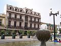
现在在城市里可以看到大量的名胜,吸引大量的游客,带动城市经济发展。瓜达拉哈拉建筑风格各异,从巴洛克风格到现代风格都有。其殖民时期的建筑基本为法国或西班牙风格。市中心广场周围以大教堂为代表的新古典主义建筑尤其有特色。这里的历史性建筑代表了瓜达拉哈拉的特色。它们的艺术、习惯、传统和传说是吸引游人的焦点。除此之外,城市还有无数绿地供市民和游客休闲娱乐。
城市有上百座特色宗教建筑,其中最重要的就是瓜达拉哈拉圣母升天圣殿主教座堂,是该市最著名的天主教宗教中心。建于1561至1618年间,以新古典主义风格建成。最古老的宗教建筑是圣方济堂,始建于1554年,以巴洛克风格建成。在这些宗教建筑中,可以看到新古典主义、巴洛克主义、新哥特主义等建筑流派。城市还有19座有意思的民用建筑,现主要用于政府办公,博物馆、广场和公墓。根据其建设时期的不同显现出各异的建筑风格。
自然地理
气候
瓜达拉哈拉气候温和,5月至十月为雨季,雨水充沛。春天是最炎热和最干燥的季节,气温达35度;夏季常有雷阵雨偶有冰雹;秋季降雨减少,多雾;冬季气温会低至零下五度左右。十月份平均气温为21.1度。
| Guadalajara, Mexico (1951–2010) | |||||||||||||
|---|---|---|---|---|---|---|---|---|---|---|---|---|---|
| 月份 | 1月 | 2月 | 3月 | 4月 | 5月 | 6月 | 7月 | 8月 | 9月 | 10月 | 11月 | 12月 | 全年 |
| 历史最高温 °C(°F) | 35.0 (95.0) |
38.0 (100.4) |
39.0 (102.2) |
41.0 (105.8) |
39.0 (102.2) |
38.5 (101.3) |
37.0 (98.6) |
36.5 (97.7) |
36.0 (96.8) |
35.0 (95.0) |
32.0 (89.6) |
33.0 (91.4) |
41.0 (105.8) |
| 平均高温 °C(°F) | 24.7 (76.5) |
26.5 (79.7) |
29.0 (84.2) |
31.2 (88.2) |
32.5 (90.5) |
30.5 (86.9) |
27.5 (81.5) |
27.3 (81.1) |
27.1 (80.8) |
27.1 (80.8) |
26.4 (79.5) |
24.7 (76.5) |
27.9 (82.2) |
| 日均气温 °C(°F) | 17.1 (62.8) |
18.4 (65.1) |
20.7 (69.3) |
22.8 (73.0) |
24.5 (76.1) |
23.9 (75.0) |
22.0 (71.6) |
21.9 (71.4) |
21.8 (71.2) |
21.0 (69.8) |
19.2 (66.6) |
17.5 (63.5) |
20.9 (69.6) |
| 平均低温 °C(°F) | 9.5 (49.1) |
10.3 (50.5) |
12.3 (54.1) |
14.3 (57.7) |
16.4 (61.5) |
17.3 (63.1) |
16.5 (61.7) |
16.4 (61.5) |
16.5 (61.7) |
14.9 (58.8) |
12.1 (53.8) |
10.3 (50.5) |
13.9 (57.0) |
| 历史最低温 °C(°F) | −1.5 (29.3) |
0.0 (32.0) |
1.0 (33.8) |
0.0 (32.0) |
1.0 (33.8) |
10.0 (50.0) |
9.0 (48.2) |
11.0 (51.8) |
10.0 (50.0) |
8.0 (46.4) |
3.0 (37.4) |
−1.0 (30.2) |
−1.5 (29.3) |
| 平均降雨量 mm(吋) | 15.6 (0.61) |
6.6 (0.26) |
4.7 (0.19) |
6.2 (0.24) |
24.9 (0.98) |
191.2 (7.53) |
272.5 (10.73) |
226.1 (8.90) |
169.5 (6.67) |
61.4 (2.42) |
13.7 (0.54) |
10.0 (0.39) |
1,002.4 (39.46) |
| 平均降雨天数(≥ 0.1 mm) | 2.1 | 1.2 | 0.7 | 1.1 | 3.5 | 15.2 | 21.6 | 20.0 | 15.5 | 6.4 | 1.8 | 1.8 | 90.9 |
| 平均相对湿度(%) | 60 | 57 | 50 | 46 | 48 | 63 | 71 | 72 | 71 | 68 | 63 | 64 | 61 |
| 月均日照时数 | 204.6 | 226.0 | 263.5 | 261.0 | 279.0 | 213.0 | 195.3 | 210.8 | 186.0 | 220.1 | 225.0 | 189.1 | 2,673.4 |
| 日均日照时数 | 6.6 | 8.0 | 8.5 | 8.7 | 9.0 | 7.1 | 6.3 | 6.8 | 6.2 | 7.1 | 7.5 | 6.1 | 7.3 |
| 数据来源1:Servicio Meteorológico Nacional (humidity, 1981–2000)[2][3][4] | |||||||||||||
| 数据来源2:Deutscher Wetterdienst (sun, 1941–1990)[5] | |||||||||||||
人口
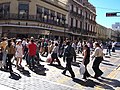
墨西哥国家统计局2005年数据显示,瓜达拉哈拉市区居住人口为1,600,894,为墨西哥人口第二多的城市,仅次于墨西哥州的埃卡提佩Ecatepec 。整个大都市区由哈里斯科州的八个城市组成,据同年统计数据,总常住人口达4,095,853,也是全国人口第二多的大都市区。瓜达拉哈拉市的人口密度也是墨西哥第二大,仅仅次于墨西哥州的内萨瓦尔科约特尔城Nezahualcóyotl城。居民54.8%信奉天主教。
-
 '
' -
 '
' -

-

-

-

-

-

-

-
-

-
-

-

-

-

-

-

-


.JPG)


事故
|
主条目:1992年瓜达拉哈拉大爆炸 |
姐妹城市
 中国厦门市
中国厦门市 西班牙西加莱斯
 美国阿尔伯克基
- 美国芝加哥
 秘鲁阿雷基帕
 委内瑞拉卡拉卡斯
 菲律宾宿务市
- 西班牙休达
- 美国克里夫兰
 巴西库里奇巴
 南韩大田广域市
- 美国唐尼
- 巴西戈亚尼亚
- 西班牙瓜达拉哈拉
 美属关岛阿加尼亚
- 美国堪萨斯城
 牙买加金斯敦
 波兰克拉科夫
 日本京都市
日本京都市- 美国兰辛
- 秘鲁利马
 赤道几内亚马拉博
 意大利米兰
意大利米兰- 西班牙奥尼亚蒂
 俄罗斯圣彼得堡
- 俄罗斯叶卡捷琳堡
- 美国圣安东尼奥
 巴拿马巴拿马城
- 意大利帕尔马
- 美国波特兰
 哥斯达黎加圣何塞
- 美国圣荷西
 萨尔瓦多圣萨尔瓦多
 多米尼加圣多明各
- 西班牙塞维尔
- 波兰弗罗茨瓦夫
- 巴西巴西利亚
- 中国上海市 [6]
 英国利物浦
英国利物浦 越南胡志明市
 台湾苗栗县
台湾苗栗县 爱尔兰都柏林
 哥伦比亚卡利
脚注
- ^ Back Matter. The Quarterly of the Texas State Historical Association. 1908, 12 (2) [2022-02-19]. ISSN 1948-3317. (原始内容存档于2022-02-20).
- ^ NORMALES CLIMATOLÓGICAS 1951–2010. Servicio Meteorológico Nacional. [2012-08-30]. (原始内容存档于2017-10-28) (西班牙语).
- ^ Extreme Temperatures and Precipitation for Guadalajara 1931–2010. Servicio Meteorológico Nacional. [2013-01-21]. (原始内容存档于2017-10-27) (西班牙语).
- ^ NORMALES CLIMATOLÓGICAS 1981–2000 (PDF). Servicio Meteorológico Nacional. [2016-01-23]. (原始内容 (PDF)存档于2016-01-30) (西班牙语).
- ^ Klimatafel von Guadalajara, Jalisco / Mexiko (PDF). Baseline climate means (1961–1990) from stations all over the world. Deutscher Wetterdienst. [2016-01-23]. (原始内容存档 (PDF)于2019-08-03) (德语).
- ^ https://portales.sre.gob.mx/coordinacionpolitica/index.php/entidades/148-jalisco
| |||||||
| ||||||||||||||||||||||
Text is available under the CC BY-SA 4.0 license; additional terms may apply.
Images, videos and audio are available under their respective licenses.
