欧罗巴岛
此条目可参照法语维基百科相应条目来扩充。 (2021年5月1日)若您熟悉来源语言和主题,请协助参考外语维基百科扩充条目。请勿直接提交机械翻译,也不要翻译不可靠、低品质内容。依版权协议,译文需在编辑摘要注明来源,或于讨论页顶部标记((Translated page))标签。
| 欧罗巴岛 Île Europa | |
|---|---|
 欧罗巴岛的地图 | |
 欧罗巴岛 在印度洋的位置 | |
| 地理 | |
| 位置 | 莫桑比克海峡 |
| 坐标 | 22°20′55″S 40°20′55″E / 22.34861°S 40.34861°E |
| 面积 | 28平方千米(10平方英里) |
| 管辖 | |
欧罗巴岛(法语:Île Europa)是一个位于莫桑比克海峡内的岛屿,面积约28平方公里,地势平坦,海岸线约长22.2公里;岛上没有港口、没有常驻人口,但有一个跑道长1,500米的机场。
命名及主权争议
该岛取名于1774年到访的英国船只“欧罗巴号”,1897年起成为法国属地,但马达加斯加宣称对其拥有主权,并称其为"Ampela"。
1944年8月13日,英国战时运输部征用的雷贝利轮(Radbury,造于1910年的老式蒸汽机船),从莫桑比克的洛伦索-马贵司驶往肯尼亚的蒙巴萨港,在莫桑比克海峡位置(24°20′S 41°45′E)被纳粹海军U-862潜艇击沉,船长、18名船员、1名英军护航炮手遇难,幸存的35人在职务最高的中国籍轮机长沈祖挺指挥下,乘一艘救生艇在海上漂流3天,最终登陆欧罗巴岛。[1]沈祖挺指挥船员收集海龟、鸟蛋、树叶充饥;用救生艇上的铜水箱改制为土造蒸馏器制淡水;围着火堆睡取暖;排班观察天空与海面,发现过往飞机与船舰时燃放轮胎求救。至10月26日被英军飞机发现,10月27日由一艘英国护卫舰接下送到加尔各答。1946年1月10日,英王乔治六世授予沈祖挺杰出官佐勋章(O.B.E.)。
-
 海滩区
海滩区 -
 机场设施
机场设施 -
 兵营区
兵营区 -
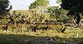 草原区
草原区


气候环境
-
 欧罗巴岛的卫星照片
 -
 欧罗巴岛的地图
 -
 欧罗巴岛的鸟瞰图
 -
 岛上北部的沙滩


| 欧罗巴岛 | |||||||||||||
|---|---|---|---|---|---|---|---|---|---|---|---|---|---|
| 月份 | 1月 | 2月 | 3月 | 4月 | 5月 | 6月 | 7月 | 8月 | 9月 | 10月 | 11月 | 12月 | 全年 |
| 历史最高温 °C(°F) | 35.5 (95.9) |
34.4 (93.9) |
35.0 (95.0) |
32.4 (90.3) |
31.2 (88.2) |
29.2 (84.6) |
30.0 (86.0) |
29.4 (84.9) |
34.0 (93.2) |
33.5 (92.3) |
34.3 (93.7) |
33.4 (92.1) |
35.5 (95.9) |
| 平均高温 °C(°F) | 30.8 (87.4) |
31.2 (88.2) |
30.6 (87.1) |
29.2 (84.6) |
27.6 (81.7) |
26.1 (79.0) |
25.6 (78.1) |
26.2 (79.2) |
27.1 (80.8) |
28.4 (83.1) |
29.3 (84.7) |
30.2 (86.4) |
28.5 (83.3) |
| 日均气温 °C(°F) | 27.5 (81.5) |
27.6 (81.7) |
27.0 (80.6) |
25.6 (78.1) |
23.5 (74.3) |
22.0 (71.6) |
21.6 (70.9) |
22.0 (71.6) |
22.7 (72.9) |
24.2 (75.6) |
25.3 (77.5) |
26.6 (79.9) |
24.7 (76.5) |
| 平均低温 °C(°F) | 24.1 (75.4) |
24.3 (75.7) |
23.6 (74.5) |
21.8 (71.2) |
19.7 (67.5) |
18.4 (65.1) |
17.7 (63.9) |
17.7 (63.9) |
18.7 (65.7) |
20.5 (68.9) |
21.8 (71.2) |
23.1 (73.6) |
20.9 (69.6) |
| 历史最低温 °C(°F) | 18.8 (65.8) |
19.1 (66.4) |
17.3 (63.1) |
15.6 (60.1) |
12.2 (54.0) |
10.2 (50.4) |
10.5 (50.9) |
11.1 (52.0) |
11.7 (53.1) |
12.4 (54.3) |
12.2 (54.0) |
15.0 (59.0) |
10.2 (50.4) |
| 平均降水量 mm(吋) | 130 (5.1) |
104 (4.1) |
62 (2.4) |
28 (1.1) |
24 (0.9) |
18 (0.7) |
11 (0.4) |
10 (0.4) |
9 (0.4) |
7 (0.3) |
30 (1.2) |
129 (5.1) |
562 (22.1) |
| 平均降水天数(≥ 0.1 mm) | 10 | 8 | 8 | 5 | 5 | 5 | 4 | 3 | 3 | 2 | 4 | 9 | 65 |
| 平均相对湿度(%) | 80 | 81 | 78 | 76 | 76 | 76 | 76 | 77 | 77 | 77 | 78 | 79 | 78 |
| 月均日照时数 | 275.9 | 257.1 | 275.9 | 255.0 | 272.8 | 246.0 | 263.5 | 288.3 | 276.0 | 300.7 | 291.0 | 272.8 | 3,275 |
| 日均日照时数 | 8.9 | 9.1 | 8.9 | 8.5 | 8.8 | 8.2 | 8.5 | 9.3 | 9.2 | 9.7 | 9.7 | 8.8 | 9.0 |
| 数据来源:Deutscher Wetterdienst[2] | |||||||||||||
参考
| |||||||||||||||||||||||||||||||||||||||||||||||||||||||||||
| |||||||||||||||||||||||||||||
| ||||||||||||||||||||||
Text is available under the CC BY-SA 4.0 license; additional terms may apply.
Images, videos and audio are available under their respective licenses.
Cover photo is available under {{::mainImage.info.license.name || 'Unknown'}} license.
Cover photo is available under {{::mainImage.info.license.name || 'Unknown'}} license.
Credit:
(see original file).
