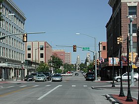
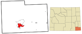
Cheyenne, Wyoming
Cheyenne | |
|---|---|
 Puseg ti ili ti Cheyenne | |
| Nagsasabtan: 41°8′44″N 104°48′7″W Nagsasabtan: 41°8′44″N 104°48′7″W | |
| Pagilian | Estados Unidos iti Amerika |
| Napundar | 1867 |
| Kalawa | |
| • Dagup | 27.12 sq mi (70.25 km2) |
| Kangato | 6,063 ft (1,848 m) |
| Populasion (Abril 1, 2020)[2] | |
| • Dagup | 65,132 |
| • Densidad | 2,400/sq mi (930/km2) |
| Kodigo ti koreo | 82001–82010, 82001, 82002, 82003, 82008, 82010 |
| Kodigo ti lugar | 307 |
| Website | www |
Ti Cheyenne (/ʃaɪˈæn/ wenno /ʃaɪˈɛn/) (Arapaho: Hítesííno'óowú' [3]) ket isu ti kapitolio ket ti kaaduan ti populasion a siudad ti Estado ti Wyoming ken tugaw ti kondado ti Kondado ti Laramie.[4] Daytoy ti kangrunaan a siudad ti Cheyenne, Wyoming, ken ti Estadistikal a Lugar ti Metropolitano a mangsakop iti amin a Kondado ti Laramie. Ti populasion ket 59,466 segun ti senso ti Estados Unidos idi 2010.[5] Ti Cheyenne ket isu ti akin-amianan unay a patingga ti nawatiwat ken napardas a dumakdakkel a lugar a gumay-at manipud idiay Cheyenne aginggana idiay Pueblo, Colorado, ken addaan iti populasion iti 5,467,633 segun ti senso ti Estados Unidos idi 2010 .[6] Ti Cheyenne ket mabirukan idiay Crow Creek ken Dry Creek. Ti Metropolitano a Lugar ti Cheyenne, Wyoming ket addaan iti populasion iti 91,738 manipud idi 2010, ken mangaramid daytoy iti maika-354 a kaaduan ti populasion a metropolitano a lugar idiay Estados Unidos.
Dagiti nagibasaran
[urnosen | urnosen ti taudan]- ^ United States. Bureau of the Census (2016), 2016 U.S. Gazetteer Files (iti Ingles), Washington, D.C.: United States Census Bureau, Wikidata Q32859555
- ^ https://data.census.gov/cedsci/table?t=Populations%20and%20People&g=0100000US,%241600000&y=2020; editor: United States Census Bureau; naala idi: Enero 1, 2022.
- ^ "English-Arapahodictionary". Naala idi 2012-05-23.
- ^ "Find a County". National Association of Counties. Naala idi 2011-06-07.
- ^ "Profile of General Population and Housing Characteristics: 2010 Demographic Profile Data (DP-1): Cheyenne city, Wyoming". U.S. Census Bureau, American Factfinder. Naala idi Abril 2, 2012.
- ^ "Archive copy". Naiyarkibo manipud iti kasisigud idi 2017-07-26. Naala idi 2014-10-06.
((cite web)): Panagtaripato ti CS1: naiyarkibo a kopia a kas titulo (silpo)
Dagiti akinruar a silpo
[urnosen | urnosen ti taudan]![]() Dagiti midia a mainaig iti Cheyenne, Wyoming iti Wikimedia Commons
Dagiti midia a mainaig iti Cheyenne, Wyoming iti Wikimedia Commons
- Opisial a website ti Siudad ti Cheyenne
- "Cheyenne (Wyoming)". Encyclopædia Britannica (iti Ingles) (Maika-11 nga ed.). 1911.
| Sapasap | |
|---|---|
| Dagiti nailian a biblioteka | |
| Dadduma | |
Text is available under the CC BY-SA 4.0 license; additional terms may apply.
Images, videos and audio are available under their respective licenses.


