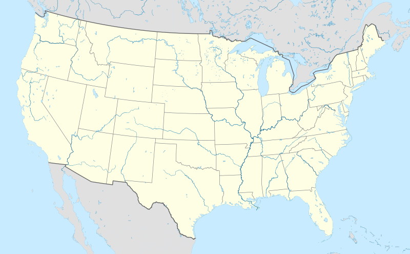
Պատկեր:Usa edcp location map.svg

Սկզբնական նիշք (SVG-նիշք, անվանապես 1181 × 731 փիքսել, նիշքի չափը՝ 2,03 ՄԲ)
Նիշքի պատմություն
Մատնահարեք օրվան/ժամին՝ նիշքի այդ պահին տեսքը դիտելու համար։
| Օր/Ժամ | Մանրապատկեր | Օբյեկտի չափը | Մասնակից | Մեկնաբանություն | |
|---|---|---|---|---|---|
| ընթացիկ | 20:48, 2 Ապրիլի 2024 |  | 1181 × 731 (2,03 ՄԲ) | Spesh531 | correction to Rhode Island border. Little Compton and Tiverton was previously shown to be in Massachusetts |
| 05:12, 7 հունվարի 2015 |  | 1181 × 731 (2,03 ՄԲ) | Wereldburger758 | Removal empty elements outside viewbox. Renaming of files. Valid SVG now. | |
| 17:56, 24 Օգոստոսի 2010 |  | 1181 × 731 (2,57 ՄԲ) | Uwe Dedering | coastline was to thin and bahamas pulled out of the atlantic | |
| 10:35, 24 Օգոստոսի 2010 |  | 1181 × 731 (3,48 ՄԲ) | Uwe Dedering | ((Information |Description=((en|1=Location map of the USA (without Hawaii and Alaska). EquiDistantConicProjection : Central parallel : * N: 37.0° N Central meridian : * E: 96.0° W Standard parallels: * 1: 32.0° N * 2: 42.0° N Made with Natural Ea |
Նիշքի օգտագործում
More than 100 pages use this file. The following list shows the first 100 pages that use this file only. A full list is available.
- Աբերդին (Վաշինգտոն)
- Ալբուկերկե
- Այովա Սիթի
- Անահայմ
- Ասպեն
- Ատլանտա
- Բաթոն Ռուժ
- Բալթիմոր
- Բանգոր (Վաշինգտոն)
- Բելինգհեմ
- Բիսմարկ (Հյուսիսային Դակոտա)
- Բոյսե
- Բոստոն
- Բուֆֆալո
- Բրեմերթոն
- Բրոնքս
- Գերի (Ինդիանա)
- Գլենդել (Կալիֆոռնիա)
- Դալաս
- Դե Մոյն
- Դենվեր
- Դետրոյթ
- Դիսնեյլենդ
- Դովեր (Դելավեր)
- Ելոուսթոուն (ազգային պարկ)
- Թալահասի
- Ինդիանապոլիս
- Լաս Վեգաս
- Լիթլ Ռոք
- Լինքոլն (Նեբրասկա)
- Լոս Անջելես
- ԿՈՆԿԱԿԱՖ-ի ոսկե գավաթ 1991
- ԿՈՆԿԱԿԱՖ-ի ոսկե գավաթ 1996
- ԿՈՆԿԱԿԱՖ-ի ոսկե գավաթ 1998
- ԿՈՆԿԱԿԱՖ-ի ոսկե գավաթ 2000
- ԿՈՆԿԱԿԱՖ-ի ոսկե գավաթ 2002
- ԿՈՆԿԱԿԱՖ-ի ոսկե գավաթ 2005
- ԿՈՆԿԱԿԱՖ-ի ոսկե գավաթ 2007
- ԿՈՆԿԱԿԱՖ-ի ոսկե գավաթ 2009
- ԿՈՆԿԱԿԱՖ-ի ոսկե գավաթ 2011
- Կալիֆոռնիայի տեխնոլոգիական ինստիտուտ
- Կանզասի համալսարան
- Կոլումբիա (Հարավային Կարոլինա)
- Կոլումբուս (Օհայո)
- Հարվարդի համալսարան
- Հելենա (Մոնտանա)
- Հյուստոն
- Հոնոլուլու
- Մազեպա
- Մամոնտի քարանձավի ազգային այգի
- Մայամի
- Մասաչուսեթսի տեխնոլոգիական ինստիտուտ
- Մոնթեբելլո
- Մոնտգոմերի (Ալաբամա)
- Նեշվիլ
- Նյու Յորք
- Նյու Յորքի համալսարան
- Նոգալես (Արիզոնա)
- Նոր Օռլեան
- Շայեն
- Չարլսթոն (Արևմտյան Վիրջինիա)
- Չիկագո
- Չիկագոյի համալսարան
- Չիքո
- Ջեքսոնվիլ (Ֆլորիդա)
- Ջորջ Վաշինգտոն համալսարան
- Ջունո (Ալյասկա)
- Ռայսի համալսարան
- Ռենտոն
- Ռիչարդսոն Սփրինգս
- Սալեմ (Օրեգոն)
- Սակրամենտո
- Սան Անտոնիո
- Սան Դիեգո
- Սան Խոսե (Կալիֆոռնիա)
- Սան Խուան (Պուերտո Ռիկո)
- Սան Ֆրանցիսկո
- Սթենֆորդի համալսարան
- Սիդար Ռեփիդս
- Սոլթ Լեյք Սիթի
- Սփրինգֆիլդ (Իլինոյս)
- Վաշինգտոն ԿՇ
- Վեբերի նահանգային համալսարան
- Վիրջինիայի համալսարան
- Տեխասի A&M համալսարան
- Տոպիկա
- Փասադենա (Կալիֆոռնիա)
- Փրովիդենս (Ռոդ Այլենդ)
- Քեմբրիջ (Մասաչուսեթս)
- Քլիվլենդ (Օհայո)
- Օլբանի (Նյու Յորք)
- Օկիչոբի (լիճ)
- Օստին (Տեխաս)
- Ֆիլադելֆիա
- Ֆինիքս
- Ֆորկս
- Ֆորտ-Ուերտ
- Ֆրանկֆորտ (Կենտուկի)
- Ֆրեզնո (Կալիֆոռնիա)
- Կաղապար:Տեղեկաքարտ Բնակավայր
View more links to this file.
Նիշքի համընդհանուր օգտագործում
Հետևյալ այլ վիքիները օգտագործում են այս նիշքը՝
- Օգտագործումը ab.wikipedia.org կայքում
- Օգտագործումը ace.wikipedia.org կայքում
- Օգտագործումը af.wikipedia.org կայքում
- Barberton (dubbelsinnig)
- Bretton Woods, New Hampshire
- Lake Placid
- Hollywood
- Aberdeen (dubbelsinnig)
- Jamestown, Virginië
- FIFA Sokker-Wêreldbekertoernooi in 1994
- Kategorie:Lughawens in die Verenigde State van Amerika
- Warrenton
- Winston-Salem
- Gettysburg
- Hartford
- Princeton, Wes-Virginië
- Princeton, Illinois
- Princeton, Indiana
- Princeton, Kentucky
- New Brunswick, New Jersey
- Mountain View
- Century City, Los Angeles
- FIFA Sokker-Wêreldbekertoernooi in 2026
- Harding, Minnesota
- Harding, Wisconsin
- Harding Township, New Jersey
- Russian Hill
- Moscow, Idaho
- Asheville
- Coloradorivier (dubbelsinnig)
- Tuscaloosa, Alabama
- Provo
- Verenigde State se nasionale krieketspan
- T20I-wêreldbeker 2024
- Kaap Canaveral- ruimtemagstasie
- Manson-krater
- Gebruiker:Aliwal2012/Lughawens in die VSA
- Օգտագործումը als.wikipedia.org կայքում
- Օգտագործումը an.wikipedia.org կայքում
Տեսնել այս նիշքի ավելի համընդհանուր օգտագործումը:
Մետատվյալներ
Text is available under the CC BY-SA 4.0 license; additional terms may apply.
Images, videos and audio are available under their respective licenses.


