For faster navigation, this Iframe is preloading the Wikiwand page for ไฟล์:Map of Brunei Demis.png.

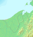
ไฟล์:Map of Brunei Demis.png

ดูภาพที่มีความละเอียดสูงกว่า(938 × 1,066 พิกเซล, ขนาดไฟล์: 238 กิโลไบต์, ชนิดไมม์: image/png)

Wikimedia Commons logo รูปภาพหรือไฟล์เสียงนี้ ต้นฉบับอยู่ที่ คอมมอนส์ รายละเอียดด้านล่าง เป็นข้อความที่แสดงผลจาก ไฟล์ต้นฉบับในคอมมอนส์
คอมมอนส์เป็นเว็บไซต์ในโครงการสำหรับเก็บรวบรวมสื่อเสรี ที่ คุณสามารถช่วยได้

ความย่อ

คำอธิบาย
Deutsch: Topografische Karte von Brunei. Quadratische Plattkarte, Zentrum: 4°39′00″N 114°45′00″E / 4.65000°N 114.75000°E / 4.65000; 114.75000. Geographische Begrenzung der Karte:
  • N: 5.5° N
  • S: 3.8° N
  • W: 114° O
  • O: 115.5° O
English: Blank relief map of Brunei. Equirectangular projection centered at 4°39′00″N 114°45′00″E / 4.65000°N 114.75000°E / 4.65000; 114.75000. Geographic limits of the map:
  • N: 5.5° N
  • S: 3.8° N
  • W: 114° E
  • E: 115.5° E
Français : Carte du relief vierge du Brunei. Projection équirectangulaire centrée en 4°39′00″N 114°45′00″E / 4.65000°N 114.75000°E / 4.65000; 114.75000. Limites géographiques de la carte :
  • N: 5.5° N
  • S: 3.8° N
  • O: 114° E
  • E: 115.5° E
วันที่
แหล่งที่มา งานของตัว, using Demis data
ผู้สร้างสรรค์ Mats Halldin (talk)

การอนุญาตใช้สิทธิ

Public domain
This image is in the public domain because it came from the site https://www.demis.nl/products/web-map-server/examples/ and was released by the copyright holder. Permission is granted to copy, distribute and/or modify this map since it is based on free of copyright images from: www.demis.nl. See also approval email on de.wp and its clarification.

Deutsch | English | македонски | മലയാളം | Nederlands | slovenščina | +/−

Public domain This work has been released into the public domain by its copyright holder, www.demis.nl. This applies worldwide.
ในบางประเทศ การกระทำดังกล่าวอาจไม่สามารถทำได้ตามกฎหมาย
www.demis.nl อนุญาตให้ทุกคนมีสิทธิ์ในการใช้ไฟล์นี้ในทุกเหตุผลการใช้ โดยไม่มีมีเงื่อนไข เว้นแต่กฎหมายไม่อนุญาตให้ทำเช่นนั้น

คำบรรยายโดยย่อ

เพิ่มคำบรรยายทรรทัดเดียวเพื่อขยายความว่าไฟล์นี้มีอะไร

รายการที่แสดงอยู่ในไฟล์นี้

ประกอบด้วย

ประวัติไฟล์

คลิกวันที่/เวลาเพื่อดูไฟล์ที่ปรากฏในขณะนั้น

วันที่/เวลารูปย่อขนาดผู้ใช้ความเห็น
ปัจจุบัน01:11, 21 ธันวาคม 2549รูปย่อสำหรับรุ่นเมื่อ 01:11, 21 ธันวาคม 2549938 × 1,066 (238 กิโลไบต์)Mats Halldin~commonswikiMap of Brunei Bounding box West 114°, South 3.8°, East 115.5°, North 5.5°. Center at ((coor d|4.65000|N|114.75000|E|scale:1020000)). ((demis-pd)) Category:Maps of Brunei

หน้าที่มีภาพนี้

หน้าต่อไปนี้ โยงมาที่ภาพนี้:

การใช้ไฟล์ข้ามโครงการ

วิกิอื่นต่อไปนี้ใช้ไฟล์นี้:

ข้อมูลเกี่ยวกับภาพ

{{bottomLinkPreText}} {{bottomLinkText}}
ไฟล์:Map of Brunei Demis.png
Listen to this article

This browser is not supported by Wikiwand :(
Wikiwand requires a browser with modern capabilities in order to provide you with the best reading experience.
Please download and use one of the following browsers:

This article was just edited, click to reload
This article has been deleted on Wikipedia (Why?)

Back to homepage

Please click Add in the dialog above
Please click Allow in the top-left corner,
then click Install Now in the dialog
Please click Open in the download dialog,
then click Install
Please click the "Downloads" icon in the Safari toolbar, open the first download in the list,
then click Install
{{::$root.activation.text}}

Install Wikiwand

Install on Chrome Install on Firefox
Don't forget to rate us

Tell your friends about Wikiwand!

Gmail Facebook Twitter Link

Enjoying Wikiwand?

Tell your friends and spread the love:
Share on Gmail Share on Facebook Share on Twitter Share on Buffer

Our magic isn't perfect

You can help our automatic cover photo selection by reporting an unsuitable photo.

This photo is visually disturbing This photo is not a good choice

Thank you for helping!


Your input will affect cover photo selection, along with input from other users.

X

Get ready for Wikiwand 2.0 🎉! the new version arrives on September 1st! Don't want to wait?