Old Saybrook, Connecticut
Old Saybrook, Connecticut | |
|---|---|
 Saybrook Breakwater Light | |
| Coordinates: 41°17′38″N 72°22′57″W / 41.29389°N 72.38250°W | |
| Country | |
| U.S. state | |
| County | Middlesex |
| Region | Lower CT River Valley |
| Settled | 1738 |
| Incorporated | 1854 |
| Area | |
| • Total | 21.6 sq mi (55.9 km2) |
| • Land | 15.0 sq mi (38.8 km2) |
| • Water | 6.6 sq mi (17.0 km2) |
| Elevation | 20 ft (6 m) |
| Population (2020)[2] | |
| • Total | 10,481 |
| • Density | 700/sq mi (270.1/km2) |
| Time zone | UTC−5 (Eastern) |
| • Summer (DST) | UTC−4 (Eastern) |
| ZIP code | 06475 |
| Area code(s) | 860/959 |
| FIPS code | 09-57320 |
| GNIS feature ID | 0213484[1] |
| Website | www |
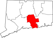
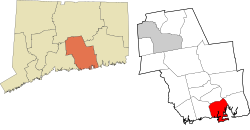
Old Saybrook is a town in Connecticut. It is in Middlesex County. There were 10,481 people living in Old Saybrook in 2020.[2] The incorporated borough of Fenwick is in Old Saybrook. The census-designated places of Old Saybrook Center and Saybrook Manor are also part of the town.
Saybrook, Illinois is named after Old Saybrook.
National Register of Historic Places in Old Saybrook
[change | change source]- Black Horse Tavern, added December 1, 1978
- Elisha Bushnell House, added November 29, 1978
- Connecticut Valley Railroad Roundhouse and Turntable Site, added April 28, 1994
- Jedidiah Dudley House, added April 12, 1982
- Samuel Eliot House, added November 9, 1972
- General William Hart House, added November 9, 1972
- James Pharmacy, added August 5, 1994
- Lynde Point Lighthouse, added May 29, 1990
- Old Saybrook South Green, added September 3, 1976
- Parker House, added November 29, 1978
- Humphrey Pratt Tavern, added November 7, 1972
- Saybrook Breakwater Lighthouse, added May 29, 1990
- William Tully House, added March 15, 1982
- Ambrose Whittlesey House, added August 23, 1985
- John Whittlesey Jr. House, added October 26, 1984
References
[change | change source]Other websites
[change | change source]Municipalities and communities of Middlesex County, Connecticut, United States | ||
|---|---|---|
| City |  | |
| Towns | ||
| Borough | ||
| CDPs |
| |
| Other communities |
| |
Text is available under the CC BY-SA 4.0 license; additional terms may apply.
Images, videos and audio are available under their respective licenses.


