New Haven County, Connecticut
New Haven County | |
|---|---|
 The New Haven Green Historic District | |
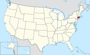
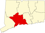
 Location within the U.S. state of Connecticut | |
 Connecticut's location within the U.S. | |
| Coordinates: 41°21′N 72°54′W / 41.35°N 72.9°W | |
| Country | |
| State | |
| Founded | 1666 |
| Named for | New Haven Colony |
| Seat | none (since 1960) New Haven (before 1960) |
| Largest municipality | New Haven (population) Guilford (area) |
| Area | |
| • Total | 862 sq mi (2,230 km2) |
| • Land | 605 sq mi (1,570 km2) |
| • Water | 258 sq mi (670 km2) 29.9% |
| Population | |
| • Total | 864,835 |
| • Density | 1,429.5/sq mi (551.9/km2) |
| Time zone | UTC−5 (Eastern) |
| • Summer (DST) | UTC−4 (EDT) |
New Haven County is a county in the US state of Connecticut. It is in the south central part of the state. The population was 864,835 in 2020.[1] This made New Haven County the third most populated county in Connecticut. There are 1,340 people per square mile.[2] Two of the state's largest cities, New Haven and Waterbury, are part of New Haven County.
Starting in 1960, county governments were no longer active. Until 1960, the city of New Haven was the county seat. In Connecticut, towns are responsible for all local government activities. This includes, fire and rescue, snow removal and schools. The county Sheriff plan was removed by voters. This was replaced by State Judicial Marshals in 2000. Because of this, the state judicial plan in New Haven County is divided into three districts: New Haven, Ansonia-Milford and Waterbury.
Colleges and universities
[change | change source]- Albertus Magnus College
- Gateway Community College
- Naugatuck Valley Community College
- Paier College of Art
- Post University
- Quinnipiac University
- Southern Connecticut State University
- University of New Haven
- University of Connecticut - Waterbury
- Yale University
New Haven county organizations
[change | change source]- New Haven County Cutters
National protected area
[change | change source]- Stewart B. McKinney National Wildlife Refuge
Towns
[change | change source]
|
|
References
[change | change source]- ↑ 1.0 1.1 "Census - Geography Profile: New Haven County, Connecticut". United States Census Bureau. Retrieved November 20, 2021.
- ↑ "2010 Census Data - 2010 Census". Archived from the original on 2012-02-15. Retrieved 2012-10-28.
Other websites
[change | change source]- New Haven County Sheriff's Department
- New Haven County Marshals Association Archived 2009-01-21 at the Wayback Machine
41°21′N 72°54′W / 41.35°N 72.90°W
Municipalities and communities of New Haven County, Connecticut, United States | ||
|---|---|---|
| Cities |  | |
| Towns | ||
| Boroughs |
*Consolidated borough and town | |
| CDPs |
| |
| Other communities |
| |
Text is available under the CC BY-SA 4.0 license; additional terms may apply.
Images, videos and audio are available under their respective licenses.


