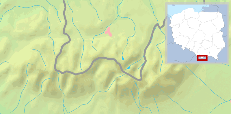
Plik:POL Tatry.svg

Rozmiar pierwotny (Plik SVG, nominalnie 811 × 401 pikseli, rozmiar pliku: 5,36 MB)
Historia pliku
Kliknij na datę/czas, aby zobaczyć, jak plik wyglądał w tym czasie.
| Data i czas | Miniatura | Wymiary | Użytkownik | Opis | |
|---|---|---|---|---|---|
| aktualny | 12:30, 11 lut 2009 |  | 811 × 401 (5,36 MB) | Mareklug | pozycjonowanie w górnym rogu na życzenie, ramka (subtelna, półprzezroczysta) / positioning in upper corner on request, border (a suttle, semi-transparent one) |
| 05:19, 11 lut 2009 |  | 811 × 401 (5,36 MB) | Mareklug | repositioned the POL white map miniature to the lower right corner, because it was occluding some of Poland. Now both Tatry maps that are national variants use that corner (SVK Tatry.svg & POL Tatry.svg) | |
| 15:32, 10 lut 2009 |  | 811 × 401 (5,19 MB) | Mareklug | ((Information |Description=((en|1=Map of the Tatra Mountains)) ((pl|1=Mapa Tatr)) |Source=*File:Tatry_mapa_2.png *File:Poland_location_map_white.svg |Date=2009-02-10 13:28 (UTC) |Author=*File:Tatry_mapa_2.png: ToSter |Dat |
Lokalne wykorzystanie pliku
Z tego pliku korzysta więcej niż 100 stron. Poniższa lista pokazuje jedynie 100 pierwszych z nich. Dostępna jest również pełna lista.
- Beskid (Tatry)
- Białczańska Przełęcz
- Białczańska Przełęcz Wyżnia
- Buczynowe Czuby
- Butorowy Wierch
- Ciemniak
- Cubryna
- Czarne Ściany
- Czarny Staw Gąsienicowy
- Czarny Staw Polski
- Czarny Staw pod Rysami
- Czerwone Stawki Gąsienicowe
- Czerwony Staw Pańszczycki
- Dwoisty Staw Gąsienicowy
- Dziura (jaskinia)
- Długi Staw Gąsienicowy
- Giewont
- Granaty
- Grześ
- Gubałówka
- Gęsia Szyja
- Gładka Przełęcz
- Gładki Wierch
- Hotel górski PTTK Kalatówki
- Jaskinia Mroźna
- Jaskinia Mylna
- Kasprowy Wierch
- Kazalnica Mięguszowiecka
- Kopa Kondracka
- Kozi Wierch
- Kozia Przełęcz
- Kozie Czuby
- Kościelec (Tatry)
- Krzesanica
- Krzyżne
- Kurtkowiec
- Liliowe (przełęcz)
- Litworowy Staw Gąsienicowy
- Marusarzowa Przełączka
- Marusarzowa Turnia
- Małołączniak
- Mały Kozi Wierch
- Mały Staw Polski
- Miedziane (Tatry)
- Mięguszowiecka Przełęcz pod Chłopkiem
- Mnich (Tatry)
- Morskie Oko
- Myślenickie Turnie
- Niżnie Rysy
- Nosal (Tatry)
- Opalony Wierch
- Orla Baszta
- Owcza Przełęcz
- Owcze Turniczki
- Palenica Białczańska
- Pańszczycka Przełączka Wyżnia
- Przedni Staw Polski
- Przełączka pod Żabią Czubą
- Roztocka Czuba
- Rusinowa Polana
- Rysy
- Schronisko Górskie ZHP „Głodówka”
- Schronisko PTTK na Hali Kondratowej
- Schronisko PTTK na Hali Ornak
- Schronisko PTTK na Polanie Chochołowskiej
- Schronisko PTTK nad Morskim Okiem
- Schronisko PTTK w Dolinie Pięciu Stawów Polskich
- Schronisko PTTK w Dolinie Roztoki
- Schronisko PTTK „Murowaniec”
- Siklawa
- Skrajna Turnia
- Smocza Jama (Tatry)
- Starorobociański Wierch
- Szpiglasowa Przełęcz
- Szpiglasowy Wierch
- Tatry
- Walentkowy Wierch
- Wielki Staw Polski
- Wierch pod Fajki
- Wodogrzmoty Mickiewicza
- Wole Oko
- Wrota Chałubińskiego
- Zadni Mnich
- Zadni Staw Gąsienicowy
- Zadni Staw Polski
- Zamarła Turnia
- Zawrat
- Zielony Staw Gąsienicowy
- Zmarzła Przełęcz
- Zmarzły Staw Gąsienicowy
- Świnica
- Żabi Koń
- Żabi Mnich
- Żabi Szczyt Niżni
- Żabi Szczyt Wyżni
- Żabia Czuba
- Żabia Lalka
- Żabia Przełęcz
- Żabia Przełęcz Wyżnia
- Żabia Turnia Mięguszowiecka
Pokaż więcej odnośników do tego pliku.
Globalne wykorzystanie pliku
Ten plik jest wykorzystywany także w innych projektach wiki:
- Wykorzystanie na de.wikivoyage.org
- Wykorzystanie na en.wikipedia.org
- Wykorzystanie na fy.wikipedia.org
- Wykorzystanie na ko.wikipedia.org
- Wykorzystanie na pl.wikibooks.org
- Wykorzystanie na uk.wikipedia.org
- Wykorzystanie na zh.wikipedia.org
Text is available under the CC BY-SA 4.0 license; additional terms may apply.
Images, videos and audio are available under their respective licenses.


