桧塚奥峰
| 桧塚奥峰 | |
|---|---|
 西方より桧塚奥峰を望む | |
| 標高 | 1,420 m |
| 所在地 | 三重県松阪市 |
| 位置 | 北緯34度21分50秒 東経136度6分43秒 / 北緯34.36389度 東経136.11194度座標: 北緯34度21分50秒 東経136度6分43秒 / 北緯34.36389度 東経136.11194度 |
| 山系 | 台高山脈 |
 桧塚奥峰 (日本)  桧塚奥峰 (三重県) | |

桧塚奥峰(ひのきづかおくみね)は、日本の三重県松阪市飯高町青田にある標高1,420mの山である。桧塚奥峰は台高山脈を構成する山のひとつ。他の府県との境界上にある山を除けば三重県の最高峰である。
登山道
[編集]桧塚奥峰に至る登山道には、主要なものが2つある。
- 三重県側のマナコ谷登山口(木屋谷川林道)から登る山道。所要時間は約2時間15分ほど。
- 奈良県側から明神岳・明神平を経由して登るルート。最寄りの駐車スペースから約2時間40分を要する。公共交通を利用する場合、奈良交通大又バス停から駐車スペースまで更に70分かかる。
交通
[編集]-
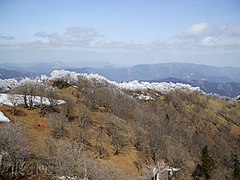
 桧塚奥峰山頂
 -
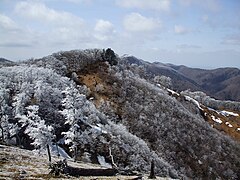
 山頂から北北東を望む
 -
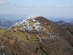 山頂から東北東に桧塚を望む
 -
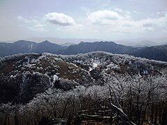
 山頂から南東を望む
 -
 西北西を望む
 -
 南南西を望む


出典
[編集]- 『大台ヶ原高見・倶留尊山 2008年版』(山と高原地図51、昭文社、2008年3月、ISBN 978-4398756114 )
- 国土地理院/ウォッちず
関連項目
[編集]外部リンク
[編集]Text is available under the CC BY-SA 4.0 license; additional terms may apply.
Images, videos and audio are available under their respective licenses.
Cover photo is available under {{::mainImage.info.license.name || 'Unknown'}} license.
Cover photo is available under {{::mainImage.info.license.name || 'Unknown'}} license.
Credit:
(see original file).
