For faster navigation, this Iframe is preloading the Wikiwand page for 奥工石山.

奥工石山

奥工石山
標高 1,515.8 m
所在地 高知県長岡郡大豊町本山町
位置 北緯33度51分20.81秒 東経133度34分46.62秒 / 北緯33.8557806度 東経133.5796167度 / 33.8557806; 133.5796167
山系 四国山地
奥工石山の位置(日本内)
奥工石山
プロジェクト 山
テンプレートを表示

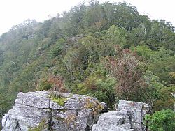
奥工石山(おくくいしやま)は、高知県長岡郡大豊町本山町にまたがり、四国山地中部にある標高1,515.8mのである。

概要

高知市の北の近郊にある工石山と区別するため、奥工石山と呼ばれる。また、立川川の源流域にあり地元では立川工石山と呼ばれる。山名の由来は、平家の落人が飢えに苦しみ山の石が喰えるものならと嘆き喰石山と呼ばれたのが変化したといわれる[1]

土佐北街道の県道5号線から林道仁尾ヶ内線を行くと登山口がある。そこには無人の工石山荘や白石神社があり、鳥居をくぐって登り始める。中ほどには水場である岩清水があり、山頂近くにはユルギ岩と呼ばれる大きな岩山があり、てっぺんに白山神社の祠と山頂表示があり頂上と間違えそうであるが、この山の頂上はさらに登ったところであり一等三角点があり、一等三角点百名山に選ばれている。

ギャラリー

脚注

  1. ^ 山と渓谷社「四国百名山」2000年9月10日発行 76ページ

関連項目

{{bottomLinkPreText}} {{bottomLinkText}}
奥工石山
Listen to this article

This browser is not supported by Wikiwand :(
Wikiwand requires a browser with modern capabilities in order to provide you with the best reading experience.
Please download and use one of the following browsers:

This article was just edited, click to reload
This article has been deleted on Wikipedia (Why?)

Back to homepage

Please click Add in the dialog above
Please click Allow in the top-left corner,
then click Install Now in the dialog
Please click Open in the download dialog,
then click Install
Please click the "Downloads" icon in the Safari toolbar, open the first download in the list,
then click Install
{{::$root.activation.text}}

Install Wikiwand

Install on Chrome Install on Firefox
Don't forget to rate us

Tell your friends about Wikiwand!

Gmail Facebook Twitter Link

Enjoying Wikiwand?

Tell your friends and spread the love:
Share on Gmail Share on Facebook Share on Twitter Share on Buffer

Our magic isn't perfect

You can help our automatic cover photo selection by reporting an unsuitable photo.

This photo is visually disturbing This photo is not a good choice

Thank you for helping!


Your input will affect cover photo selection, along with input from other users.

X

Get ready for Wikiwand 2.0 🎉! the new version arrives on September 1st! Don't want to wait?