プンタレナス
プンタレナス市 | |
|---|---|
 | |
|
愛称: La perla del Pacífico, El Puerto | |
| 北緯9度58分 西経84度50分 / 北緯9.967度 西経84.833度 | |
| 国 | コスタリカ |
| 州 | プンタレナス州 |
| 市(カントン) | プンタレナス市 |
| 創設 | 1858年9月17日 |
| 政府 | |
| • 種別 | 基礎自治体(ムニシピオ) |
| • 首長 | ラファエル・アンヘル・ロドリゲス・カストロ(国民解放党) |
| 面積 | |
| • 合計 | 1,842 km2 |
| 標高 | 5 m |
| 人口 (2020年[1]) | |
| • 合計 | 140,102人 |
| 等時帯 | UTC-6 (中部標準時) |
| 市外局番 | + 506 |
| ウェブサイト | www.puntarenas.go.cr/ |


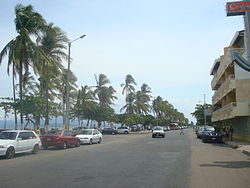
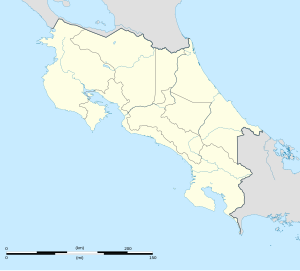
プンタレナス(西: Puntarenas、「砂地」の意)は、コスタリカのプンタレナス州の州都。人口は約14万人で州内最大の都市である。いびつな形をしたプンタレナス州の北部にある。
太平洋のビーチはサーファーをはじめ、多くの観光客を惹きつける。北西にも観光地のモンテベルデがある。
市内のカルデーラ港は、国内きっての主要港である。プンタレナスとニコヤ半島を結ぶフェリー航路がある[2]。
歴史
[編集]植民地時代にビジャ・ブルセラス (Villa Bruselas) として知られたプンタレナスは1519年、フアン・ポンセ・デ・レオンによって発見された。ニコヤ湾がコスタリカ内陸部の玄関口であるにもかかわらず、プンタレナス港は高地でのコーヒー生産が輸出可能な規模にまで拡大する1840年まで開発されなかった。1845年、コスタリカ国会はプンタレナスを(コニャックなどアルコール度数の高い酒類を除いて)免税港に指定した。コーヒーは元々、山岳地帯から牛車で運ばれていたが、1879年にエスパルサの町まで鉄道が開通した。1910年にはサンホセまで鉄道が全通し、輸送が始まった。
中央盆地とを結ぶ鉄道のおかげで、太平洋の運輸業は20世紀を通じてこの地域の要であり続けた。しかし港湾施設の老朽化・劣化とさらに大規模な船団を停泊させられる収容能力が求められたことから、1980年代、プンタレナスの南に新しく港が建設された。
気候
[編集]プンタレナスはコスタリカ中央盆地よりも概して気温が高い。最高気温は一年を通じて、30度から35度のあいだで推移する[3]。
| プンタレナスの気候 | |||||||||||||
|---|---|---|---|---|---|---|---|---|---|---|---|---|---|
| 月 | 1月 | 2月 | 3月 | 4月 | 5月 | 6月 | 7月 | 8月 | 9月 | 10月 | 11月 | 12月 | 年 |
| 平均最高気温 °C (°F) | 33.5 (92.3) |
34.4 (93.9) |
34.0 (93.2) |
34.6 (94.3) |
33.1 (91.6) |
32.2 (90) |
32.2 (90) |
32.2 (90) |
31.9 (89.4) |
31.6 (88.9) |
31.8 (89.2) |
32.0 (89.6) |
32.79 (91.03) |
| 日平均気温 °C (°F) | 27.6 (81.7) |
28.3 (82.9) |
28.5 (83.3) |
29.2 (84.6) |
28.6 (83.5) |
27.9 (82.2) |
27.7 (81.9) |
27.7 (81.9) |
27.5 (81.5) |
27.4 (81.3) |
27.3 (81.1) |
27.1 (80.8) |
27.9 (82.23) |
| 平均最低気温 °C (°F) | 21.7 (71.1) |
22.2 (72) |
22.9 (73.2) |
23.7 (74.7) |
24.1 (75.4) |
23.6 (74.5) |
23.2 (73.8) |
23.1 (73.6) |
23.1 (73.6) |
23.2 (73.8) |
22.8 (73) |
22.1 (71.8) |
22.98 (73.37) |
| 雨量 mm (inch) | 5.5 (0.217) |
4.1 (0.161) |
4.9 (0.193) |
30.3 (1.193) |
204.1 (8.035) |
217.3 (8.555) |
175.7 (6.917) |
223.1 (8.783) |
296.1 (11.657) |
279.1 (10.988) |
132.0 (5.197) |
27.7 (1.091) |
1,599.9 (62.987) |
| 平均降雨日数 | 1.8 | 1.9 | 2.9 | 7.8 | 19.1 | 21.0 | 18.0 | 21.8 | 24.3 | 24.5 | 14.7 | 5.7 | 163.5 |
| 平均月間日照時間 | 263.5 | 254.3 | 282.1 | 255.0 | 201.5 | 156.0 | 164.3 | 170.5 | 159.0 | 167.4 | 183.0 | 232.5 | 2,489.1 |
| 出典1:World Meteorological Organization[4] | |||||||||||||
| 出典2:Hong Kong Observatory[5] | |||||||||||||
スポーツ
[編集]- プンタレナスFC - サッカークラブ
ゆかりの人物
[編集]- ロナルド・ゴメス - 元コスタリカ代表サッカー選手。同市出身。
- ジギスムント・フォン・プロイセン - プロイセン王国の王族。同市で死去。
姉妹都市
[編集]脚注
[編集]- ^ “city population”. 30 May 2023閲覧。
- ^ Ferry information
- ^ Puntarenas temperatures from Climatezone.com
- ^ “Climate Information for Puntarenas”. World Meteorological Organization. 2012年8月4日閲覧。
- ^ “Climatological Information for Puntarenas, Costa Rica”. Hong Kong Observatory. 2012年8月4日閲覧。
外部リンク
[編集]座標: 北緯9度58分 西経84度50分 / 北緯9.967度 西経84.833度
| 全般 | |
|---|---|
| 国立図書館 | |
| その他 | |
Text is available under the CC BY-SA 4.0 license; additional terms may apply.
Images, videos and audio are available under their respective licenses.

