サンホセ (コスタリカ)
| サンホセ San José | |||||
|---|---|---|---|---|---|

| |||||
| |||||
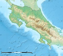
| 位置 | |||||
 コスタリカ国内の位置 | |||||
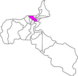
| 位置 | |||||
 サンホセ州内の位置 | |||||

| |||||
| 座標 : 北緯9度56分 西経84度05分 / 北緯9.933度 西経84.083度 | |||||
| 歴史 | |||||
| 建設 | 1738年 | ||||
| 行政 | |||||
| 国 | |||||
| 州 | サンホセ州 | ||||
| 市 | サンホセ | ||||
| 市長 | ホニー・アラヤ・モンヘ (国民解放党) | ||||
| 地理 | |||||
| 面積 | |||||
| 市域 | 44.62 km2 | ||||
| 標高 | 1161 m | ||||
| 人口 | |||||
| 人口 | (2015年現在) | ||||
| 市域 | 33万3981人 | ||||
| 人口密度 | 6455.71人/km2 | ||||
| 市街地 | 154万3000人 | ||||
| 都市圏 | 215万8898人 | ||||
| 都市圏人口密度 | 1056.2人/km2 | ||||
| その他 | |||||
| 等時帯 | UTC-6 (UTC-6) | ||||
| 夏時間 | なし | ||||
| 公式ウェブサイト : www.msj.go.cr/SitePages/home.aspx | |||||
サンホセあるいはサンジョゼ(San José)は、コスタリカの首都および同国サンホセ州の州都である、また、コスタリカの最大の都市である。中米の世界都市。
サンホセはコスタリカの中央に位置する。山岳地帯にあり、標高約1170mである。
歴史
サンホセは、かつては重要性のない小さな村だった。
1824年に国家元首のフアン・モラ・フェルナンデスがスペインの植民都市だったカルタゴからサンホセに政庁を移すことを決定した。それによって、町は急成長した。
このため、18世紀半ばに都市の起源を持つサンホセは、他のラテンアメリカの首都と異なり、スペインの植民都市の雰囲気が全くない。
気候
ケッペンの気候区分ではサバナ気候(Aw)に属し、雨季と乾期がある。標高1100mの高原にあるため、最高気温は比較的低く過ごしやすい。
| サンホセ(フアン・サンタマリーア国際空港)の気候 | |||||||||||||
|---|---|---|---|---|---|---|---|---|---|---|---|---|---|
| 月 | 1月 | 2月 | 3月 | 4月 | 5月 | 6月 | 7月 | 8月 | 9月 | 10月 | 11月 | 12月 | 年 |
| 最高気温記録 °C (°F) | 31.5 (88.7) |
33.3 (91.9) |
33.4 (92.1) |
34.5 (94.1) |
32.8 (91) |
32.1 (89.8) |
31.7 (89.1) |
32.0 (89.6) |
32.0 (89.6) |
31.4 (88.5) |
30.3 (86.5) |
31.5 (88.7) |
34.5 (94.1) |
| 平均最高気温 °C (°F) | 28.2 (82.8) |
29.1 (84.4) |
29.9 (85.8) |
30.3 (86.5) |
28.8 (83.8) |
28.2 (82.8) |
28.2 (82.8) |
28.3 (82.9) |
27.8 (82) |
27.1 (80.8) |
27.2 (81) |
27.9 (82.2) |
28.4 (83.1) |
| 日平均気温 °C (°F) | 22.6 (72.7) |
23.0 (73.4) |
23.5 (74.3) |
23.7 (74.7) |
22.9 (73.2) |
22.5 (72.5) |
22.6 (72.7) |
22.4 (72.3) |
22.0 (71.6) |
21.8 (71.2) |
21.9 (71.4) |
22.3 (72.1) |
22.6 (72.7) |
| 平均最低気温 °C (°F) | 18.5 (65.3) |
18.7 (65.7) |
18.8 (65.8) |
19.1 (66.4) |
19.2 (66.6) |
19.0 (66.2) |
19.0 (66.2) |
18.8 (65.8) |
18.3 (64.9) |
18.5 (65.3) |
18.3 (64.9) |
18.3 (64.9) |
18.7 (65.7) |
| 最低気温記録 °C (°F) | 11.7 (53.1) |
13.2 (55.8) |
14.5 (58.1) |
14.9 (58.8) |
14.9 (58.8) |
15.8 (60.4) |
15.2 (59.4) |
16.0 (60.8) |
15.8 (60.4) |
15.5 (59.9) |
14.5 (58.1) |
14.2 (57.6) |
11.7 (53.1) |
| 降水量 mm (inch) | 6.3 (0.248) |
10.2 (0.402) |
13.8 (0.543) |
79.9 (3.146) |
267.6 (10.535) |
280.1 (11.028) |
181.5 (7.146) |
276.9 (10.902) |
355.1 (13.98) |
330.6 (13.016) |
135.5 (5.335) |
33.5 (1.319) |
1,971 (77.6) |
| 平均降水日数 (≥0.1 mm) | 3 | 3 | 5 | 10 | 23 | 22 | 20 | 22 | 26 | 25 | 17 | 8 | 184 |
| % 湿度 | 68 | 68 | 66 | 70 | 77 | 83 | 80 | 83 | 85 | 87 | 79 | 74 | 76.7 |
| 平均月間日照時間 | 285.2 | 266.0 | 282.1 | 240.0 | 182.9 | 144.0 | 151.9 | 158.1 | 147.0 | 161.2 | 177.0 | 244.9 | 2,440.3 |
| 出典1:Deutscher Wetterdienst[1] | |||||||||||||
| 出典2:NOAA (sun 1961–1990)[2] | |||||||||||||
交通
市中心部から18kmのところに、フアン・サンタマリーア国際空港をもつ。
姉妹都市
ギャラリー
-
コスタリカ国立劇場
-
サンホセのダウンタウン
-
サンホセの衛星写真
出典
- ^ “Klimatafel von San José (Int. Flugh.) / Costa Rica”. Federal Ministry of Transport and Digital Infrastructure. 2016年9月17日閲覧。
- ^ “Juan Santamaria Climate Normals 1961–1990”. National Oceanic and Atmospheric Administration. 2017年7月26日閲覧。
関連項目
外部リンク
Text is available under the CC BY-SA 4.0 license; additional terms may apply.
Images, videos and audio are available under their respective licenses.


