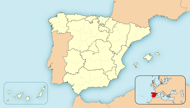
ファイル:EspañaLoc.svg

元のファイル (SVG ファイル、3,300 × 1,885 ピクセル、ファイルサイズ: 1.9メガバイト)
ファイルの履歴
過去の版のファイルを表示するには、その版の日時をクリックしてください。
| 日付と時刻 | サムネイル | 寸法 | 利用者 | コメント | |
|---|---|---|---|---|---|
| 現在の版 | 2010年12月8日 (水) 12:22 |  | 3,300 × 1,885 (1.9メガバイト) | Miguillen | quito bordes |
| 2010年11月24日 (水) 14:33 |  | 3,300 × 1,885 (1.9メガバイト) | Miguillen | no se ve. y abriendo la imagen en inkscape veo que se ha vandalizado | |
| 2010年11月24日 (水) 14:23 |  | 3,300 × 1,885 (777キロバイト) | Mutxamel | Borders | |
| 2010年2月15日 (月) 01:28 |  | 3,300 × 1,885 (1.9メガバイト) | Miguillen | Reverted to version as of 09:28, 27 April 2008 | |
| 2010年2月13日 (土) 15:50 |  | 3,300 × 1,885 (1.63メガバイト) | Malus Catulus | Removed fancy shadow effect which is un-standard | |
| 2008年4月27日 (日) 09:28 |  | 3,300 × 1,885 (1.9メガバイト) | HansenBCN | Sombreado de agua - desplazado - y fronteras provinciales más tenues | |
| 2008年4月26日 (土) 19:23 |  | 3,300 × 1,885 (1.89メガバイト) | HansenBCN | +fronteras provinciales | |
| 2008年4月26日 (土) 14:39 |  | 3,300 × 1,885 (967キロバイト) | HansenBCN | Bordes | |
| 2008年4月26日 (土) 14:34 |  | 3,300 × 1,885 (967キロバイト) | HansenBCN | == Summary == ((Information |Description=Spain Location Map |Source=self-made |Date=26/april/2008 |Author= HansenBCN |Permission= |other_versions=50px )) == Licensing == ((PD-self)) |
ファイルの使用状況
このファイルへは 100 を超える数のページで使用されています。 以下の一覧ではこのファイルを使用している最初の 100 ページのみを表示しています。 完全な一覧も参照してください。
- アイェルベ
- アタプエルカ
- アドルフォ・スアレス・マドリード=バラハス空港
- アビラ
- アランコン
- アランフエス
- アリカンテ
- アルカニス
- アルカラ・デ・エナーレス
- アルハンブラ宮殿
- アルバセテ
- アルマサン
- アルメリア
- ア・コルーニャ
- ウエスカ
- ウエルバ
- ウベダ
- エステーリャ
- エルチェ
- エントレナ
- オウレンセ
- オビエド
- オリベンサ
- カステリョン・デ・ラ・プラナ
- カセレス
- カディス
- カラタユー
- カラバカ・デ・ラ・クルス
- カルタヘナ (スペイン)
- クエンカ (スペイン)
- グアダラハラ (スペイン)
- グラナダ
- ゲルニカ
- コリア・デル・リオ
- コルドバ (スペイン)
- サグント
- サバデイ
- サモラ (スペイン)
- サラゴサ
- サラマンカ
- サングエサ
- サンタンデール (スペイン)
- サンティアゴ・デ・コンポステーラ
- サン・セバスティアン
- シウダー・レアル
- ジローナ
- セゴビア
- セビリア
- ソリア
- タラゴナ
- タラサ
- タリファ
- テルエル
- トゥデラ
- トルデシリャス
- トレド
- ハエン
- ハカ (スペイン)
- バエサ
- バサ
- バダホス
- バリャドリッド
- バルセロナ
- バル・デ・ボイ
- バレンシア (スペイン)
- パウ
- パルマ・デ・マヨルカ
- パレンシア
- パンプローナ
- ヒホン
- ビック (スペイン)
- ビトリア=ガステイス
- ビリャロブレド
- ビルバオ
- ビーゴ (スペイン)
- フィゲラス
- ブニョール
- ブルゴス
- プエンテ・ラ・レイナ
- ヘレス・デ・ラ・フロンテーラ
- ペニスコラ
- ポンテベドラ
- マドリード
- マハン (スペイン)
- マヨルカ島
- マラガ
- ミランダ・デ・エブロ
- メノルカ島
- メリダ (スペイン)
- モンソン
- ラ・セウ・ドゥルジェイ
- リェイダ
- リビア (スペイン)
- リポイ
- ルシアーナ
- ルーゴ (スペイン)
- レウス
- レオン (スペイン)
- ログローニョ
- ロルカ
このファイルへのリンク元を更にを表示する。
グローバルなファイル使用状況
以下に挙げる他のウィキがこの画像を使っています:
- ar.wikipedia.org での使用状況
- azb.wikipedia.org での使用状況
- br.wikipedia.org での使用状況
- ca.wikipedia.org での使用状況
- cbk-zam.wikipedia.org での使用状況
- eml.wikipedia.org での使用状況
- en.wikipedia.org での使用状況
- eo.wikipedia.org での使用状況
- es.wikipedia.org での使用状況
このファイルのグローバル使用状況を表示する。
メタデータ
Text is available under the CC BY-SA 4.0 license; additional terms may apply.
Images, videos and audio are available under their respective licenses.


