Isla ti Paskua
Teritorio ti Isla ti Paskua | |
|---|---|
|
Wagayway | |
| Nailian a kanta: Advance Australia Fair | |
 | |
| Kapitolio | Flying Fish Cove ("The Settlement") |
| Kadakkelan a siudad | capital |
| Opisial a sasao | Inggles (de facto) |
| Grupgrupo ti etniko |
|
| Nagan dagiti umili | Taga-Isla ti Paskua |
| Gobierno | Pederal a batay-linteg a monarkia |
• Monarko | Isabel II |
• Gobernador-Heneral ti Mankomunidad ti Australia | Apo Peter Cosgrove |
• Administrador | Jon Stanhope |
• Presidente ti Shire | Foo Kee Heng |
| Territorio ti Australia | |
• Kinaturay naipan iti Australia | 1957 |
| Kalawa | |
• Dagup | 135 km2 (52 sq mi) |
• Danum (%) | 0 |
| Populasion | |
• Karkulo idi 2011 | 2,072[1] (Maika-220) |
• Densidad | 10.39/km2 (26.9/sq mi) (n/a) |
| Kuarta | Doliar ti Australia (AUD) |
| Sona ti oras | UTC+7 (CXT) |
| Kodigo ti panagtawag | 61 |
| TLD ti internet | .cx |
Nagsasabtan: 10°29′S 105°38′E / 10.483°S 105.633°E
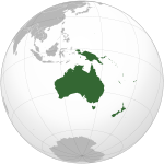
Ti Teritorio ti Isla ti Paskua ket teritorio ti Australia idiay Taaw Indiano. Daytoy ket addaan iti populasion iti 2,072 nga agtataeng nga agnanaed kadagiti nadumaduma a "Pagtaengan a luglugar" idiay akin-amianan nga ungto ti isla: ti Flying Fish Cove (naam-ammuan pay a kas ti Kampong), Silver City, Poon Saan, ken Drumsite. Kaaduan ti populasion ket Australiano nga Insik. Daytoy ket tinawtawaga a kas Isla ti Paskua gapu ta naduktalan daytoy iti Aldaw ti Paskua.
Ti heograpiko a pannakaisalsalumina ti isla ken ti naipakasaritaan a bassit a pannakadisturbo ti tattao ket nakaiturongan ti nangato nga agpang ti endemismo kadagiti bukodna a flora ken fauna isu a kaaduan daytoy iti pannakainteresado dagiti sientista ken dagiti naturalista.[2] 63% iti bukodna a 135 kuadrado kilometro (52 sq mi) ket nailian a parke ti Australia. Adda met dagiti dadakkel a luglugar a kaaduanna ket katuduan a bakir.
Dagiti nota
[urnosen | urnosen ti taudan]- ^ Opisina dagiti Estadistika ti Australia (31 Oktubre 2012). "Isla ti Paskua". 2011 Census QuickStats. Naala idi 30 Hulio 2013.
- ^ "Save Christmas Island – Introduction". The Wilderness Society. 19 Septiembre 2002. Naiyarkibo manipud iti kasisigud idi 2007-06-09. Naala idi 14 Abril 2007.
Dagiti nagibasaran
[urnosen | urnosen ti taudan]- "Flora: Endemic plants". Parks and Reserves: Christmas Island National Park. Australia Government – Dept of Sustainability, Environment, Water, Population and Communities. 21 Nobiembre 2012. Naala idi 25 Disiembre 2012.
 Daytoy nga artikulo ket agilaklak-am iti material ti publiko a dominio manipud kadagiti website wenno dagiti dokumento ti CIA World Factbook.
- L, Klemen (1999–2000). "Forgotten Campaign: The Dutch East Indies Campaign 1941–1942". Naiyarkibo manipud iti kasisigud idi 2011-07-26. Naala idi 2014-06-26.
Dagiti akinruar a silpo
[urnosen | urnosen ti taudan]![]() Dagiti midia a mainaig iti Isla ti Paskua iti Wikimedia Commons
Dagiti midia a mainaig iti Isla ti Paskua iti Wikimedia Commons
![]() Pakaammo ti panagbiahe idiay Isla ti Paskua manipud iti Wikivoyage (iti Ingles)
Pakaammo ti panagbiahe idiay Isla ti Paskua manipud iti Wikivoyage (iti Ingles)
- Shire ti Isla ti Paskua – opisial a website ti gobierno
- Gunglo ti Turismo ti Isla ti Paskua – opisial a website ti turismo
- Nailian a Parke ti isla ti Paskua – opisial a website ti Nailian a Parke ti Isla ti Paskua
- Tignay ti Isla ti Paskua idi 1958 Naiyarkibo 2008-12-18 iti Wayback Machine
- Isla ti Paskua iti Curlie (iti Ingles)
- Isla ti Paskua a naikabil iti The World Factbook (iti Ingles)
Dagiti pagilian ken teritorio iti Oceania | |||||||||||
|---|---|---|---|---|---|---|---|---|---|---|---|
| Dagiti naturay nga estado |
| ||||||||||
| Agkamkammatalek ken dadduma pay a teritorio |
| ||||||||||
1 Kankanayon a mairamraman iti Abagatan a daya nga Asia. | |||||||||||
Pagpagilian ken terteritorio ti Abagatan a daya nga Asia | |
|---|---|
| Naturay nga es-estado | |
| Agkamkammatalek a terteritorio | |
| Dagiti subdibision | |
Text is available under the CC BY-SA 4.0 license; additional terms may apply.
Images, videos and audio are available under their respective licenses.


