Chihuahua (estado)
Chihuahua | |
|---|---|
Estado ti Mehiko | |
 Ti pannakailadawan ti Chihuahua | |
| Nagsasabtan: 28°38′21″N 106°4′24″W Nagsasabtan: 28°38′21″N 106°4′24″W | |
| Pagilian | Mehiko |
| Napundar | 1824 |
| Kapitolio | Chihuahua |
| Gobierno | |
| • Daulo | María Eugenia Campos Galván |
| Kalawa | |
| • Dagup | 247,455.00 km2 (95,542.91 sq mi) |
| Populasion (2015) | |
| • Dagup | 3,556,574 |
| • Densidad | 14/km2 (37/sq mi) |
| Sona ti oras | UTC−07:00 |
| Kodigo ti koreo | 31 |
| Website | www |
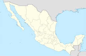
Ti Chihuahua (Panangibalikas nga Espaniol: [tʃiˈwawa] (![]() dengngen)), opisial a ti Nawaya ken Naturay nga Estado ti Chihuahua (Espaniol: Estado Libre y Soberano de Chihuahua), ket maysa kadagiti 32 nga estado ti Mehiko. Ti kapitolio a siudadna ket ti Siudad ti Chihuahua.
dengngen)), opisial a ti Nawaya ken Naturay nga Estado ti Chihuahua (Espaniol: Estado Libre y Soberano de Chihuahua), ket maysa kadagiti 32 nga estado ti Mehiko. Ti kapitolio a siudadna ket ti Siudad ti Chihuahua.
Daytoy ket mabirukan idiay Amianan a laud ti mehiko ken beddengan babaen dagiti estado ti Sonora iti laud, ti Sinaloa iti abagatan a laud, ti Durango iti abagatan, ken ti Coahuila iti daya. Iti amianan ken iti amianan a daya, daytoy ket addaan iti atiddog a pagbeddengan iti Estados Unidos a kadenna kadagiti estado ti Estados Unidos ti New Mexico ken Texas.
Ti Chihuahua ket ti kadakkelan nga estdo idiay Mehiko babaen ti kalawa, iti kalawa iti 247,455 a kuadrado kilometro (95,543 sq mi),[2] daytoy ket dakdakkel bassit ngem ti Nagkaykaysa a Pagarian. Ti estado ket ammo iti parbo a nagan iti El Estado Grande ("Ti Nalatak nga Estado" wenno "Ti Dakkel nga Estado").
Dagiti nagibasaran
[urnosen | urnosen ti taudan]- ^ https://books.google.es/books?id=PBs9DgAAQBAJ&printsec=frontcover#v=snippet&q=Chihuahua&f=false.
- ^ "Resumen". Cuentame INEGI. Naala idi Oktubre 4, 2010.
Dagiti akinruar a silpo
[urnosen | urnosen ti taudan]![]() Dagiti midia a mainaig iti Chihuahua (estado) iti Wikimedia Commons
Dagiti midia a mainaig iti Chihuahua (estado) iti Wikimedia Commons
![]() Heograpiko a datos a mainaig iti Chihuahua (estado) iti OpenStreetMap
Heograpiko a datos a mainaig iti Chihuahua (estado) iti OpenStreetMap
- (iti Espaniol) Gobierno ti Estado ti Chihuahua
| Sapasap | |
|---|---|
| Dagiti nailian a biblioteka | |
| Dadduma | |
Text is available under the CC BY-SA 4.0 license; additional terms may apply.
Images, videos and audio are available under their respective licenses.


