קובץ:Latino Peak.jpg
גודל התצוגה המקדימה הזאת: 800 × 500 פיקסלים. רזולוציות אחרות: 320 × 200 פיקסלים | 640 × 400 פיקסלים | 1,200 × 750 פיקסלים.
לקובץ המקורי (1,200 × 750 פיקסלים, גודל הקובץ: 859 ק"ב, סוג MIME: image/jpeg)
| זהו קובץ שמקורו במיזם ויקישיתוף. תיאורו בדף תיאור הקובץ המקורי (בעברית) מוצג למטה. |
תקציר
| תיאור |
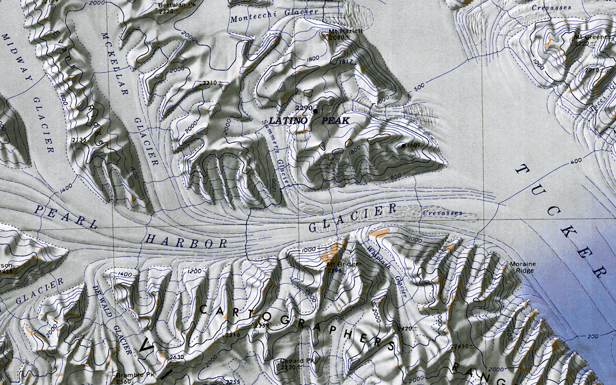
English: Map of Antarctica by the United States Antarctic Resource Center of the US Geological Society. |
| תאריך יצירה | (UTC) |
| מקור |
קובץ זה הוא יצירה נגזרת של : C72189s1 Ant.Map Cape Hallet.jpg: |
| יוצר |
|
| זוהי תמונה מרוטשת, זאת אומרת שהתמונה שונתה בצורה דיגיטלית מהמקור. Modifications: cropped excerpt of "Latino Peak". את התמונה המקורית ניתן לראות ב: C72189s1 Ant.Map Cape Hallet.jpg. השינוי בוצע על ידי Oae448.
|
רישיון
קובץ מדיה זה נמצא ברשות הציבור בארצות הברית. זה תקף לעבודות אמריקניות שבהן זכויות היוצרים פגו, לעתים מסיבה שהפרסום הראשון היה לפני 1 בינואר 1929. ראו דף זה להסבר נוסף.
|
 | |
 |
יומן העלאה מקורי
This image is a derivative work of the following images:
- File:C72189s1_Ant.Map_Cape_Hallet.jpg licensed with PD-US
- 2005-04-03T17:40:20Z Achim Raschka 3860x3250 (2369572 Bytes) Map of Antarctica by the United States Antarctic Ressource Center of the US Geological Society. ((PD-US)) Copyrights and Trademarks USGS-authored or produced data and information are in the public domain. While the content o
Uploaded with derivativeFX
היסטוריית הקובץ
ניתן ללחוץ על תאריך/שעה כדי לראות את הקובץ כפי שנראה באותו זמן.
| תאריך/שעה | תמונה ממוזערת | ממדים | משתמש | הערה | |
|---|---|---|---|---|---|
| נוכחית | 14:57, 1 בפברואר 2012 | | 750 × 1,200 (859 ק"ב) | Oae448 | == ((int:filedesc)) == ((Information |Description=Map of Antarctica by the United States Antarctic Ressource Center of the US Geological Society. |Source=((Derived from|C72189s1_Ant.Map_Cape_Hallet.jpg|display=50)) |Date=2012-02-01 11:47 (UTC) |Author=*[[ |
שימוש בקובץ
הדפים הבאים משתמשים בקובץ הזה:
- אוכף טובוגאן
- הר אלברטס
- הר ברוסטר (אנטארקטיקה)
- הר ברטון (אנטארקטיקה)
- הר הרינגטון (ארץ ויקטוריה)
- הר מקדונלד (ארץ ויקטוריה)
- הר נורת'האמפטון (אנטארקטיקה)
- הר פיליפס (אנטארקטיקה)
- הר פירסון (אנטארקטיקה)
- הרי ויקטורי
- מפרצון טאקר
- נונאטאק נלסון (אנטארקטיקה)
- פסגת אולדריג'
- פסגת בוס
- פסגת גלס
- פסגת הד (אנטארקטיקה)
- פסגת לטינו
- פסגת ניו ייר (אנטארקטיקה)
- פסגת סירק (אנטארקטיקה)
- פסגת קולינס (אנטארקטיקה)
- קרחון אולסון
- קרחון אוסוגה
- קרחון אינגהם
- קרחון אלדר
- קרחון באוורס
- קרחון בארג
- קרחון בורשקרווינק (ארץ ויקטוריה)
- קרחון בייקר (אנטארקטיקה)
- קרחון בר
- קרחון הירפילד
- קרחון המפריז
- קרחון הנד
- קרחון ווד (אנטארקטיקה)
- קרחון וייטהול
- קרחון טאקר
- קרחון טריינר
- קרחון טרפלגר
- קרחון לאנגוואד
- קרחון ליין
- קרחון לנסן
- קרחון מרינר (אנטארקטיקה)
- קרחון פרל הארבור
- קרחון קולסטון
- קרחון קרול (אנטארקטיקה)
- קרחון רודולף (ארץ ויקטוריה)
- רכס בארקר
- רכס הנדלר
- רכס מילן
- רכס קלאפ (אנטארקטיקה)
- רכס קרטוגרפים
- רכס קרטר
- רמת מלטה (אנטארקטיקה)
- תבנית:הרי ויקטורי
שימוש גלובלי בקובץ
אתרי הוויקי השונים הבאים משתמשים בקובץ זה:
- שימוש באתר ceb.wikipedia.org
- שימוש באתר en.wikipedia.org
- שימוש באתר nn.wikipedia.org
- שימוש באתר www.wikidata.org
- שימוש באתר zh.wikipedia.org
מטא־נתונים
Text is available under the CC BY-SA 4.0 license; additional terms may apply.
Images, videos and audio are available under their respective licenses.
Cover photo is available under {{::mainImage.info.license.name || 'Unknown'}} license.
Cover photo is available under {{::mainImage.info.license.name || 'Unknown'}} license.
Credit:
(see original file).
