Uzenice
| Uzenice | |||
| municipo | |||
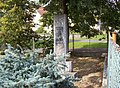
.jpg) Kruco apud vojo inter Uzenice kaj Chobot
| |||
|
|||
| Oficiala nomo: Uzenice | |||
| Ŝtato | |||
|---|---|---|---|
| Regiono | Sudbohemia regiono | ||
| Distrikto | Distrikto Strakonice | ||
| Administra municipo | Blatná | ||
| Historia regiono | Bohemio | ||
| Montaro | Beneŝova montetaro | ||
| Situo | Uzenice | ||
| - alteco | 488 m s. m. | ||
| - koordinatoj | 49° 28′ 24″ N 13° 57′ 36″ O / 49.47333 °N, 13.96000 °O (mapo) | ||
| Katastro | 5,37 km² (537 ha) Uzenice | ||
| Loĝantaro | 110 (2024) | ||
| Denseco | 20,48 loĝ./km² | ||
| Unua skribmencio | 1227 | ||
| Horzono | MET (UTC+1) | ||
| - somera tempo | MET (UTC+2) | ||
| Poŝtkodo | 388 01 | ||
| NUTS 3 | CZ031 | ||
| NUTS 4 | CZ0316 | ||
| NUTS 5 | CZ0316 551937 | ||
| Katastraj teritorioj | 1 | ||
| Partoj de municipo | 1 | ||
| Bazaj setlejunuoj | 1 | ||
  Situo enkadre de Ĉeĥio
| |||
| Retpaĝo: www.obec-uzenice.cz | |||


Uzenice estas municipo de Ĉeĥio situanta en distrikto Strakonice en Sudbohemia regiono. Vivas ĉi tie 110 loĝantoj (2024).
La najbaraj municipoj de la setlejo estas Mišovice, Myštice, Blatná, Uzeničky kaj Chobot.
Historio
[redakti | redakti fonton]La unua skribmencio pri la vilaĝo devenas el la jaro 1227.
Loĝantaro
[redakti | redakti fonton]Evoluo de nombro de loĝantoj
La datoj devenas el datumbazo de Vikidatumoj
| Jaro | Loĝantoj |
|---|---|
| 1869 | 310 |
| 1880 | 345 |
| 1890 | 368 |
| 1900 | 339 |
| 1910 | 301 |
| 1921 | 303 |
| Jaro | Loĝantoj |
|---|---|
| 1930 | 274 |
| 1950 | 181 |
| 1961 | 185 |
| 1970 | 168 |
| 1980 | 162 |
| 1991 | 121 |
| Jaro | Loĝantoj |
|---|---|
| 2001 | 120 |
| 2014 | 121 |
| 2016 | 113 |
| 2017 | 118 |
| 2018 | 114 |
| 2019 | 112 |
| Jaro | Loĝantoj |
|---|---|
| 2020 | 113 |
| 2021 | 91 |
| 2022 | 112 |
| 2023 | 114 |
| 2024 | 110 |
Memorindaĵoj
[redakti | redakti fonton]- Dia torturo
- Ortrovejo en arbaro okcidente de la vilaĝo
- Monumento de T. G. Masaryk
Pluaj fotoj
[redakti | redakti fonton]-
 Monumento en Uzenice
.jpg)
Text is available under the CC BY-SA 4.0 license; additional terms may apply.
Images, videos and audio are available under their respective licenses.
Cover photo is available under {{::mainImage.info.license.name || 'Unknown'}} license.
Cover photo is available under {{::mainImage.info.license.name || 'Unknown'}} license.
Credit:
(see original file).
