San Cristóbal de las Casas
| San Cristóbal de las Casas San Cristóbal de las Casas | |||
|---|---|---|---|
| |||
 | |||
| Overblik | |||
| Land | |||
| Grundlagt | 31. marts 1528[1] | ||
| Postnr. | 29200–29299 | ||
| Telefonkode | 967 | ||
| Nummerpladebogstav(er) | 7 | ||
| UN/LOCODE | MXSZT | ||
| Demografi | |||
| Indbyggere | 183.509 (2020)[2] | ||
| Andet | |||
| Tidszone | UTC−06:00 | ||
| Højde m.o.h. | 2.121 m | ||
| Hjemmeside | www.sancristobal.gob.mx | ||
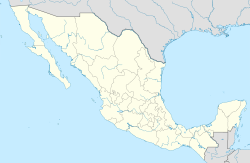
| Oversigtskort | |||
San Cristóbal de las Casas' beliggenhed i Mexico 16°44′13″N 92°38′15″V / 16.737022°N 92.637564°V | |||

San Cristóbal de las Casas (også omtalt som blot San Cristóbal) er en by i den mexicanske delstat Chiapas. Den ligger i Sierra Madre-bjergene i en højde af omkring 2100 m over havets overfalde og havde i 2003 et anslået indbyggertal på 121.100.
Byen var tidligere kendt som kun "San Cristóbal", "de las Casas"-delen blev tilføjet til ære for Bartolomé de las Casas, en spansk præst der kæmpede for indianernes rettigheder. Den blev grundlagt i 1528 og var tidligere hovedstad i Chiapas og hørte ind under Guatemala. Byen er kendt for sin smukke arkitektur fra kolonitiden, blandt andet kirken Templo de Santo Domingo med en kunstfærdig facade.
Den danske opdagelsesrejsende og arkæolog Frans Blom boede i byen fra 1950 til sin død i 1963. Han og hans kone grundlagde Na Bolom kulturcentret i byen som huser et hotel og museum.
Ved Ocosingo på vejen til Palenque ligger mayaruinen Toniná. Videre på vejen til Palenque er vandfaldene Agua Azul, flodstranden Agua Clara og det store vandfald Misol-Ha.
Transport
[redigér | rediger kildetekst]Den nærmeste lufthavn ligger ved delstatens hovedstad Tuxtla Gutiérrez. Vejene omkring San Christóbal er bjergveje med mange sving. Der er en betalingsvej til Tuxtla Gutiérrez – som muligvis er lukket. I selve byen er vejene lige og parallelle/vinkelrette på hinanden og dem i centrum er typisk ensrettede. En enkelt vej er gågade.
Referencer
[redigér | rediger kildetekst]- Rejsen rundt i Mexico, Politikens Forlag.
- Na Bolom kulturcenter – hjemmeside.
- Weather Underground, San Cristobal De Las Casas, Mexico – vejrudsigt.
 |
Wikimedia Commons har medier relateret til: |
Text is available under the CC BY-SA 4.0 license; additional terms may apply.
Images, videos and audio are available under their respective licenses.


