فایل:Canada Southern Ontario location map 2.png
سیناق گؤستریشی اؤلچوسو: ۸۰۰ × ۵۷۷ پیکسل. آیری کیفیتلر: ۳۲۰ × ۲۳۱ پیکسل | ۶۴۰ × ۴۶۲ پیکسل | ۹۹۴ × ۷۱۷ پیکسل.
فایلین اصلی (۹۹۴ × ۷۱۷ پیکسل, فایل اؤلچوسو: ۲۹۶ کیلوبایت, MIME نوعو: image/png)
قیساسی
| آچیقلاما |
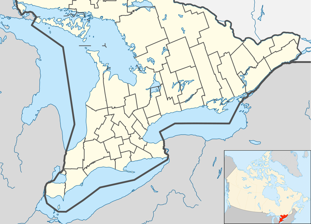
English: Location map of Southern Ontario, Canada.
Equirectangular projection, N/S stretching 155%. Geographic limits of the map:
Русский: Южная Онтарио
Українська: Південне Онтаріо |
| تاریخ | |
| قایناق | File:Canada Ontario location map 2.svg |
| یازار | User:NordNordWest |
| آیری نوسخهلر |
|


لیسانس
من، صاحب حقوق قانونی این اثر، به این وسیله این اثر را تحث اجازهنامهٔ ذیل منتشر میکنم:
بو فایل کریتیو کامانز مجوز ایله Attribution-Share Alike 3.0 اویغونلاشمامیش یاییملانیبدیر.
- سیزین ایجازه نیز وار دیر:
- بؤلۆشمک – اثرین کپی، پایلاشماق و چاتدیرماسی اوچون
- تلفیق ائت – اثرین توتوشدورماسی اوچون
- آشاغی داکی شرایطله:
- تخصیص – اثری مؤلف و یا لیسئنزییالی طرفیندن گؤستریلدیی کیمی ایستیناد ائتملیسینیز (آنجاق سنی دستکلدیینی و یا اثردن ایستیفاده ائتمیینیزی تکلیف ائتمملیسینیز).
- بیرگه پایلاشیم – اگر بو اثرده دَییشدیرمه، چؤندرمه، یا دا کؤکدن دوزلتمه ائتسز، اله گلمیش اثری یالنیز بیر ائشیت یوخسا اوخشار بیر مجوزین آلتیندا یاییملایابیلرسینیز .
فايل گئچمیشی
فايلین اولکی وئرسیياسینی گؤرمک اۆچون گۆن/تاریخ بؤلمهسیندهکی تاریخلری تێقلايین.
| تاریخ/واخت | کیچیک عکس | اؤلچولر | ایشلدن | باخیش | |
|---|---|---|---|---|---|
| ایندیکی | ۲۰ جولای ۲۰۱۲، ساعت ۰۵:۴۷ | | ۹۹۴ در ۷۱۷ (۲۹۶ کیلوبایت) | 117Avenue | slight fix |
| ۲۰ جولای ۲۰۱۲، ساعت ۰۵:۴۳ |  | ۹۹۴ در ۷۱۷ (۲۹۶ کیلوبایت) | 117Avenue | ((Information |Description =((en|1=Location map of Southern Ontario, Canada. Equirectangular projection, N/S stretching 155%. Geographic limits of the map: * N: 46.4° N * S: 41.4° N * W: 84.7° W * E: 74.0°... |
فايل ایشلدمهسی
آشاغیداکی 10 صحیفهلر بو فایلا باغلانیرلار
فایلین باشاباش ایشلنیلمهسی
بو فایل آشاغی داکی آیری ویکی لرده ایشلَنیر:
- ar.wikipedia.org-ده ایشلنمهسی
- ban.wikipedia.org-ده ایشلنمهسی
- bn.wikipedia.org-ده ایشلنمهسی
- bs.wikipedia.org-ده ایشلنمهسی
- ceb.wikipedia.org-ده ایشلنمهسی
- ckb.wikipedia.org-ده ایشلنمهسی
- cs.wikipedia.org-ده ایشلنمهسی
- en.wikipedia.org-ده ایشلنمهسی
- Bay of Quinte
- Hamilton, Ontario
- Ottawa
- Windsor, Ontario
- Niagara Falls
- Waterloo, Ontario
- Sarnia
- Perth, Ontario
- Kitchener, Ontario
- Point Pelee National Park
- Kingston, Ontario
- Brampton
- Caledon, Ontario
- Prescott, Ontario
- Leamington, Ontario
- Cornwall, Ontario
- Guelph
- Aurora, Ontario
- Barrie
- Belleville, Ontario
- Brantford
- Brockville
- Burlington, Ontario
- Cambridge, Ontario
- Lindsay, Ontario
- Markham, Ontario
- Newmarket, Ontario
- Niagara Falls, Ontario
- Oakville, Ontario
- Orillia
- Oshawa
- Owen Sound
- Carleton Place
- St. Catharines
- Woodstock, Ontario
- Stratford, Ontario
بو فایلینسراسری ایستفاده لرینه باخین.
مِتابیلگیلر
Text is available under the CC BY-SA 4.0 license; additional terms may apply.
Images, videos and audio are available under their respective licenses.
Cover photo is available under {{::mainImage.info.license.name || 'Unknown'}} license.
Cover photo is available under {{::mainImage.info.license.name || 'Unknown'}} license.
Credit:
(see original file).
