Piñeres (Ayer)
 | |
| Alministración | |
| País | |
| Autonomía | |
| Provincia | |
| Conceyu | |
| Partíu xudicial | Ḷḷena |
| Tipu d'entidá | parroquia d'Asturies |
| Códigu postal |
33685 |
| Xeografía | |
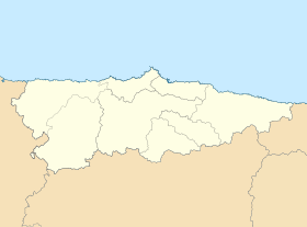
| Coordenaes | 43°10′12″N 5°42′13″W / 43.17003°N 5.70355°O |
| Superficie | 16.1 km² |
| Altitú | 343 m[1] |
| Llenda con | Morea, Nembra, Soto, Serrapio, Turón y Urbiés |
| Demografía | |
| Población |
608 hab. (2019) - 295 homes (2019) - 318 muyeres (2019) |
| Porcentaxe | 6.03% de Ayer |
| Densidá | 37,76 hab/km² |
| Viviendes | 520 (2001) |
| Más información | |
| Estaya horaria | UTC+01:00 |
| pineres.asturi.as | |
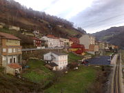
Piñeres[2] ye una parroquia del conceyu asturianu d'Ayer.
Llenda al norte col conceyu de Mieres y coles parroquies de Morea, Nembra, Serrapio y Soto.
Nos sos 16,1 km² [3] habiten un total de 608 persones (2019)[4].
Xeografía
[editar | editar la fonte]Llocalidaes
[editar | editar la fonte]| Nᵘ | Nome
|
Población | % población Piñeres (Ayer)
|
|---|---|---|---|
| 1 | Arteos
|
n/d
| |
| 2 | Les Barroses
|
n/d | |
| 3 | Beyo
|
n/d | |
| 4 | El Cabanón
|
n/d | |
| 5 | Cambrosio
|
0 | 00% |
| 6 | La Cantera
|
n/d | |
| 7 | Carrocera
|
n/d | |
| 8 | Casares
|
n/d | |
| 9 | La Casiḷḷina
|
n/d | |
| 10 | Castandieḷḷo
|
4 | 0,660,66% |
| 11 | Castieḷḷo
|
n/d | |
| 12 | Corigos
|
n/d | |
| 13 | La Cortina
|
n/d | |
| 14 | Cubrenes
|
n/d | |
| 15 | L'Escuyu
|
n/d | |
| 16 | Fresnaza
|
n/d | |
| 17 | Ḷḷagar
|
n/d | |
| 18 | Ḷḷameres
|
n/d | |
| 19 | Ḷḷongalendo
|
n/d | |
| 20 | Misiegos
|
n/d | |
| 21 | Muries
|
n/d | |
| 22 | El Palacio
|
n/d | |
| 23 | El Pandiiḷḷu
|
n/d | |
| 24 | Perea
|
n/d | |
| 25 | La Pruvía
|
n/d | |
| 26 | Pineo
|
n/d | |
| 27 | El Puiblu
|
n/d | |
| 28 | La Roza
|
n/d | |
| 29 | Rucastieḷḷo
|
n/d | |
| 30 | San Antonio
|
n/d | |
| 31 | La Sierra
|
n/d | |
| 32 | Les Tercies
|
n/d | |
| 33 | Valdediós
|
n/d | |
| 34 | Vegalatorre
|
n/d | |
| 35 | La Vegueḷḷina
|
n/d | |
| 36 | La Venta
|
n/d | |
| 37 | La Viesca
|
n/d | |
| 38 | Viḷḷar
|
n/d |
Sitios
[editar | editar la fonte]- L'Acebal
- La Braña
- El Caburnu
- Casares de Baxo
- Casares de Riba
- La Cuesta
- La Cueva
- Pasaolrío
- El Ribeyu
- Los Solares
Ver tamién
[editar | editar la fonte]- Pa ver otros sitios col mesmu nome: Piñeres
Referencies
[editar | editar la fonte]- ↑ Afirmao en: Modelo Digital del Terreno de España de 5 metros. Editorial: Institutu Xeográficu Nacional d'España.
- ↑ «Espediente colos topónimos oficiales d'Ayer». BOPA.
- ↑ (2000) Diccionario Geográfico de Asturias (en castellanu). Uviéu: Editorial Prensa Asturiana, S.A.
- ↑ padrón municipal d'España de 2019
Enllaces esternos
[editar | editar la fonte]Text is available under the CC BY-SA 4.0 license; additional terms may apply.
Images, videos and audio are available under their respective licenses.

