Schnüfis
| Schnifis | ||
|---|---|---|
 |
| |
| Basisdate | ||
| Staat: | Östriich | |
| Bundesland: | Vorarlberg | |
| Politische Bezirk: | Feldkirch | |
| Kfz-Kennzeiche: | FK | |
| Fläche: | 4,87 km² | |
| Koordinate: | 47° 13′ N, 9° 43′ O | |
| Höchi: | 657 m ü. A. | |
| Iiwohner: | 789 (1. Jän. 2023) | |
| Bevölkerigsdichti: | 162,01 Iiw. pro km² | |
| Poschtleitzahl: | 6822 | |
| Vorwahl: | 05524 | |
| Gmoandskennziffer: | 8 04 19 | |
| NUTS-Region | AT342 | |
| Adress vo dr Gmoandsverwaltig: |
Jagdbergstrasse 200 6822 Schnifis | |
| Website: | ||
| Politik | ||
| Burgermoaschter: | Anton Mähr | |
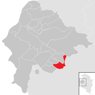
| Lag vo dr Gmuand Schnifis im Bezirk Feldkirch | ||
 | ||
 Schnüfis | ||
| (Quelle: Gmoanddate bi Statistik Austria) | ||


| Dialäkt: Vorarlbärgisch |
Schnüfis (amtlich Schnifis) ischt a Gmuand im Bezirk Fealkirch (Region Walgau) z Vorarlberg, Öschtriich.
Geografi
[ändere | Quälltäxt bearbeite]Schnüfis lit uf 657 Meter Höhe südlich vom Schnifner Berg. Vom Gmuandsgbiet siand im Johr 1996 39,4 % Landwirtschaftsfläch, 38,0 % Wald, 14,8 % Alpa, 4,1 % Sidlungsfläche und 3,7 % sunschtige Fläche gsi.[1]
Gschicht
[ändere | Quälltäxt bearbeite]Schnüfis ischt zum erschte Mol gnennt worra im Johr 820 als Senobium.
Verwaltig
[ändere | Quälltäxt bearbeite]Dr Bürgermoaschter vo Schnüfis ischt dr Anton Mähr.
Iiwohner
[ändere | Quälltäxt bearbeite]Quella: Statistik Austria: Bevölkerung seit 1869 für Gemeinden. STATcube
| Johr | 1869 | 1880 | 1890 | 1900 | 1910 | 1923 | 1934 | 1939 |
| Iiwohner | 379 | 386 | 379 | 399 | 379 | 390 | 449 | 442 |
| Johr | 1951 | 1961 | 1971 | 1981 | 1991 | 2001 | 2011 | 2021 |
| Iiwohner | 418 | 442 | 490 | 567 | 637 | 706 | 762 | 808 |
Dialekt
[ändere | Quälltäxt bearbeite]Dr Dialekt vo Schnüfis khört zum Bodeseealemannisch.
Literatur
[ändere | Quälltäxt bearbeite]- Rosemarie Steixner (Geländeerhebung), Abteilung Umweltschutz (Bericht): Aktualisierung des Biotopinventars Vorarlberg – Gemeinde Schnifis. In: Vorarlberger Landesregierung [IVe], AVL Arge Vegetationsökologie und Landschaftsplanung (Hrsg.): Biotopinventar Vorarlberg. Februar 2009 (pdf, vorarlberg.at). pdf (Memento vom 4. März 2016 im Internet Archive)
Weblink
[ändere | Quälltäxt bearbeite]Fuaßnota
[ändere | Quälltäxt bearbeite]- ↑ Amt der Vorarlberger Landesregierung (Hrsg): Strukturdaten Vorarlberg. Bregenz 1996
Städt und Gmoanda im Bezirk Fealdkirch
Alta |
Düns |
Dünserberg |
Fealdkirch |
Frastaz |
Fraxara |
Göfis |
Getzis |
Kluus |
Kobla |
Laterns |
Mäder |
Moanige |
Rankl |
Röns |
Röthis |
Sattaas |
Schlins |
Schnifis |
Sulz |
Übersaxe |
Viktorsbearg |
Wiiler |
Zwüschawasser
Text is available under the CC BY-SA 4.0 license; additional terms may apply.
Images, videos and audio are available under their respective licenses.
Cover photo is available under {{::mainImage.info.license.name || 'Unknown'}} license.
Cover photo is available under {{::mainImage.info.license.name || 'Unknown'}} license.
Credit:
(see original file).
