File:ISS065-E-206242 - View of Taiwan.jpg
本预览的尺寸:800 × 533像素。 其他分辨率:320 × 213像素 | 640 × 427像素 | 1,024 × 683像素 | 1,280 × 853像素 | 2,560 × 1,707像素 | 5,568 × 3,712像素。
原始文件 (5,568 × 3,712像素,文件大小:18.4 MB,MIME类型:image/jpeg)
摘要
| 描述 |
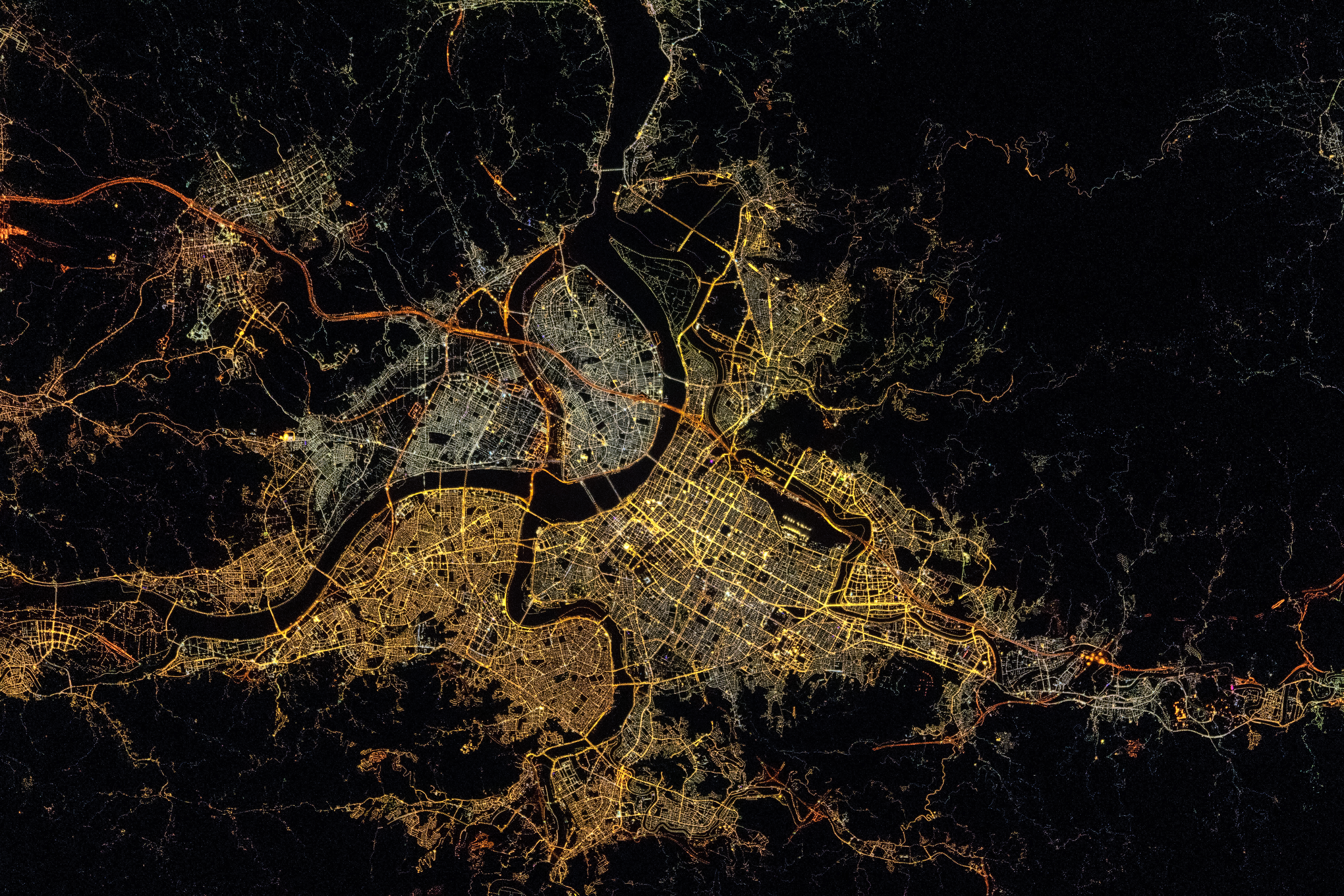
English: A very distinctive city at night with its winding rivers: Taipei!
Français : Au nord de Taïwan, Taipei saute aux yeux avec ses cours d’eau sinueux.
中文(臺灣):在國際太空站上執行遠征65(Expedition 65)任務的太空人佩斯凱(Thomas Pesquet)於臺灣時間2021年7月26日深夜拍攝的大臺北地區,可見燈光形塑出淡水河水系的輪廓。 |
||||||||||||||||||||||||||||||||||||||||||||||||
| 日期 | |||||||||||||||||||||||||||||||||||||||||||||||||
| 来源 |
Frame 206242 from ISS Expedition 65 Crew Earth Observations Post by Thomas Pesquet on Instagram |
||||||||||||||||||||||||||||||||||||||||||||||||
| 作者 |
Original frame: Thomas Pesquet/The Earth Science and Remote Sensing Unit, NASA Johnson Space Center Stabilization correction by Tiouraren (Y.-C. Tsai) |
||||||||||||||||||||||||||||||||||||||||||||||||
| 相机位置 | | 在以下服务上查看本图像和附近其他图像: OpenStreetMap |
|---|
本图像或视频收录于美国国家航空航天局 (NASA)休斯顿太空中心(Johnson Space Center),其照片编号是: ISS065-E-206242 此标签不表示文件的著作权状态。任何文件在附有此标签的同時还需要一个有效的著作权标签。请参阅许可协议说明页面以了解更多信息。 其他语言:
|
许可协议
| 本文件完全由NASA创作,在美国属于公有领域。根据NASA的版权方针,NASA的材料除非另有声明否则不受版权保护。(参见Template:PD-USGov/zh、NASA版权方针页面或JPL图片使用方针。) | ||
 |
警告:
|
文件历史
点击某个日期/时间查看对应时刻的文件。
| 日期/时间 | 缩略图 | 大小 | 用户 | 备注 | |
|---|---|---|---|---|---|
| 当前 | 2023年1月6日 (五) 05:32 | | 5,568 × 3,712(18.4 MB) | Tiouraren | Stabilization |
| 2022年7月5日 (二) 05:23 |  | 5,568 × 3,712(4.76 MB) | AskeBot |
文件用途
以下页面使用本文件:
全域文件用途
以下其他wiki使用此文件:
- en.wikipedia.org上的用途
元数据
Text is available under the CC BY-SA 4.0 license; additional terms may apply.
Images, videos and audio are available under their respective licenses.
Cover photo is available under {{::mainImage.info.license.name || 'Unknown'}} license.
Cover photo is available under {{::mainImage.info.license.name || 'Unknown'}} license.
Credit:
(see original file).
