For faster navigation, this Iframe is preloading the Wikiwand page for File:Corfu topographic map-en.svg.

File:Corfu topographic map-en.svg
原始文件(SVG文件,尺寸为2,096 × 2,341像素,文件大小:2.19 MB)


Pour agrandir l'image

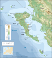
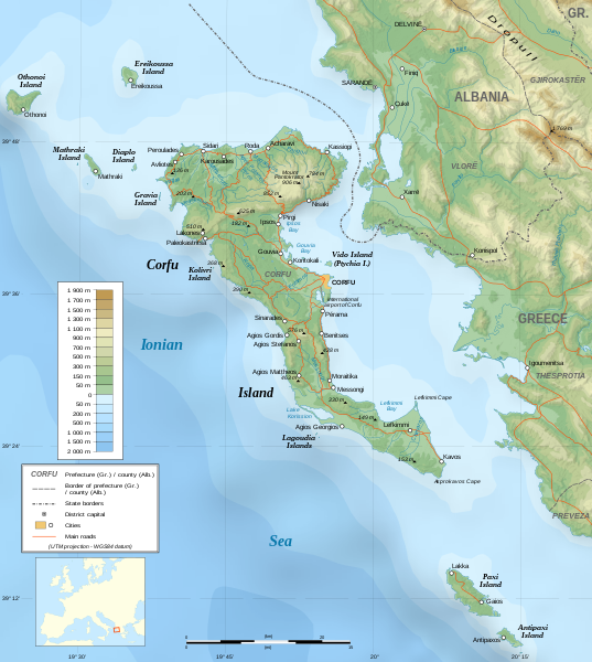
Detailed map of large dimension. For a better viewing, click on the link of the image above.
Carte détaillée de grande dimension. Pour une visualisation optimale, cliquer sur le lien de l'image ci-dessus.

摘要

描写
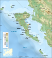
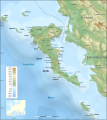
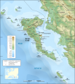
English: Topographic map in English of the Corfu island area in Greece.
Note : The shaded relief is a raster image embedded in the SVG file.
Français : Carte topographique en anglais de la zone de l'île de Corfou en Grèce.
Note : Le relief ombré est une image bitmap embarquée dans le fichier SVG.

UTM projection ; WGS84 datum ; shaded relief (composite image of N-W, W and N lightning positions) ;
Approximate scales:

  • Topography: 1:372,000 (precision: 93 m) ;
  • Bathymetry: 1:7,520,000 (precision: 1,880 m).
SVG开发
InfoField
 
SVG的源代码为无效代码,因为发现了2个问题。
 
本W3C无效的矢量图使用Inkscape创作。
 
 此SVG 文件使用了内嵌文本,可以使用任何文本编辑器轻松翻译
 
  This SVG map uses embedded raster graphics to show its topographic structures.
日期 March 2007 (modified 09/2008)
来源

Own work ;

創作作者
Eric Gaba (Sting - fr:Sting)
授权
(二次使用本文件)
Attribution and Share-Alike required
地理参考 地理参考Wikimaps Warper中的地图 如果不适当,请设置 warp_status = skip 为隐藏。
其他版本

[编辑]


许可协议

我,本作品著作权人,特此采用以下许可协议发表本作品:
GNU head 已授权您依据自由软件基金会发行的无固定段落及封面封底文字(Invariant Sections, Front-Cover Texts, and Back-Cover Texts)的GNU自由文件许可协议1.2版或任意后续版本的条款,复制、传播和/或修改本文件。该协议的副本请见“GNU Free Documentation License”。
w:zh:知识共享
署名 相同方式共享
本文件采用知识共享署名-相同方式共享 3.0 未本地化版本许可协议授权。
您可以自由地:
  • 共享 – 复制、发行并传播本作品
  • 修改 – 改编作品
惟须遵守下列条件:
  • 署名 – 您必须对作品进行署名,提供授权条款的链接,并说明是否对原始内容进行了更改。您可以用任何合理的方式来署名,但不得以任何方式表明许可人认可您或您的使用。
  • 相同方式共享 – 如果您再混合、转换或者基于本作品进行创作,您必须以与原先许可协议相同或相兼容的许可协议分发您贡献的作品。
本许可协议标签作为GFDL许可协议更新的组成部分被添加至本文件。
w:zh:知识共享
署名 相同方式共享
本文件采用知识共享署名-相同方式共享2.5 通用2.0 通用1.0 通用许可协议授权。
您可以自由地:
  • 共享 – 复制、发行并传播本作品
  • 修改 – 改编作品
惟须遵守下列条件:
  • 署名 – 您必须对作品进行署名,提供授权条款的链接,并说明是否对原始内容进行了更改。您可以用任何合理的方式来署名,但不得以任何方式表明许可人认可您或您的使用。
  • 相同方式共享 – 如果您再混合、转换或者基于本作品进行创作,您必须以与原先许可协议相同或相兼容的许可协议分发您贡献的作品。
您可以选择您需要的许可协议。

评价

图像 of the year
图像 of the year
Featured 图像

维基共享资源

本文件是2007年年度图片比赛的候选图片。
本文件是维基共享资源特色图片(Featured pictures),并被视为最好的图像之一。

如果你拥有相似质量的可采用适当著作权许可协议发布的图像,一定要上传标记推荐它。

说明

添加一行文字以描述该文件所表现的内容

此文件中描述的项目

描繪內容

image/svg+xml

e879e88550b42dd3dbf2a450866574081c50746f

2,296,324 字节

2,341 像素

2,096 像素

文件历史

点击某个日期/时间查看对应时刻的文件。

日期/时间缩⁠略⁠图大小用户备注
当前2021年8月24日 (二) 07:172021年8月24日 (二) 07:17版本的缩略图2,096 × 2,341(2.19 MB)Praça de MaioFile uploaded using svgtranslate tool (https://svgtranslate.toolforge.org/). Added translation for tr.
2014年10月29日 (三) 22:472014年10月29日 (三) 22:47版本的缩略图2,096 × 2,341(2.18 MB)Ras67cropped
2008年9月4日 (四) 22:412008年9月4日 (四) 22:41版本的缩略图2,100 × 2,345(2.47 MB)StingUsing bathymetry from ETOPO1 ; new standard colors
2007年10月29日 (一) 18:592007年10月29日 (一) 18:59版本的缩略图2,100 × 2,345(3.17 MB)Sting"Pavllo" river name correction ; + river names on Corfu island ; key more complete
2007年5月16日 (三) 01:052007年5月16日 (三) 01:05版本的缩略图2,100 × 2,345(3.14 MB)StingInternational elevation key
2007年3月30日 (五) 01:072007年3月30日 (五) 01:07版本的缩略图2,100 × 2,345(3.14 MB)Sting((Information| |Description=Topographic map in French of the Corfu island area in Greece. |Source=Own work ;<br/>Background map : [http://www2.jpl.nasa.gov/srtm NASA Shuttle Radar Topography Mission] (SRTM3 v.2) (public domain) edited with [

文件用途

以下2个页面使用本文件:

全域文件用途

以下其他wiki使用此文件:

查看此文件的更多全域用途

元数据

{{bottomLinkPreText}} {{bottomLinkText}}
File:Corfu topographic map-en.svg
Listen to this article

This browser is not supported by Wikiwand :(
Wikiwand requires a browser with modern capabilities in order to provide you with the best reading experience.
Please download and use one of the following browsers:

This article was just edited, click to reload
This article has been deleted on Wikipedia (Why?)

Back to homepage

Please click Add in the dialog above
Please click Allow in the top-left corner,
then click Install Now in the dialog
Please click Open in the download dialog,
then click Install
Please click the "Downloads" icon in the Safari toolbar, open the first download in the list,
then click Install
{{::$root.activation.text}}

Install Wikiwand

Install on Chrome Install on Firefox
Don't forget to rate us

Tell your friends about Wikiwand!

Gmail Facebook Twitter Link

Enjoying Wikiwand?

Tell your friends and spread the love:
Share on Gmail Share on Facebook Share on Twitter Share on Buffer

Our magic isn't perfect

You can help our automatic cover photo selection by reporting an unsuitable photo.

This photo is visually disturbing This photo is not a good choice

Thank you for helping!


Your input will affect cover photo selection, along with input from other users.

X

Get ready for Wikiwand 2.0 🎉! the new version arrives on September 1st! Don't want to wait?