雲峰
| 雲峰 | |
|---|---|
 由南橫公路遠望雲峰 | |
| 最高点 | |
| 海拔 | 3,564米(11,693英尺) |
| 地形突起度 | 734米(2,408英尺) 主鞍部:拉庫音溪山屋北方偏東約1.1公里處2830公尺 |
| 母峰 | 關山3668公尺 |
| 列表 | |
| 坐标 | 23°21′13.32″N 120°58′32.88″E / 23.3537000°N 120.9758000°E |
| 地理 | |
| 位置 | |
| 山脈 | 中央山脈 |
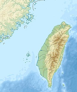
雲峰是台灣中央山脈南段的知名高山,標高3,564公尺(3563.757公尺),台灣百岳排名第19、九峨之一,設有二等三角點編號1684、三等衛星點MZ82,[1]位於高雄市桃源區梅山里東部,東方偏北距花蓮縣卓溪鄉邊界約1.3公里,玉山國家公園核心資源保護區西南側。雲峰在中央山脈南段主脊往西南轉西岔出的支脈上約1.5公里處,主脊南方連接南雙頭山、三叉山、向陽山,北邊連接轆轆山、塔芬山、達芬尖山,西側支稜續往西連接玉穗山。
參考文獻
[编辑]- ^
 OpenStreetMap上有關5582288639 雲峰 二等三角點1684的地理信息
- 楊建夫,《台灣的山脈》,2001年,臺北,遠足文化公司
| 1. 玉山 | 2. 雪山 | 3. 玉山東峰 | 4. 玉山北峰 | 5. 玉山南峰 | 6. 秀姑巒山 | 7. 馬博拉斯山 | 8. 南湖大山 | 9. 東小南山 | 10. 中央尖山 | ||||||||||||||||||||||||||||||||||||||||||||||||||||
| 11. 雪山北峰 | 12. 關山 | 13. 大水窟山 | 14. 南湖大山東峰 | 15. 東郡大山 | 16. 奇萊北峰 | 17. 向陽山 | 18. 大劍山 | 19. 雲峰 | 20. 奇萊主山 | ||||||||||||||||||||||||||||||||||||||||||||||||||||
| 21. 馬利加南山 | 22. 南湖北山 | 23. 大雪山 | 24. 品田山 | 25. 玉山西峰 | 26. 頭鷹山 | 27. 三叉山 | 28. 大霸尖山 | 29. 南湖大山南峰 | 30. 東巒大山 | ||||||||||||||||||||||||||||||||||||||||||||||||||||
| 31. 無明山 | 32. 巴巴山 | 33. 馬西山 | 34. 合歡北峰 | 35. 合歡東峰 | 36. 小霸尖山 | 37. 合歡主峰 | 38. 南玉山 | 39. 畢祿山 | 40. 卓社大山 | ||||||||||||||||||||||||||||||||||||||||||||||||||||
| 41. 奇萊南峰 | 42. 南雙頭山 | 43. 能高南峰 | 44. 志佳陽大山 | 45. 白姑大山 | 46. 八通關山 | 47. 新康山 | 48. 桃山 | 49. 丹大山 | 50. 佳陽山 | ||||||||||||||||||||||||||||||||||||||||||||||||||||
| 51. 火石山 | 52. 池有山 | 53. 伊澤山 | 54. 卑南主山 | 55. 干卓萬山 | 56. 太魯閣大山 | 57. 轆轆山 | 58. 喀西帕南山 | 59. 內嶺爾山 | 60. 鈴鳴山 | ||||||||||||||||||||||||||||||||||||||||||||||||||||
| 61. 郡大山 | 62. 能高山 | 63. 萬東山西峰 | 64. 劍山 | 65. 屏風山 | 66. 小關山 | 67. 義西請馬至山 | 68. 牧山 | 69. 玉山前峰 | 70. 石門山 | ||||||||||||||||||||||||||||||||||||||||||||||||||||
| 71. 塔關山 | 72. 馬比杉山 | 73. 達芬尖山 | 74. 雪山東峰 | 75. 無雙山 | 76. 南華山 | 77. 關山嶺山 | 78. 海諾南山 | 79. 中雪山 | 80. 閂山 | ||||||||||||||||||||||||||||||||||||||||||||||||||||
| 81. 甘薯峰 | 82. 合歡西峰 | 83. 審馬陣山 | 84. 喀拉業山 | 85. 庫哈諾辛山 | 86. 加利山 | 87. 白石山 | 88. 磐石山 | 89. 帕托魯山 | 90. 北大武山 | ||||||||||||||||||||||||||||||||||||||||||||||||||||
| 91. 塔芬山 | 92. 西巒大山 | 93. 立霧主山 | 94. 安東軍山 | 95. 光頭山 | 96. 鹿山 | 97. 布拉克桑山 | 98. 駒盆山 | 99. 六順山 | 100. 羊頭山 | ||||||||||||||||||||||||||||||||||||||||||||||||||||
| 註:由高至低排列,順序與標高參照聯勤總部測量署於1985年至1987年測繪發行之地形圖[來源請求] | |||||||||||||||||||||||||||||||||||||||||||||||||||||||||||||
| |||||||||||||||||||||||||||||||||||||||||||||||||||||||||||||
Text is available under the CC BY-SA 4.0 license; additional terms may apply.
Images, videos and audio are available under their respective licenses.

