金崙溪
| 金崙溪 | |
|---|---|
.jpg) | |
| 流域 | |
| 源頭 | |
| - 位置 | 衣丁山 |
| 河口 | 太平洋 |
- 海拔 | 0米(0英尺) |
| 面積 | 151.94平方公里(59平方英里) |
| 流經国家 | 台東縣太麻里鄉、金峰鄉 |
| 本貌 | |
| 長度 | 26.40公里(16英里) |
金崙溪為一位於台灣東部之縣市管河川,幹流長度26.40公里,流域面積151.94平方公里,分佈於台東縣太麻里鄉、金峰鄉。主流發源於金峰鄉歷坵村衣丁山東麓[1],先向北北東流,匯集源自南大武山、茶仁山諸支流後,轉向東南流,經飛龍、近黃、地克崙、莫哥布各、歷坵,進入太麻里鄉境,再流經仁愛部落、賓茂,最終於金崙村南側的金崙大橋注入太平洋。[2][3]
水系主要河川
[编辑]以下由下游至源頭列出水系主要河川,其中粗體字為主流河道。
照片集
[编辑]-
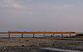 金崙溪鐵橋
金崙溪鐵橋 -
 金崙溪鐵橋
金崙溪鐵橋 -
 金崙溪鐵橋
金崙溪鐵橋 -
 金崙溪鐵橋
金崙溪鐵橋 -
 金崙溪鐵橋
金崙溪鐵橋
.jpg)
.jpg)
.jpg)
.jpg)
.jpg)
相關條目
[编辑]參考資料及注釋
[编辑]- ^ 《臺東縣金峰鄉行政區域圖》,內政部,2006年3月
- ^ 金侖溫泉 飽覽海岸風光 人間福報. [2023-05-06]. (原始内容存档于2023-05-11).
- ^ 金崙溪、大竹溪和大武溪流域的地形演育及其環境變遷意義 齊士崢. [2023-05-06]. (原始内容存档于2023-05-06).
Text is available under the CC BY-SA 4.0 license; additional terms may apply.
Images, videos and audio are available under their respective licenses.
Cover photo is available under {{::mainImage.info.license.name || 'Unknown'}} license.
Cover photo is available under {{::mainImage.info.license.name || 'Unknown'}} license.
Credit:
(see original file).
