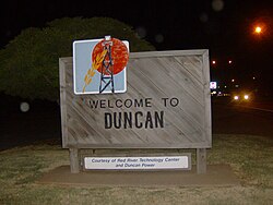
鄧肯 (奧克拉荷馬州)
| 鄧肯 Duncan | |
|---|---|
| 城市 | |
 | |
 鄧肯在阿拉巴馬州的位置 | |
| 坐标:34°30′8″N 97°57′28″W / 34.50222°N 97.95778°W[1] | |
| 國家 | |
| 州 | |
| 郡 | 史帝芬斯郡 |
| 面积[2] | |
| • 总计 | 47.84 平方英里(123.89 平方公里) |
| • 陸地 | 42.95 平方英里(111.24 平方公里) |
| • 水域 | 4.88 平方英里(12.65 平方公里) |
| 海拔 | 1,122 英尺(342 公尺) |
| 人口(2020) | |
| • 總計 | 22,692人 |
| • 密度 | 528.31人/平方英里(203.98人/平方公里) |
| 时区 | CST(UTC−6) |
| • 夏时制 | CDT(UTC−5) |
| 郵遞區號 | 73533-73599 |
| 電話區號 | 580 |
| FIPS代碼 | 40-21900[3] |
| GNIS ID | 1092291 |
| 網站 | www |
邓肯(英語:Duncan)是美国俄克拉荷马州史帝芬斯郡的郡治[4]。2010年人口普查显示该地人口为23,431人。 该地哈利伯顿公司的诞生地,并以此闻名[5]。哈利伯顿于1919年在此成立了哈利伯顿公司。 哈利伯顿在邓肯维护着七个不同的综合大楼以及一个员工休闲公园,但是公司办公室首先搬到了達拉斯,然后搬到了休斯敦。
邓肯位于史帝芬斯郡的中心 ,在俄克拉荷马州于1907年建州后成为郡治。 1918年,史帝芬斯郡开设了油井,并以此迅速发展。 直到黑色风暴事件使棉花减少之前,棉花一直是主要农作物,但牛依然是经济发展的重要组成部分。 奇索姆步道在该镇成立之前经过了邓肯的东部,该镇是奇索姆步道遗产中心的所在地。
历史
奇索姆步道在该镇成立之前就经过了邓肯的东部[6]。在得克萨斯州和堪萨斯州阿比林之间,估计有980万头长角牛曾被放牧。 在得知政府正在修建从堪萨斯州到得克萨斯州的芝加哥,岩石岛和太平洋铁路的扩建部分后,苏格兰人威廉·邓肯携其妻子、父母和其他亲戚在南北向奇瑟姆小径和阿巴克尔堡-锡尔堡东西向军事通道的交叉口建立了一个贸易站。 第一列火车于1892年6月27日到达,该日被视为城镇的正式诞生日期。
这座城市的首批建筑大多为木结构,在被自然灾害摧毁后被砖石结构取代[7]。1901年发生的四场大火烧毁了几栋建筑物[7]。
邓肯成立时位于印第安领地奇卡索国的皮肯斯县[8]。
邓肯位于斯蒂芬斯县的中心,在俄克拉荷马州于1907年建州后成为县城[9]。作为县北部和南部居民之间的折衷方案,县法院大楼位于邓肯大街的中部,其中一半位于县城北部,另一半位于南部。大街在其两端绕了一个大圈。
油井于1918年在斯蒂芬斯县开设,引领了邓肯的快速发展[10]。在油井开放后,政府立即禁止了棚屋的搭设,还制定了其他法规以有组织的方式引导发展[10]。
1930年代建造了几栋都铎复兴风格的房屋[11]。在大萧条之后,旨在改善经济的“工程进度管理”项目建造了公共图书馆,高中学校,体育场,游泳池,黑人社区的学校和礼堂,军械库以及许多桥梁和人行道[11]。
在第二次世界大战带来的经济繁荣期间,邓肯扩大了城市范围[12]。在经济繁荣快要结束时,市中心地区繁荣程度开始下降[12]。
参考资料
- ^ Duncan. Geographic Names Information System. United States Geological Survey.
- ^ ArcGIS REST Services Directory. United States Census Bureau. [September 20, 2022]. (原始内容存档于2022-01-19).
- ^ U.S. Census website. United States Census Bureau. [2008-01-31]. (原始内容存档于2021-07-09).
- ^ Find a County. National Association of Counties. [2011-06-07]. (原始内容存档于2012-07-12).
- ^ Savage, Cynthia. online. 缺少或
|title=为空 (帮助) - ^ Savage, Cynthia. online. 缺少或
|title=为空 (帮助) - ^ 7.0 7.1 Reconnaissance Level Survey of Duncan (PDF) (报告). Oklahoma Historical Society. 2000 [2010-05-10]. (原始内容存档 (PDF)于2010-07-03).
- ^ Charles Goins, Historical Atlas of Oklahoma (Norman: University of Oklahoma Press, 2006), p. 105.
- ^ Savage, Cynthia. online. 缺少或
|title=为空 (帮助) - ^ 10.0 10.1 Savage, Cynthia. online. 缺少或
|title=为空 (帮助) - ^ 11.0 11.1 Reconnaissance Level Survey of Duncan (PDF) (报告). Oklahoma Historical Society. 2000 [2010-05-10]. (原始内容存档 (PDF)于2010-07-03).
- ^ 12.0 12.1 Reconnaissance Level Survey of Duncan (PDF) (报告). Oklahoma Historical Society. 2000 [2010-05-10]. (原始内容存档 (PDF)于2010-07-03).
Text is available under the CC BY-SA 4.0 license; additional terms may apply.
Images, videos and audio are available under their respective licenses.
