達洛爾
| 達洛爾 | |
|---|---|
| 被廢棄的城市 | |
| ዳሎል | |
 | |
| 坐标:14°14′00″N 40°18′00″E / 14.2333333°N 40.3°E | |
| 國家 | |
| 州 | 阿法爾州 |
| 管理區 | 阿法爾州第二管理區 |
| 海拔 | −130 公尺(−430 英尺) |
| 人口 | |
| • 總計 | 0人 |
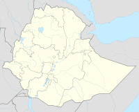
達洛爾(阿姆哈拉語:ዳሎል,羅馬化:Dallol)是一個位於衣索比亞北部阿法爾州第二管理區的屯墾區,海拔低於海平面約130公尺。由於衣索比亞中央統計局2005年之後的人口報告中,已經無此地區的人口數據,故此可以視為一座鬼城。
達洛爾在1960年到1966年間,創下世界有人居住地中最高年均溫記錄。[1]達洛爾也是世界上最遙遠的地區之一,此地沒有道路連接,對外交通工具除了吉普車外只有前往該地區收集鹽的駱駝商隊。
鄰近有達洛爾火山,上一次噴發是在1926年。
歷史
早期
1918年4月,一條由厄立垂亞梅薩法特瑪港至離達洛爾28公里處的鐵路建成。1917年至1918年,使用1呎11 5/8吋(600毫米)軌距的杜克維勒列車系統,從達洛爾附近的鐵路終點,經由庫露理運送鹽到港口。[2]
礦業
在鐵路建造後,鉀肥的產量已達到約50,000噸。第一次世界大戰後,由於大量物資從德國、美國和蘇聯進口,因而停止了生產。在1920年至1941年間,曾嘗試恢復生產鉀肥,但並不成功。1925年至1929年間,一家義大利公司利用梅薩法特瑪鐵路,共開採了25,000噸含70%氯化鉀的鉀鹽岩。[2]二戰結束後,英國政府拆除鐵路,移除所有的軌道。[3]
1951年至1953年,位於厄立垂亞阿斯馬拉的達洛爾礦業公司,仍從達洛爾販鹽到印度。1960年代,美國帕森斯礦業公司對此地進行了一系列的地質調查。到了1965年,其已在65處地點挖了10,000個鑽探孔。[2]
由於2004年英國第四台所播送的國家地理學會紀錄片《走向極端》(Going to Extremes),達洛爾突然被西方國家廣為知曉。從紀錄片中的影像中,仍可見到有建物佇立在鹽岩旁。
氣候
| 達洛爾 | ||||||||||||||||||||||||||||||||||||||||||||||||||||||||||||
|---|---|---|---|---|---|---|---|---|---|---|---|---|---|---|---|---|---|---|---|---|---|---|---|---|---|---|---|---|---|---|---|---|---|---|---|---|---|---|---|---|---|---|---|---|---|---|---|---|---|---|---|---|---|---|---|---|---|---|---|---|
| 氣候圖表 | ||||||||||||||||||||||||||||||||||||||||||||||||||||||||||||
| ||||||||||||||||||||||||||||||||||||||||||||||||||||||||||||
| ||||||||||||||||||||||||||||||||||||||||||||||||||||||||||||
達洛爾在1960年到1966年間,創下世界有人居住地中最高年均溫記錄,平均气温達34.6°C (96.1°F),此紀錄至今仍未被打破。
| 1960年到1966年間達洛爾 | |||||||||||||
|---|---|---|---|---|---|---|---|---|---|---|---|---|---|
| 月份 | 1月 | 2月 | 3月 | 4月 | 5月 | 6月 | 7月 | 8月 | 9月 | 10月 | 11月 | 12月 | 全年 |
| 历史最高温 °C(°F) | 46 (115) |
46 (115) |
46 (115) |
45 (113) |
45 (113) |
45 (113) |
46 (115) |
47 (117) |
46 (115) |
46 (115) |
45 (113) |
46 (115) |
47 (117) |
| 平均高温 °C(°F) | 36.1 (97.0) |
36.1 (97.0) |
38.9 (102.0) |
40.6 (105.1) |
44.4 (111.9) |
46.7 (116.1) |
45.6 (114.1) |
45.0 (113.0) |
42.8 (109.0) |
41.7 (107.1) |
39.4 (102.9) |
36.7 (98.1) |
41.2 (106.1) |
| 日均气温 °C(°F) | 30.3 (86.5) |
30.5 (86.9) |
32.5 (90.5) |
33.9 (93.0) |
36.4 (97.5) |
38.6 (101.5) |
38.7 (101.7) |
37.6 (99.7) |
37.3 (99.1) |
35.6 (96.1) |
33.2 (91.8) |
30.8 (87.4) |
34.6 (94.3) |
| 平均低温 °C(°F) | 24.6 (76.3) |
24.6 (76.3) |
26.0 (78.8) |
27.1 (80.8) |
28.5 (83.3) |
30.4 (86.7) |
31.8 (89.2) |
31.0 (87.8) |
31.6 (88.9) |
29.6 (85.3) |
27.1 (80.8) |
25.7 (78.3) |
28.2 (82.7) |
| 历史最低温 °C(°F) | 24 (75) |
24 (75) |
24 (75) |
24 (75) |
24 (75) |
23 (73) |
23 (73) |
23 (73) |
24 (75) |
24 (75) |
24 (75) |
24 (75) |
23 (73) |
| 数据来源:D.E. Pedgley, "Air Temperature at Dallol, Ethiopia," Meteorological Magazine v.96 (1967): 265-271 | |||||||||||||
參考資料
- ^ Average of table on p. 26, Extreme Weather: A Guide & Record Book, Christopher C. Burt and Mark Stroud, New York: W. W. Norton & Company, 2007, ISBN 0-393-33015-X.
- ^ 2.0 2.1 2.2 "Local History in Ethiopia" (PDF). The Nordic Africa Institute website. [1 May 2008]. (原始内容 (PDF)存档于2008-12-17).
- ^ Wrong, Michela. I Didn't Do It for You: How the World Betrayed a Small African Nation. New York: HarperCollins. 2005: 149f. ISBN 978-0060780920.
外部連結
Text is available under the CC BY-SA 4.0 license; additional terms may apply.
Images, videos and audio are available under their respective licenses.

