For faster navigation, this Iframe is preloading the Wikiwand page for 聖瑪麗亞島.

聖瑪麗亞島

聖瑪麗亞島在北大西洋的位置
聖瑪麗亞島
在北大西洋的位置

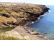
聖瑪麗亞島(葡萄牙語:Ilha de Santa Maria),是葡萄牙的島嶼,屬於亞速爾群島的一部分,長16.76公里、寬10.29公里,面積97.18平方公里,最高點海拔高度587米,人口6,500,人口密度每平方公里66.89人。

二战时,葡萄牙政府允许美军在该岛上建立了一个短暂运行的空军基地。[1]

參考資料

  1. ^ Norman Herz. Covering the Azores Gap in World War II. Warfare History Network. [2020-07-14]. (原始内容存档于2021-01-31). 
{{bottomLinkPreText}} {{bottomLinkText}}
聖瑪麗亞島
Listen to this article

This browser is not supported by Wikiwand :(
Wikiwand requires a browser with modern capabilities in order to provide you with the best reading experience.
Please download and use one of the following browsers:

This article was just edited, click to reload
This article has been deleted on Wikipedia (Why?)

Back to homepage

Please click Add in the dialog above
Please click Allow in the top-left corner,
then click Install Now in the dialog
Please click Open in the download dialog,
then click Install
Please click the "Downloads" icon in the Safari toolbar, open the first download in the list,
then click Install
{{::$root.activation.text}}

Install Wikiwand

Install on Chrome Install on Firefox
Don't forget to rate us

Tell your friends about Wikiwand!

Gmail Facebook Twitter Link

Enjoying Wikiwand?

Tell your friends and spread the love:
Share on Gmail Share on Facebook Share on Twitter Share on Buffer

Our magic isn't perfect

You can help our automatic cover photo selection by reporting an unsuitable photo.

This photo is visually disturbing This photo is not a good choice

Thank you for helping!


Your input will affect cover photo selection, along with input from other users.

X

Get ready for Wikiwand 2.0 🎉! the new version arrives on September 1st! Don't want to wait?