For faster navigation, this Iframe is preloading the Wikiwand page for 沖島.

沖島

35°12′28″N 136°03′58″E / 35.20778°N 136.06611°E / 35.20778; 136.06611

沖島
沖島,1982年日本國土交通省之國土畫像情報空拍圖
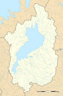
沖島在滋贺县的位置
沖島
沖島
沖島在滋賀縣的位置
地理
坐标35°12′28″N 136°3′58″E / 35.20778°N 136.06611°E / 35.20778; 136.06611
面積1.51平方公里(0.58平方英里)
海岸線6.8千米(4.23英里)
最高海拔225米(738英尺)
管轄
沖島
日语名称
汉字 沖島

沖島(日语:沖島おきしま Oki shima)或稱作沖之島(日语:沖ノ島おきのしま Okino shima)是日本滋賀縣琵琶湖東側的一個島嶼,為琵琶湖中最大島嶼,位於琵琶湖北部的竹生島夜間為無人島,因此沖島為日本唯一淡水湖中的有人島[1]。屬於滋賀縣近江八幡市沖島町管轄。

設施

[编辑]

參考文獻

[编辑]
  1. ^ 日本で唯一の淡水の有人島、琵琶湖の沖島 16歳以上島民に一斉接種へ. 京都新聞. 2021-04-23 [2022-04-13]. (原始内容存档于2022-04-13). 
{{bottomLinkPreText}} {{bottomLinkText}}
沖島
Listen to this article

This browser is not supported by Wikiwand :(
Wikiwand requires a browser with modern capabilities in order to provide you with the best reading experience.
Please download and use one of the following browsers:

This article was just edited, click to reload
This article has been deleted on Wikipedia (Why?)

Back to homepage

Please click Add in the dialog above
Please click Allow in the top-left corner,
then click Install Now in the dialog
Please click Open in the download dialog,
then click Install
Please click the "Downloads" icon in the Safari toolbar, open the first download in the list,
then click Install
{{::$root.activation.text}}

Install Wikiwand

Install on Chrome Install on Firefox
Don't forget to rate us

Tell your friends about Wikiwand!

Gmail Facebook Twitter Link

Enjoying Wikiwand?

Tell your friends and spread the love:
Share on Gmail Share on Facebook Share on Twitter Share on Buffer

Our magic isn't perfect

You can help our automatic cover photo selection by reporting an unsuitable photo.

This photo is visually disturbing This photo is not a good choice

Thank you for helping!


Your input will affect cover photo selection, along with input from other users.

X

Get ready for Wikiwand 2.0 🎉! the new version arrives on September 1st! Don't want to wait?