For faster navigation, this Iframe is preloading the Wikiwand page for 歐魯昆郡政府.

歐魯昆郡政府

歐魯昆郡
歐魯昆郡於昆士蘭州轄境圖
歐魯昆郡於昆士蘭州轄境圖
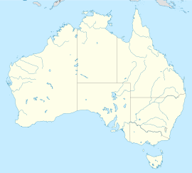
歐魯昆郡在澳大利亚的位置
歐魯昆郡
歐魯昆郡
坐标:13°24′S 141°42′E / 13.4°S 141.7°E / -13.4; 141.7
国家 澳大利亞
一级行政区昆士蘭州
地區遠北
建立1978
政府所在地歐魯昆
政府
 • 市長Neville Pootchemunka
面积
 • 总计7,375.0 平方公里(2,847.5 平方英里)
人口(2006年人口調查)[1]
 • 總計1,044人
 • 密度0.142人/平方公里(0.367人/平方英里)
州選區庫克
聯邦選區萊卡特
網站歐魯昆郡

歐魯昆郡澳大利亞昆士蘭州遠北地區的地方政府,轄境有7,375平方公里 。

人口

[编辑]

澳大利亞統計局由於歐魯昆郡有語言、文化、地理和交通障礙,構成人口分布遼闊,許多社群因此鮮少與外界交流,使調查不易進行,暫時不列入詳述範圍。有鑑於此,多項統計數據於人口調查表回收當日,皆低於實際數字。

參考文獻

[编辑]
  1. ^ 澳大利亚统计局. Aurukun (S) (Local Government Area). 2006 Census QuickStats. 2007-10-25 [26 September 2009]. 

外部連結

[编辑]
{{bottomLinkPreText}} {{bottomLinkText}}
歐魯昆郡政府
Listen to this article

This browser is not supported by Wikiwand :(
Wikiwand requires a browser with modern capabilities in order to provide you with the best reading experience.
Please download and use one of the following browsers:

This article was just edited, click to reload
This article has been deleted on Wikipedia (Why?)

Back to homepage

Please click Add in the dialog above
Please click Allow in the top-left corner,
then click Install Now in the dialog
Please click Open in the download dialog,
then click Install
Please click the "Downloads" icon in the Safari toolbar, open the first download in the list,
then click Install
{{::$root.activation.text}}

Install Wikiwand

Install on Chrome Install on Firefox
Don't forget to rate us

Tell your friends about Wikiwand!

Gmail Facebook Twitter Link

Enjoying Wikiwand?

Tell your friends and spread the love:
Share on Gmail Share on Facebook Share on Twitter Share on Buffer

Our magic isn't perfect

You can help our automatic cover photo selection by reporting an unsuitable photo.

This photo is visually disturbing This photo is not a good choice

Thank you for helping!


Your input will affect cover photo selection, along with input from other users.

X

Get ready for Wikiwand 2.0 🎉! the new version arrives on September 1st! Don't want to wait?