For faster navigation, this Iframe is preloading the Wikiwand page for 文森山.

文森山

此條目可参照法語維基百科相應條目来扩充,此條目在對應語言版為高品質條目。 (2021年4月24日)若您熟悉来源语言和主题,请协助参考外语维基百科扩充条目。请勿直接提交机械翻译,也不要翻译不可靠、低品质内容。依版权协议,译文需在编辑摘要注明来源,或于讨论页顶部标记((Translated page))标签。

78°31′31.74″S 85°37′1.73″W / 78.5254833°S 85.6171472°W / -78.5254833; -85.6171472

文森山
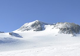
自溫森高原眺望文森山
文森山在南極洲的位置
文森山
文森山
文森山的位置
最高点
海拔4,892米(16,050英尺)
地形突起度
第8名英语List of peaks by prominence
地理
位置南极洲
山脈森蒂納爾嶺
攀山
首次登頂1966年尼古拉斯·克林奇(Nicholas Clinch)和登山隊
最简路线英语Normal route雪/冰攀登
NASA 从太空拍摄的文森山

文森山(英語:Vinson Massif),是南极洲的最高峰,以致力於推動南極探險的美國國會議員卡爾·文森為此峰命名。於2004年以GPS技術最新測得海拔4,892公尺(16,050英尺),山頂距南极點约1,200公里,山體长21公里,宽13公里。

外部链接

[编辑]
{{bottomLinkPreText}} {{bottomLinkText}}
文森山
Listen to this article

This browser is not supported by Wikiwand :(
Wikiwand requires a browser with modern capabilities in order to provide you with the best reading experience.
Please download and use one of the following browsers:

This article was just edited, click to reload
This article has been deleted on Wikipedia (Why?)

Back to homepage

Please click Add in the dialog above
Please click Allow in the top-left corner,
then click Install Now in the dialog
Please click Open in the download dialog,
then click Install
Please click the "Downloads" icon in the Safari toolbar, open the first download in the list,
then click Install
{{::$root.activation.text}}

Install Wikiwand

Install on Chrome Install on Firefox
Don't forget to rate us

Tell your friends about Wikiwand!

Gmail Facebook Twitter Link

Enjoying Wikiwand?

Tell your friends and spread the love:
Share on Gmail Share on Facebook Share on Twitter Share on Buffer

Our magic isn't perfect

You can help our automatic cover photo selection by reporting an unsuitable photo.

This photo is visually disturbing This photo is not a good choice

Thank you for helping!


Your input will affect cover photo selection, along with input from other users.

X

Get ready for Wikiwand 2.0 🎉! the new version arrives on September 1st! Don't want to wait?