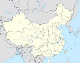
海坛岛
| 海壇島 | |
|---|---|
 海壇島地圖 | |
| 地理 | |
| 位置 | |
| 坐标 | 25°31′49″N 119°45′42″E / 25.5303°N 119.7617°E |
| 鄰近水域 | 臺灣海峽 |
| 管轄 | |
| 省 | 福建省 |
| 市 | 福州市 |
| 縣 | 平潭縣 |
| 人口统计 | |
| 人口 | 211万(2020) |
| 語言 | 漢語(閩語福州話、普通話) |
| 族群 | 漢族福州民系 |
| 其他资料 | |
| 时区 | |
海坛岛又稱平潭島,位於福建省福州市,闽江河口以南,东临台湾海峡,屬於該市平潭縣的平潭綜合實驗區。該島是中國福建省福州市平潭縣臨近亞洲大陸東海岸外的一個島嶼[1],是福建省最大的島嶼,也是中華人民共和國管理的第四大島嶼。[2]南北长约29公里,东西宽约19公里,总面积约为267.13平方公里。
地理
海壇島是福建省的最大島,中國大陸第四大島,面積370.9平方公里。海域面積6064平方公里,海岸線長408公里。素有“千礁島縣”之稱。與福清市隔著海壇海峽。另外,平潭與臺灣新竹間為臺灣海峽最狹處(140公里),島上立有相關示意碑。平潭在2010年建成通向大陸的橋樑後,成為距離台灣島最近的中國“大陸”部分。
在行政上,平潭島是平潭縣的一部分,平潭縣包括幾個較小的島嶼和附近大陸的一部分。該縣主要的城鎮,包括縣政府所在地都在島上,大部分海岸線都經歷土地開墾以及重大建築設施項目。[3]平潭被海壇海峽與中國大陸隔開,附近大陸地區是縣級市福清,隸屬於地級市福州。
根據目前的國際協議,該島的最南端構成了東海和南海之間的邊界。[4]在尚未批准的新版 IHO 海洋界限草案中,該島最北端的象角構成了東海和台灣海峽之間的邊界,至於南海的北邊界移至海峽南端。[5]
氣候
海坛岛地处东亚季风气候区,夏季长而冬季短暂,气候温暖湿润。根据2018年的数据显示,该岛年均气温为19.6摄氏度。[6]
歷史
1048年(宋慶曆八年),海坛岛被編入福清縣太平鄉海壇里管轄。
1731年(清雍正九年四月),縣丞署設址此地後,歷代縣政府機關均設址於此,是全縣的政治、經濟、文化、教育中心。
1798年(清嘉慶三年),置平潭廳。1912年(民國元年)建縣,隸屬於福州府。
1949年5月5日深夜,中共的平潭人民遊擊支隊攻下縣城中正堂,攻克平潭縣城。5月13日,中共成立平潭縣人民政府。
1949年7月,平潭人民遊擊支隊退至福清。
1949年8月,福州戰役後,国军第七十三軍殘部退守海坛島。為了強化海坛島防衛能力,第七十四軍殘部全部被編入第五十一師內改隸至李天霞所指揮的第七十三軍。
1949年9月16日,中國人民解放軍在平潭人民遊擊支隊配合下,占领平潭全境。
|
主条目:平潭綜合實驗區 |
2009年7月,福州市人民政府在平潭縣設立「福州(平潭)綜合實驗區」。
2010年11月30日,全線長4976公尺的平潭海峽大橋興建完成並於同年12月25日正式通車,其中橋梁長3510公尺。橋面和接線公路寬度同為17公尺,通航等級為5000噸級海輪。
2012年,更名為「福建省平潭綜合實驗區」[7]。
對外交通
高速公路
公共運輸
- 鐵路:福平鐵路平潭站
- 公共汽車:平潭客運站—福州汽車南站。由福建省汽車運輸公司(簡稱閩運)提供營運。(2010年11月30日正式開通,搭車公共汽車需時80分鐘)
- 公共汽車:平潭客運站—廈門。由福建省汽車運輸公司(簡稱閩運)提供營運。
船運
風景与旅游
海壇島為福州市唯一的國家級風景名勝區——海壇國家重點風景名勝區,面積71平方公里。
参考文献
- ^ Faming Huang, Yanhong Lin, Huixin Liang, Rongrong Zhao, Qiuming Chen, Jie Lin and Jinliang Huang (3 December 2019). "Coordination of Marine Functional Zoning Revision at the Provincial and Municipal Levels: A Case Study of Putian, China". Journal of Marine Science and Engineering: 5. Retrieved 10 February 2020. Haitan Island
- ^ "About Pingtan". www.chinadaily.com.cn. Retrieved 2021-04-24.
- ^ Cf. especially the historical imagery timeline available for Google Earth.
- ^ IHO (1953), §49.
- ^ IHO (1986), Ch. 7.2
- ^ GAO Sheng, 高升; CAO Guangxi, 曹广喜; HONG Tao, 洪滔; ZHAO Lin, 赵林; XU Min, 徐敏. Dynamic evaluation of ecological security and its driving factors in the process of urbanization of islands: a case study of Pingtan Island. Acta Ecologica Sinica. 2018, 38 (7). doi:10.5846/stxb201704250746.
- ^ 台方应客观看待两岸关系中的新生事物——两岸学者谈平潭开发争议. 新华网. [2012年]. (原始内容存档于2013-04-28) (中文(中国大陆)).
外部链接
- (简体中文)平潭岛
| |||||||||||||||||||||||||||
| ||||||||||||||||||||
| ||||||||||||||||||||||||||||||||||||||||||||||||||||||||||||||||||||||
| |||||||||||||||||||||||||||||||||||||||||||||
| |||||||||||||||||||||||||||||||||||||||||||||||||||||||||||||||||||||||||||||||||||||||||||||||||||||||||||||||||||||||||||||||||||
Text is available under the CC BY-SA 4.0 license; additional terms may apply.
Images, videos and audio are available under their respective licenses.


