For faster navigation, this Iframe is preloading the Wikiwand page for 巴纳巴岛.

巴纳巴岛

此條目需要擴充。 (2018年3月25日)请協助改善这篇條目,更進一步的信息可能會在討論頁扩充请求中找到。请在擴充條目後將此模板移除。
巴纳巴岛
Banaba
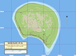
巴纳巴岛地图
巴纳巴岛在大洋洲的位置
巴纳巴岛
巴纳巴岛
在大洋洲的位置
地理
位置太平洋
坐标0°51′34″S 169°32′13″E / 0.85944°S 169.53694°E / -0.85944; 169.53694
面積6平方公里(2.3平方英里)
最高海拔81米(266英尺)
管轄
人口统计
人口335(2012)
巴纳巴岛卫星影像

巴纳巴岛(英語:Banaba),亦称大洋岛,是基里巴斯最西邊的岛屿,位于吉尔伯特群岛以西,瑙鲁以东300公里。为一珊瑚岛,面积6.5平方公里,最高点海拔81米,也是基里巴斯的海拔最高点。與瑙魯及法屬玻里尼西亞馬卡泰阿島,同為開採磷酸鹽的重要岛屿。因環境破壞,自1945年起大部分人口陸繼被遷移至斐濟蘭比島

人口

村庄名称 人口(人口普查
1995年 2005年 2010年 2015年
塔比昂(Antereen/Tabiang) 16 108 83 102
奥马(Umwa/Ooma/Uma) 269 135 155 166
塔皮瓦(Tabewa/Tapiwa/Tabwewa) 54 58 57
布阿科尼凯(Buakonikai)
巴纳巴岛 339 301 295 268
{{bottomLinkPreText}} {{bottomLinkText}}
巴纳巴岛
Listen to this article

This browser is not supported by Wikiwand :(
Wikiwand requires a browser with modern capabilities in order to provide you with the best reading experience.
Please download and use one of the following browsers:

This article was just edited, click to reload
This article has been deleted on Wikipedia (Why?)

Back to homepage

Please click Add in the dialog above
Please click Allow in the top-left corner,
then click Install Now in the dialog
Please click Open in the download dialog,
then click Install
Please click the "Downloads" icon in the Safari toolbar, open the first download in the list,
then click Install
{{::$root.activation.text}}

Install Wikiwand

Install on Chrome Install on Firefox
Don't forget to rate us

Tell your friends about Wikiwand!

Gmail Facebook Twitter Link

Enjoying Wikiwand?

Tell your friends and spread the love:
Share on Gmail Share on Facebook Share on Twitter Share on Buffer

Our magic isn't perfect

You can help our automatic cover photo selection by reporting an unsuitable photo.

This photo is visually disturbing This photo is not a good choice

Thank you for helping!


Your input will affect cover photo selection, along with input from other users.

X

Get ready for Wikiwand 2.0 🎉! the new version arrives on September 1st! Don't want to wait?