實龍崗
| 實龍崗 | |
|---|---|
| 新加坡規劃區與 新加坡新城鎮 | |
| 別稱轉寫 | |
| • 馬來語 | Serangoon (馬來語字母) سرڠݢون (爪夷文) |
| • 中文 | 实龙岗 (簡化字) 實龍崗 (繁體字) Shílónggǎng (漢語拼音) Si̍t-lêng-kong (新加坡福建話 白話字) |
| • 坦米爾語 | சிராங்கூன் Cirāṅkūṉ (Transliteration) |
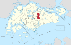 Location of Serangoon in Singapore | |
| 坐标:1°21′19.28″N 103°52′4.33″E / 1.3553556°N 103.8678694°E | |
| 國家 | |
| 地區 | 東北區
|
| 社群發展理事會 |
|
| 鎮議會 |
|
| 新加坡選區 | |
| 面积[1][2] | |
| • 总计 | 10.1 平方公里(3.9 平方英里) |
| • Residential | 1.63 平方公里(0.63 平方英里) |
| 人口(2019)[1][2][3] | |
| • 總計 | 116,310人 |
| • 密度 | 11,516人/平方公里(29,826人/平方英里) |
| Postal districts | 19, 28 |
| Dwelling units | 21,293 |
| Projected ultimate | 30,000 |
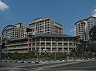
实龙岗(英語:Serangoon,/səræŋɡuːn/)是新加坡東北部的一个规划区。該規劃區共有七個分區:實龍崗中心、羅弄泉、巴耶利峇上段、實龍崗花園、實龍崗北、實里達山和實龍崗北工業區。[4]
交通
[编辑]公共交通
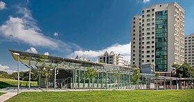
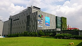
[编辑]最初的實龍崗巴士交匯處於1988年3月13日於實龍崗中心開放。[5]後來於2011年9月3日搬遷至NEX購物中心 。[6]
东北线的大部分與主幹道平行。沿著這條路的車站是從小印度地铁站到高文地铁站。
公路網
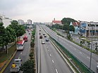
[编辑]沿着東北地区的实龙岗路上段是一条主要的公路,连接镇中心与市区或东北区。是新加坡其中最古老的道路之一。 另外主要公路有楊厝港路、巴耶里峇路上段、巴特里路、布萊德路与宏茂桥三道。
鎭西部可連接中央高速公路前往实理达机场或大巴窑、中央区等。
教育
[编辑]截至2017年,該區共有小學5所,中學4所和南洋初級學院。[7]
政治
[编辑]实龙岗分列爲三個选区:马林百列、阿裕尼及宏茂橋集选区。分区有布莱德岭(马林百列),实龙岗分区(阿裕尼)及惹兰加由(宏茂桥)。
马林百列及宏茂桥两区由人民行動黨管理,工人黨管理阿裕尼。
第一、二邻里与实龙岗花园属于阿裕尼集选区。1997至2006分区属于马林百列,如今还是管理第二(部分)、三、四邻里包括鎭中心。第五邻里属于宏茂桥市镇理事会管理。
参考文献
[编辑]- ^ 1.0 1.1 City Population – statistics, maps and charts | Serangoon. [2022-07-06]. (原始内容存档于2019-08-15).
- ^ 2.0 2.1 HDB Key Statistics FY 2014/2015 互联网档案馆的存檔,存档日期4 March 2016.
- ^ Statistics Singapore - Geographic Distribution - 2018 Latest Data. [February 11, 2019]. (原始内容存档于2016-01-30).
- ^ Archived copy (PDF). [24 October 2015]. (原始内容 (PDF)存档于5 March 2016).
- ^ Interchange in new town opens on Sunday. The Straits Times. 8 March 1988 [23 June 2017]. (原始内容存档于2022-07-06) –通过NewspaperSG.
- ^ Bus Services Operating From The New Serangoon Bus Interchange. SBS Transit. 25 August 2017 [23 June 2017]. (原始内容存档于2021-06-29).
- ^ School Information Service. [2022-07-06]. (原始内容存档于2016-05-31).
- 書目
- Victor R Savage, Brenda S A Yeoh (2003), Toponymics – A Study of Singapore Street Names, Eastern Universities Press, ISBN 981-210-205-1
外部連結
[编辑]Text is available under the CC BY-SA 4.0 license; additional terms may apply.
Images, videos and audio are available under their respective licenses.

