For faster navigation, this Iframe is preloading the Wikiwand page for 合歡尖山.

合歡尖山

此條目已列出參考文獻,但因為沒有文內引註而使來源仍然不明。 (2020年3月4日)请加上合适的文內引註来改善这篇条目
合歡尖山
合歡尖山登山口
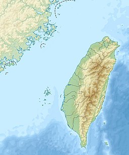
合歡尖山在臺灣的位置
合歡尖山
合歡尖山
在臺灣的位置
最高点
海拔3,217米(10,554英尺)
列表合歡群峰
坐标 24°08′40″N 121°17′01″E / 24.144444°N 121.283611°E / 24.144444; 121.283611
地理
位置 臺灣南投縣仁愛鄉花蓮縣秀林鄉
所属山脉中央山脈

合歡尖山,是台灣的一座山峰,位於南投縣仁愛鄉大同村與花蓮縣秀林鄉富世村交界,處太魯閣國家公園範圍內,位在中央山脈北段主脊上,為合歡群峰的一座山峰,海拔3217.7公尺。山頂無基石,有立牌標示合歡尖山。位於省道台14甲線33公里合歡山中心旁,交通方便。

參考文獻

[编辑]
  • 楊建夫,《台灣的山脈》,2001年,臺北,遠足文化。
  • 陳遠建,《大台中全覽百科地圖》,2015年,臺北,戶外生活圖書公司。
{{bottomLinkPreText}} {{bottomLinkText}}
合歡尖山
Listen to this article

This browser is not supported by Wikiwand :(
Wikiwand requires a browser with modern capabilities in order to provide you with the best reading experience.
Please download and use one of the following browsers:

This article was just edited, click to reload
This article has been deleted on Wikipedia (Why?)

Back to homepage

Please click Add in the dialog above
Please click Allow in the top-left corner,
then click Install Now in the dialog
Please click Open in the download dialog,
then click Install
Please click the "Downloads" icon in the Safari toolbar, open the first download in the list,
then click Install
{{::$root.activation.text}}

Install Wikiwand

Install on Chrome Install on Firefox
Don't forget to rate us

Tell your friends about Wikiwand!

Gmail Facebook Twitter Link

Enjoying Wikiwand?

Tell your friends and spread the love:
Share on Gmail Share on Facebook Share on Twitter Share on Buffer

Our magic isn't perfect

You can help our automatic cover photo selection by reporting an unsuitable photo.

This photo is visually disturbing This photo is not a good choice

Thank you for helping!


Your input will affect cover photo selection, along with input from other users.

X

Get ready for Wikiwand 2.0 🎉! the new version arrives on September 1st! Don't want to wait?