Unless stated otherwise, UN maps are to be considered in the public domain. This applies worldwide.
Some UN maps have special copyrights, as indicated on the map itself.
UN maps are, in principle, open source material and you can use them in your work or for making your own map. UN requests however that you delete the UN name, logo and reference number upon any modification to the map. Content of your map will be your responsibility. You can state in your publication, if you wish, something like: based on UN map … (map name, map number, revision number and date). See: Geospatial Information Section. And: Geospatial, location data for a better world.
说明
添加一行文字以描述该文件所表现的内容
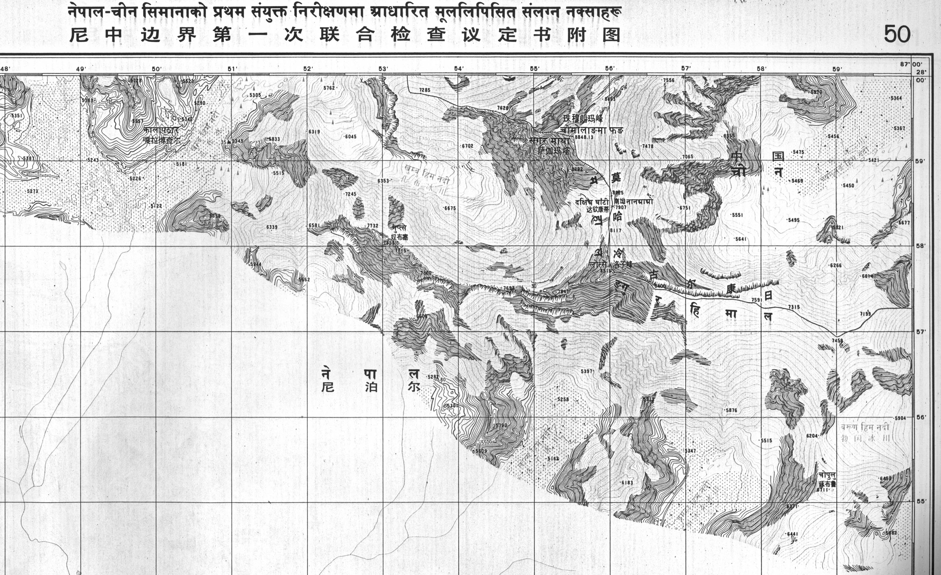
Map 50 of the Survey of Nepal. At top centre, a boundary line identified as separating China & Nepal passes through the summit contour of Mt. Everest. The boundary here & for much of the China–Nepal border follows the main Himalayan watershed divide.
((Information |Description =((en|1=Boundary maps in the public domain published by the Survey of Nepal, sent to the UN)) |Source =Boundary treaty maps held at UN Treaty Office |Author =Survey of Nepal |Date =1980-07-01 |Permis
This browser is not supported by Wikiwand :( Wikiwand requires a browser with modern capabilities in order to provide you with the best reading experience. Please download and use one of the following browsers:
Your input will affect cover photo selection, along with input from other users.
X
Get ready for Wikiwand 2.0 🎉! the new version arrives on September 1st! Don't want to wait?
Oh no, there's been an error
Please help us solve this error by emailing us at support@wikiwand.com
Let us know what you've done that caused this error, what browser you're using, and whether you have any special extensions/add-ons installed.
Thank you!

