For faster navigation, this Iframe is preloading the Wikiwand page for 鸭仔山.

鸭仔山

鸭仔山
从鸭仔山望向将军澳
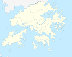
鸭仔山在香港的位置
鸭仔山
鸭仔山
鸭仔山的位置
最高点
海拔152.6m
坐标22°19′24.7″N 114°15′49.2″E / 22.323528°N 114.263667°E / 22.323528; 114.263667
地理
位置香港新界东部

鸭仔山(英语:Ap Tsai Shan/Duckling Hill),又称鱿鱼湾山,位于香港西贡将军澳坑口鱿鱼湾一带的一座小山。[1]原来由坑口村直指至鸭仔湾,但后来鸭头和鸭颈被平整,成为了今日的富宁花园厚德邨

游人可在此饱览将军澳坑口及宝林一带景色,而北面可远眺西贡海牛尾洲吊钟洲

邻近山峰

邻近建筑

参考资料

  1. ^ Discovery, 野外动向 HK. 【西貢行山路線】將軍澳坑口站出發 鴨仔鷓鴣尖風葵坳四山連走. 香港01. 2019-02-23 [2019-12-16]. (原始内容存档于2020-08-07) (中文(香港)). 

外部链接

{{bottomLinkPreText}} {{bottomLinkText}}
鸭仔山
Listen to this article

This browser is not supported by Wikiwand :(
Wikiwand requires a browser with modern capabilities in order to provide you with the best reading experience.
Please download and use one of the following browsers:

This article was just edited, click to reload
This article has been deleted on Wikipedia (Why?)

Back to homepage

Please click Add in the dialog above
Please click Allow in the top-left corner,
then click Install Now in the dialog
Please click Open in the download dialog,
then click Install
Please click the "Downloads" icon in the Safari toolbar, open the first download in the list,
then click Install
{{::$root.activation.text}}

Install Wikiwand

Install on Chrome Install on Firefox
Don't forget to rate us

Tell your friends about Wikiwand!

Gmail Facebook Twitter Link

Enjoying Wikiwand?

Tell your friends and spread the love:
Share on Gmail Share on Facebook Share on Twitter Share on Buffer

Our magic isn't perfect

You can help our automatic cover photo selection by reporting an unsuitable photo.

This photo is visually disturbing This photo is not a good choice

Thank you for helping!


Your input will affect cover photo selection, along with input from other users.

X

Get ready for Wikiwand 2.0 🎉! the new version arrives on September 1st! Don't want to wait?