西北地区 (加拿大)
| 西北地区 Northwest Territories(英文) Territoires du Nord-Ouest(法文) Denendeh(德内文) Nunatsiaq(牛纳纳通文) ᓄᓇᑦᓯᐊᖅ(伊努克提图特文) | |||
|---|---|---|---|
| |||
| 格言:无 | |||
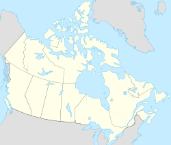
 西北地区在加拿大的位置 | |||
| 坐标:67°N 121°W / 67°N 121°W | |||
| 加入联邦 | 1870年7月15日(第5位) | ||
| 首府 | 黄刀市(Yellowknife) | ||
| 最大城市 | 黄刀市(Yellowknife) | ||
| 政府 | |||
| • 地区专员 | 玛格丽特·托姆 | ||
| • 地区长官 | R.J. 辛普森(共识政府)
| ||
| 立法机关 | 西北地区立法会 | ||
| 国会席位 | (加拿大国会) | ||
| 下议员席位 | 1席(0.3%) | ||
| 上议院席位 | 1席(1%) | ||
| 面积 | |||
| • 总计 | 1,346,106 平方公里(519,734 平方英里) | ||
| • 陆地 | 1,183,085 平方公里(456,792 平方英里) | ||
| • 水域 | 163,021 平方公里(62,943 平方英里) 12.1% | ||
| 面积排名 | 第3位 | ||
| 13.5% of Canada | |||
| 人口(2016年) | |||
| • 总计 | 41,786[1]人 | ||
| • 排名 | 第11位 | ||
| 居民称谓 | |||
| 官方语言 | 因纽特语,英语, 法语 奇标扬语(Dene Suline) 克里语(Cree) 多格里布语(Dogrib) 哥威迅语(Gwich'in) 斯拉维语(Slavey) | ||
| 时区 | UTC-7 | ||
| 邮政简称 | NT | ||
| 邮编前缀 | X0,X1 (首府地区) | ||
| ISO 3166码 | CA-NT | ||
| 网站 | www | ||
| 排名包含所有省和地区 | |||


西北地区(英语:Northwest Territories,缩写为NWT;法语:les Territoires du Nord-Ouest,因纽特语:ᓄᓇᑦᓯᐊᖅ)是加拿大一级行政区里面的三个“地区”(Territory)之一,面积1,171,918平方公里,但在1999年努纳武特自西北地区分离而出之前,面积曾高达3,439,296平方公里,占了加拿大领土的三分之一。2011年普查时人口为41,462人。首府为耶洛奈夫。
简介

西北地区于1870年6月加入加拿大联邦,是为当时哈德逊湾公司将其下的西北领地转让给加拿大政府后成立的。当时的西北地区范围极广,包括除了不列颠哥伦比亚省、安大略省及魁北克省南部、大西洋地区以外的全部地方。但随着区内部分地方的人口增长,新省份亦逐渐在西北地区内设立。当中包括曼尼托巴省(1870年)、育空地区(1898年)、萨斯喀彻温省(1905年)、和阿尔伯塔省(1905年);而西北地区的管辖范围亦逐渐缩小。1999年4月努纳武特地区成立,西北地区的管辖范围进一步缩小。现今西北地区包括在努纳武特成立后的西面地区。
地理
现在的西北地区是位处加拿大部近北极圈,南部以北纬60度线与萨斯喀彻温省、阿尔伯塔省、不列颠哥伦比亚省接壤,西面则是育空地区。
历史
西北地区原来的范围极广,包括了北极圈到今日草原三省。古时居于此地的都是土著,印第安人为主。
自16世纪欧洲人西渡美洲殖民起,西北地区属于哈德逊湾公司拥有。1870年加拿大联邦成立,该公司把西北地区转让给加拿大政府。随着十九世纪末淘金热,加拿大西部人口增加,西北地区逐渐要分拆多个省份,先有1870年成立曼尼托巴省;后于1898-1905年间,成立育空地区、萨斯喀彻温省、阿尔伯塔省。到了1999年4月,为让因纽特人自治,再在东面分拆出努纳武特地区。西北地区的范围,乃缩小到现在的规模。
经济
西北地区属北极地区,人口稀少,故经济上主要以自然资源开发为主。采矿方面有金、银、铜等等。而石油和天然气的开采,也是该地经济的主要部分。
政治
由于西北地区相对南部其他省分更为地广人稀,因而只设了一个选区即西北地区。
重要城市
| 西北领地最大城市排名 来源:2016人口普查[2] | |||||||||
|---|---|---|---|---|---|---|---|---|---|
| 排名 | 城市名称 | 普查区| | 人口 | ||||||
 耶洛奈夫市(黄刀市)
|
1 | 耶洛奈夫市(黄刀市) | 第6普查区 | 19,569 |  因纽维克镇 | ||||
| 2 | 干草河镇 | 第5普查区 | 3,528 | ||||||
| 3 | 因纽维克镇 | 第1普查区 | 3,243 | ||||||
| 4 | 史密斯堡镇 | 第5普查区 | 2,542 | ||||||
| 5 | 贝霍措克奥社区 | 第3普查区 | 1,874 | ||||||
| 6 | 辛普森堡村 | 第4普查区 | 1,202 | ||||||
| 7 | 图克托亚图克庄 | 第1普查区 | 898 | ||||||
| 8 | 诺曼韦尔斯镇 | 第2普查区 | 778 | ||||||
| 9 | 麦克弗森堡庄 | 第1普查区 | 700 | ||||||
| 10 | 普罗维登斯堡庄 | 第6普查区 | 695 | ||||||


都会区
| 排名 | 都会区名称 | 2016人口[3] |
|---|---|---|
| 1 | 耶洛奈夫 CA | 19,569 |
参考文献
- ^ Population and Dwelling Count Highlight Tables, 2016 Census – Canada, provinces and territories. 2016 Census. Statistics Canada. February 8, 2017 [2021-10-13]. (原始内容存档于2019-06-29).
- ^ Population and dwelling counts, for Canada and census subdivisions (municipalities), 2016 and 2011 censuses – 100% data. Statistics Canada. Statistics Canada. [2019-09-20]. (原始内容存档于2020-02-09).
- ^ Population and dwelling counts, for Canada, provinces and territories, census metropolitan areas and census agglomerations, 2016 and 2011 censuses – 100% data. Statistics Canada. Statistics Canada. [2019-10-01]. (原始内容存档于2019-10-05).
| ||||||||||||||||||||||||||||||||
| |||||||||||||||||||||||||||
Text is available under the CC BY-SA 4.0 license; additional terms may apply.
Images, videos and audio are available under their respective licenses.
