For faster navigation, this Iframe is preloading the Wikiwand page for 苏莱曼山.

苏莱曼山

苏莱曼-至圣之山
世界遗产
位置吉尔吉斯斯坦
标准文化 (iii), (vi)
参考编码1230rev
登录年份2009年(第33届会议
面积112 ha(280 acre)
缓冲区4,788 ha(11,830 acre)
坐标40°31′52″N 72°46′58″E / 40.53111°N 72.78278°E / 40.53111; 72.78278
苏莱曼山在吉尔吉斯的位置
苏莱曼山
苏莱曼山在吉尔吉斯的位置
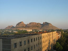
奥什观看苏莱曼山

苏莱曼山 (另外以Taht-I-Suleiman, Sulayman RockSulayman Throne著称) 是唯一完全位于吉尔吉斯斯坦世界遗产[1](天山丝路与哈萨克及中国共同拥有)它位在奥什,是穆斯林与伊斯兰时代以前的本地信仰者朝圣的场所之一。

在山顶的岩石

参考资料

[编辑]
  1. ^ Sulaiman-Too Sacred Mountain. UNESCO. [9 August 2014]. (原始内容存档于2017-04-17). 
{{bottomLinkPreText}} {{bottomLinkText}}
苏莱曼山
Listen to this article

This browser is not supported by Wikiwand :(
Wikiwand requires a browser with modern capabilities in order to provide you with the best reading experience.
Please download and use one of the following browsers:

This article was just edited, click to reload
This article has been deleted on Wikipedia (Why?)

Back to homepage

Please click Add in the dialog above
Please click Allow in the top-left corner,
then click Install Now in the dialog
Please click Open in the download dialog,
then click Install
Please click the "Downloads" icon in the Safari toolbar, open the first download in the list,
then click Install
{{::$root.activation.text}}

Install Wikiwand

Install on Chrome Install on Firefox
Don't forget to rate us

Tell your friends about Wikiwand!

Gmail Facebook Twitter Link

Enjoying Wikiwand?

Tell your friends and spread the love:
Share on Gmail Share on Facebook Share on Twitter Share on Buffer

Our magic isn't perfect

You can help our automatic cover photo selection by reporting an unsuitable photo.

This photo is visually disturbing This photo is not a good choice

Thank you for helping!


Your input will affect cover photo selection, along with input from other users.

X

Get ready for Wikiwand 2.0 🎉! the new version arrives on September 1st! Don't want to wait?