For faster navigation, this Iframe is preloading the Wikiwand page for 狼林郡.

狼林郡

狼林郡
朝鲜语名称转写
 • 谚文랑림군
 • 汉字
 • 文化观光部2000年式 Rangnim-gun
 • 马科恩-赖肖尔表记法 Rangnim-gun
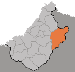
DPRK2006_Chagang-Rangrim.PNG
狼林郡在朝鲜民主主义人民共和国的位置
狼林郡
狼林郡
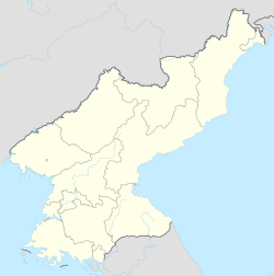
坐标:40°50′00″N 127°10′00″E / 40.83333°N 127.16667°E / 40.83333; 127.16667
国家 朝鲜民主主义人民共和国
行政区1邑、2劳动者区、14里
面积
 • 总计887.4 平方公里(342.6 平方英里)
人口(2008)
 • 总计36,481人
 • 密度41.1人/平方公里(106人/平方英里)

狼林郡韩语:랑림군狼林郡 Rangnim gun */?)是朝鲜民主主义人民共和国慈江道北部的一个郡,东邻两江道咸镜南道。位于狼林山脉东麓。最高点为海拔2,355米的莲花山。属长津江流域。面积2,062.438平方公里,2008年人口36,481人。[1]下分1邑、2劳动者区、14里。

历史

1952年设郡,1954年自咸镜南道划入慈江道。

参考文献

  1. ^ 朝鲜中央统计局,2008年人口普查结果页面存档备份,存于互联网档案馆),2009 年。
{{bottomLinkPreText}} {{bottomLinkText}}
狼林郡
Listen to this article

This browser is not supported by Wikiwand :(
Wikiwand requires a browser with modern capabilities in order to provide you with the best reading experience.
Please download and use one of the following browsers:

This article was just edited, click to reload
This article has been deleted on Wikipedia (Why?)

Back to homepage

Please click Add in the dialog above
Please click Allow in the top-left corner,
then click Install Now in the dialog
Please click Open in the download dialog,
then click Install
Please click the "Downloads" icon in the Safari toolbar, open the first download in the list,
then click Install
{{::$root.activation.text}}

Install Wikiwand

Install on Chrome Install on Firefox
Don't forget to rate us

Tell your friends about Wikiwand!

Gmail Facebook Twitter Link

Enjoying Wikiwand?

Tell your friends and spread the love:
Share on Gmail Share on Facebook Share on Twitter Share on Buffer

Our magic isn't perfect

You can help our automatic cover photo selection by reporting an unsuitable photo.

This photo is visually disturbing This photo is not a good choice

Thank you for helping!


Your input will affect cover photo selection, along with input from other users.

X

Get ready for Wikiwand 2.0 🎉! the new version arrives on September 1st! Don't want to wait?