埃尔克哈特 (堪萨斯州)
| 埃尔克哈特 Elkhart | |
|---|---|
| 县城 | |
 莫顿县法院(2009年) | |
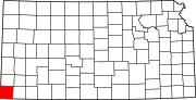
 埃尔克哈特于莫顿县及堪萨斯州之地理位置 | |
 莫顿县交通地图(图例) | |
| 坐标:37°00′11″N 101°53′53″W / 37.0031°N 101.898°W | |
| 国家 | 美国 |
| 州 | 堪萨斯州 |
| 县 | 莫顿县 |
| 成立 | 1913年 |
| 面积[1] | |
| • 总计 | 5.46 平方公里(2.11 平方英里) |
| • 陆地 | 5.46 平方公里(2.11 平方英里) |
| • 水域 | 0 平方公里(0 平方英里) |
| 海拔 | 1,094 米(3,589 英尺) |
| 人口(2010)[2] | |
| • 总计 | 2,205人 |
| • 估计(2012[3]) | 2,157 |
| • 密度 | 404人/平方公里(1,045人/平方英里) |
| 时区 | CST(UTC-6) |
| • 夏时制 | CDT(UTC-5) |
| 邮区编号 | 67950 |
| 电话区号 | 620 |
| FIPS代码 | 20-20350 [4] |
| GNIS编号 | 0485090 [5] |
| 网站 | 官方网站 |
埃尔克哈特(Elkhart)为美国堪萨斯州莫顿县的一座城市,也是莫顿县的县治[6]。城市南端即为堪萨斯州-俄克拉荷马州州界。根据2010年美国人口普查,此城市人口有2,205人[7]。
历史
早期
数千年以来,北美洲的北美大平原已有美洲原住民居住。16世纪至18世纪期间,法兰西王国声称拥有北美洲大部分的土地。1762年英法北美战争结束后,法国秘密签署枫丹白露条约,将新法兰西割让给西班牙。
19世纪
1802年,西班牙将大部分的土地归还予法国,但西班牙仍持有约7,500平方英里的土地。1803年,美国在路易斯安那购地中以1英亩2.83美分的价格从法国购得超过828,000平方英里的土地。1848年美墨战争结束后,与西班牙签订了瓜达卢佩-伊达尔戈条约,并且将全部或部分的土地给予美国,其中包含西南堪萨斯州。
1854年,堪萨斯领地成立,然而在1861年成为美国第34个州。1886年,莫顿县成立,其中也包含现今的县治埃尔克哈特。
20世纪
埃尔克哈特成立于1913年[8],城市名以印第安纳州的城市埃尔克哈特为名[9]。
人口统计
| 历史人口数 | |||
|---|---|---|---|
| 调查年 | 人口 | %± | |
| 1920年 | 1,160 | — | |
| 1930年 | 1,485 | 28.0% | |
| 1940年 | 902 | −39.3% | |
| 1950年 | 1,132 | 25.5% | |
| 1960年 | 1,780 | 57.2% | |
| 1970年 | 2,089 | 17.4% | |
| 1980年 | 2,243 | 7.4% | |
| 1990年 | 2,318 | 3.3% | |
| 2000年 | 2,233 | −3.7% | |
| 2010年 | 2,205 | −1.3% | |
| 2014年估计 | 2,113 | [11] | −4.2% |
| U.S. Decennial Census | |||
2010年普查
据2010年的人口普查,此城市人口有2,205人,户数856户,571个家庭。人口密度为403.5人/每平方公里(1,045.0人/每平方英里)。此城市有999栋住宅,平均每平方公里有182.8栋住宅。此城市居民之种族中,白人占87.7%,非裔美国人占0.1%,美洲原住民占1.2%,亚裔美国人占2.5%,其他种族占6.8%,混血种族则占1.6%。而西班牙裔或拉丁裔美国人占此城市人口的20.7%[2]。
此城市之户籍数计有856户。其中拥有18岁以下孩童的住户占33.8%;已婚夫妇且同居的住户占52.9%,住户为女性单亲者占9.1%;住户为男性单亲者占4.7%;住户并非一个家庭的占33.3%。住户为独自一人居住的占全户之29.2%,其中有14.6%为65岁或以上之独居老人。每户住户平均成员人数为2.48人,每个家庭平均成员人数则是3.07人[2]。
此城市居民之年龄中位数为38.4岁。以年龄层分类,年龄低于18岁者占26.4%;年龄介在18岁至24岁之间者占7.6%;年龄介在25岁至44岁之间者占23%;年龄介在45岁至64岁之间者占25.6%;年龄高于65岁者占17.6%。男性占全市人口之47.7%,女性则占全市人口之52.3%[2]。
2000年普查
据2000年人口普查,此城市人口有2,233人,户数854户,610个家庭。人口密度为466.0人/每平方公里(1,205.0人/每平方英里)。此城市有977栋住宅,平均每平方公里有203.9栋住宅。此城市居民之种族中,白人占89.34%,非裔美国人占0.09%,美洲原住民占1.16%,亚裔美国人占1.25%,其他种族占6.63%,混血种族则占1.52%。而西班牙裔或拉丁裔美国人占此城市人口的13.39%[4]。
此城市之户籍数计有854户,其中拥有18岁以下孩童的住户占36.2%;已婚夫妇且同居的住户占61.9%,住户为女性单亲者占7.4%;住户并非一个家庭的占28.5%。住户为独自一人居住的占全户之26.1%,其中有10.4%为65岁或以上之独居老人。每户住户平均成员人数为2.55人,每个家庭平均成员人数则是3.08人[4]。
以年龄层分类,年龄低于18岁者占28.0%;年龄介在18岁至24岁之间者占9.0%;年龄介在25岁至44岁之间者占27.4%;年龄介在45岁至64岁之间者占20.8%;年龄高于65岁者占14.8%。此城市居民之年龄中位数为36岁。性别比方面,每100名女性所对应的男性数为91.8名,如只计算18岁或以上的居民,则是每100名女性所对应的男性数为88.2名[4]。
此城市每户平均收入为37,333美元,每个家庭平均收入为43,548美元。男性平均收入33,333美元;女性平均收入19.792美元。此城市人均收入为17,900美元。此城市约有7.3%的家庭以及9.3%的居民低于贫穷门槛,其中18岁以下者占13.8%,65岁以上者占4.7%[4]。
地理
埃尔克哈特坐落在北纬37度0分11秒、西经101度53分53秒(亦可表示为37.003108, -101.898085)处[12]。根据美国人口调查局的资料,此城市总面积为5.46平方千米(2.11平方英里),全境皆为陆地[1]。
气候
| 堪萨斯州埃尔克哈特 | |||||||||||||
|---|---|---|---|---|---|---|---|---|---|---|---|---|---|
| 月份 | 1月 | 2月 | 3月 | 4月 | 5月 | 6月 | 7月 | 8月 | 9月 | 10月 | 11月 | 12月 | 全年 |
| 历史最高温 °F(°C) | 83 (28) |
87 (31) |
91 (33) |
96 (36) |
104 (40) |
110 (43) |
110 (43) |
108 (42) |
105 (41) |
96 (36) |
91 (33) |
85 (29) |
110 (43) |
| 平均高温 °F(°C) | 47 (8) |
51 (11) |
59 (15) |
69 (21) |
78 (26) |
88 (31) |
93 (34) |
91 (33) |
83 (28) |
71 (22) |
58 (14) |
47 (8) |
70 (21) |
| 平均低温 °F(°C) | 22 (−6) |
25 (−4) |
32 (0) |
41 (5) |
51 (11) |
60 (16) |
66 (19) |
65 (18) |
56 (13) |
43 (6) |
32 (0) |
23 (−5) |
43 (6) |
| 历史最低温 °F(°C) | −22 (−30) |
−18 (−28) |
−18 (−28) |
8 (−13) |
21 (−6) |
33 (1) |
45 (7) |
43 (6) |
25 (−4) |
6 (−14) |
−7 (−22) |
−18 (−28) |
−22 (−30) |
| 平均降水量 吋(mm) | 0.49 (12) |
0.49 (12) |
1.42 (36) |
1.44 (37) |
2.32 (59) |
2.97 (75) |
2.33 (59) |
2.86 (73) |
1.46 (37) |
1.45 (37) |
0.55 (14) |
0.56 (14) |
18.34 (466) |
| 数据来源:The Weather Channel [13] | |||||||||||||
地区景点
- 锡马龙国家草原
知名人物
埃尔克哈特出身了两名奥林匹克运动会运动员:
- 索诺拉·巴布,美国作家
- 沃尔特·塔纳·贝克塔纳,奥运选手,于1952年夏季奥林匹克运动会和1956年夏季奥林匹克运动会中获得奥运奖牌
- 卡尔·伯尔德,男演员
- 格伦·坎宁安,绰号“Elkhart Express”,奥运选手、前英里跑世界纪录保持人,于1936年夏季奥林匹克运动会田径男子1500米比赛中获得银牌
- 达林·西蒙斯,辛辛那提孟加拉虎特别队教练
参见
- 埃尔克哈特-莫顿县机场
- 高地平原公共广播电台
参考资料
- ^ 1.0 1.1 US Gazetteer files 2010. 美国人口调查局. [2012-07-06]. (原始内容存档于2012-07-14).
- ^ 2.0 2.1 2.2 2.3 American FactFinder. 美国人口调查局. [2012-07-06]. (原始内容存档于2012-02-17).
- ^ Population Estimates. 美国人口调查局. [2013-05-29]. (原始内容存档于2013-06-17).
- ^ 4.0 4.1 4.2 4.3 4.4 American FactFinder. 美国人口调查局. [2008-01-31]. (原始内容存档于2013-09-11).
- ^ US Board on Geographic Names. 美国地质调查局. 2007-10-25 [2008-01-31]. (原始内容存档于2018-12-25).
- ^ Find a County. National Association of Counties. [2011-06-07]. (原始内容存档于2012-07-12).
- ^ 2010 City Population and Housing Occupancy Status. U.S. Census Bureau. [2011-03-27]. (原始内容存档于2011-07-21).
- ^ Kansas State Historical Society. Biennial Report of the Board of Directors of the Kansas State Historical Society. Kansas State Printing Plant. 1916: 248 [2016-07-02]. (原始内容存档于2015-02-22).
- ^ Profile for Elkhart, Kansas. ePodunk. [2014-06-16]. (原始内容存档于2014-07-14).
- ^ Morton County Facts; mtcoks.com. [2016-07-02]. (原始内容存档于2020-10-30).
- ^ Annual Estimates of the Resident Population for Incorporated Places: April 1, 2010 to July 1, 2014. [2015-06-04]. (原始内容存档于2015-05-23).
- ^ US Gazetteer files: 2010, 2000, and 1990. 美国人口调查局. 2011-02-12 [2011-04-23]. (原始内容存档于2006-07-20).
- ^ Climate Statistics for Elkhart, Kansas. [2012-04-07]. (原始内容存档于2012-10-23).
外部链接
- 城市
- 学校
- 历史
- 莫顿县历史社会博物馆 (页面存档备份,存于互联网档案馆)
- 地图
延伸阅读
- History of the State of Kansas; William G. Cutler; A.T. Andreas Publisher; 1883. (Online HTML eBook)(页面存档备份,存于互联网档案馆)
- Kansas : A Cyclopedia of State History, Embracing Events, Institutions, Industries, Counties, Cities, Towns, Prominent Persons, Etc; 3 Volumes; Frank W. Blackmar; Standard Publishing Co; 944 / 955 / 824 pages; 1912. (Volume1 - Download 54MB PDF eBook),(Volume2 - Download 53MB PDF eBook), (Volume3 - Download 33MB PDF eBook)
| |||||||||||||||||||||||||
Text is available under the CC BY-SA 4.0 license; additional terms may apply.
Images, videos and audio are available under their respective licenses.
